TopoQuest Logo
Do you find TopoQuest useful?
Help keep TopoQuest running and adding new maps/features by donating!
Bitcoin:  19c7KJd3qBynnjoSw5npx9KScwjBe4ifkT
Litecoin:  LXs6TkuXGGXo1vDsWCkWVdjQX94eUKd6ui
Home View Maps Find Maps Find Places Resources & Links


Waukena, California Topographic Map

USGS Map Title: Waukena, CA
USGS Map MRC: 36119B5
DRG (GeoTIFF) Download: o36119b5.tif


Neighboring USGS Topographic Map Quads:


  Hanford, CA  
36119C6
 

  Remnoy, CA  
36119C5
 

  Goshen, CA  
36119C4
 

  Guernsey, CA  
36119B6
 

  Waukena, CA  
36119B5
 

  Paige, CA  
36119B4
 

  El Rico Ranch, CA  
36119A6
 

  Corcoran, CA  
36119A5
 

  Taylor Weir, CA  
36119A4


Map MRC Location:

N37°
W120°
N37°
W119°
H8 H7 H6 H5 H4 H3 H2 H1
G8 G7 G6 G5 G4 G3 G2 G1
F8 F7 F6 F5 F4 F3 F2 F1
E8 E7 E6 E5 E4 E3 E2 E1
D8 D7 D6 D5 D4 D3 D2 D1
C8 C7 C6 C5 C4 C3 C2 C1
B8 B7 B6 B5 B4 B3 B2 B1
A8 A7 A6 A5 A4 A3 A2 A1
N36°
W120°
N36°
W119°

Waukena, CA USGS 1:24K Topographic Map Preview:
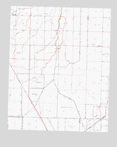
Waukena, CA USGS Topographic Map
Click on map above to begin viewing in our Map Viewer.

This topographic map contains these locations and features:
Feature Name Type Latitude Longitude GNIS ID View Map
Adriano Nunes DairyLocaleN36.1289°W119.5025°2681424View Map
Aurora SchoolLocaleN36.2113°W119.5112°238835View Map
Bean (historical)Populated PlaceN36.1377°W119.5851°1665680View Map
Cadillac Ranch DairyLocaleN36.2219°W119.5542°2703848View Map
Caetano DairyLocaleN36.2128°W119.5367°2515618View Map
Cameron CreekStreamN36.1275°W119.5296°240067View Map
Cascade DairyLocaleN36.2281°W119.5067°2701882View Map
Diman G DairyLocaleN36.2281°W119.5936°2703523View Map
East Branch Lakeside DitchCanalN36.2105°W119.5793°241741View Map
Endeavor Gold DairyLocaleN36.1797°W119.5153°2701965View Map
Felicita DairyLocaleN36.1947°W119.5319°2703852View Map
Hollandia Farms North DairyLocaleN36.2050°W119.5956°2703854View Map
Kansas Holstein DairyLocaleN36.2136°W119.6081°2515619View Map
Lakeside CemeteryCemeteryN36.2258°W119.6071°244538View Map
Lakeside Elementary SchoolSchoolN36.2411°W119.6196°244542View Map
M F Gomes DairyLocaleN36.1611°W119.5128°2681608View Map
Mattos Brothers DairyLocaleN36.2086°W119.5314°2703857View Map
Phil Vannette DairyLocaleN36.2222°W119.5544°2515620View Map
River RanchLocaleN36.2494°W119.5675°2515614View Map
River Ranch DairyLocaleN36.2497°W119.5692°2703645View Map
Tulare County Fire Department Battalion 1 Waukena Fire Station 24BuildingN36.1372°W119.5098°2624426View Map
Valley View Farms DairyLocaleN36.2442°W119.5514°2703859View Map
WaukenaPopulated PlaceN36.1386°W119.5096°251266View Map
Waukena Census Designated PlaceCensusN36.1361°W119.5110°2585463View Map
Waukena Joint Union Elementary SchoolSchoolN36.1363°W119.5101°1835737View Map
West Branch Lakeland CanalCanalN36.1463°W119.5957°251318View Map
Westview DairyLocaleN36.1656°W119.5083°2701868View Map
Wreden Ranch DairyLocaleN36.1931°W119.6058°2703860View Map

Note: Coordinates in the location and feature list above are referenced to NAD83 datum.


Copyright (C) 2008-2024 Ryan Niemi / Sunset Dynamics ... All Rights Reserved