TopoQuest Logo
Do you find TopoQuest useful?
Help keep TopoQuest running and adding new maps/features by donating!
Bitcoin:  19c7KJd3qBynnjoSw5npx9KScwjBe4ifkT
Litecoin:  LXs6TkuXGGXo1vDsWCkWVdjQX94eUKd6ui
Home View Maps Find Maps Find Places Resources & Links


Bond Pond, Mississippi Topographic Map

USGS Map Title: Bond Pond, MS
USGS Map MRC: 30089H1
DRG (GeoTIFF) Download: o30089h1.tif


Neighboring USGS Topographic Map Quads:


  Brooklyn, MS  
31089A2
 

  Janice, MS  
31089A1
 

  Taylor Hill, MS  
31088A8
 

  Bond, MS  
30089H2
 

  Bond Pond, MS  
30089H1
 

  Barbara, MS  
30088H8
 

  Wiggins, MS  
30089G2
 

  Whites Crossing, MS  
30089G1
 

  Ramsey Springs, MS  
30088G8


Map MRC Location:

N31°
W90°
N31°
W89°
H8 H7 H6 H5 H4 H3 H2 H1
G8 G7 G6 G5 G4 G3 G2 G1
F8 F7 F6 F5 F4 F3 F2 F1
E8 E7 E6 E5 E4 E3 E2 E1
D8 D7 D6 D5 D4 D3 D2 D1
C8 C7 C6 C5 C4 C3 C2 C1
B8 B7 B6 B5 B4 B3 B2 B1
A8 A7 A6 A5 A4 A3 A2 A1
N30°
W90°
N30°
W89°

Bond Pond, MS USGS 1:24K Topographic Map Preview:
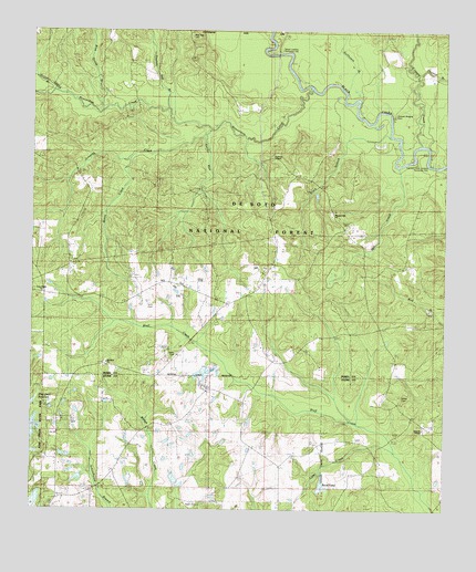
Bond Pond, MS USGS Topographic Map
Click on map above to begin viewing in our Map Viewer.

This topographic map contains these locations and features:
Feature Name Type Latitude Longitude GNIS ID View Map
Amanda Chapel Baptist ChurchChurchN30.8963°W89.0065°692391View Map
Andrews ChapelChurchN30.9671°W89.0542°692401View Map
Beaverdam CreekStreamN30.9857°W89.0425°692518View Map
Black BranchStreamN30.9727°W89.0167°692625View Map
Black Creek WildernessReserveN30.9768°W89.0282°2035056View Map
Blue Goose BranchStreamN30.9805°W89.1039°692641View Map
Bluff Creek School (historical)SchoolN30.9255°W89.0695°704595View Map
Bond PondLakeN30.8815°W89.0368°692669View Map
Clear CreekStreamN30.8905°W89.0153°692927View Map
Cypress CreekStreamN30.9707°W89.0067°693035View Map
Cypress Creek LandingLocaleN30.9686°W89.0051°2596131View Map
Cypress Creek Landing Recreation SiteParkN30.9655°W89.0048°704601View Map
Ebenezer ChurchChurchN30.9141°W89.1048°693155View Map
Fairley CemeteryCemeteryN30.9043°W89.0131°704555View Map
Griffin Spring BranchStreamN30.9838°W89.1201°693374View Map
Haynes Lake DamDamN30.8802°W89.0784°695327View Map
Haynes Lake DamDamN30.8835°W89.0800°695328View Map
Howard-Breland CemeteryCemeteryN30.9782°W89.0153°704616View Map
Janice Landing Recreation SiteParkN30.9946°W89.0503°704618View Map
Jumping CreekStreamN30.9741°W89.0737°693644View Map
Mill CreekStreamN30.9652°W89.0145°693980View Map
Mossy CreekStreamN30.9663°W89.0956°705644View Map
New Covenant Assembly of God ChurchChurchN30.8822°W89.1173°2596790View Map
New York CemeteryCemeteryN30.9988°W89.0798°694190View Map
New York School (historical)SchoolN30.9955°W89.0962°704631View Map
Pleasant Hill ChurchChurchN30.9527°W89.0356°694430View Map
Prescott Lake DamDamN30.8835°W89.1084°695329View Map
Sandy RunStreamN30.9730°W89.0728°705645View Map
Sims CemeteryCemeteryN30.9282°W89.0903°704640View Map
Stillhouse BranchStreamN30.9841°W89.0312°694891View Map
Taylor CemeteryCemeteryN30.9155°W89.0814°704643View Map
Taylor CmeteryCemeteryN30.8768°W89.0756°705642View Map
Thomas Bay BranchStreamN30.9794°W89.0870°694961View Map
Thomas BranchStreamN30.9888°W89.0089°694962View Map

Note: Coordinates in the location and feature list above are referenced to NAD83 datum.


Copyright (C) 2008-2024 Ryan Niemi / Sunset Dynamics ... All Rights Reserved