TopoQuest Logo
Do you find TopoQuest useful?
Help keep TopoQuest running and adding new maps/features by donating!
Bitcoin:  19c7KJd3qBynnjoSw5npx9KScwjBe4ifkT
Litecoin:  LXs6TkuXGGXo1vDsWCkWVdjQX94eUKd6ui
Home View Maps Find Maps Find Places Resources & Links


Warrensville, North Carolina Topographic Map

USGS Map Title: Warrensville, NC
USGS Map MRC: 36081D5
DRG (GeoTIFF) Download: o36081d5.tif


Neighboring USGS Topographic Map Quads:


  Grayson, NC  
36081E6
 

  Park, NC  
36081E5
 

  Grassy Creek, NC  
36081E4
 

  Baldwin Gap, NC  
36081D6
 

  Warrensville, NC  
36081D5
 

  Jefferson, NC  
36081D4
 

  Zionville, TN  
36081C6
 

  Todd, NC  
36081C5
 

  Glendale Springs, NC  
36081C4


Map MRC Location:

N37°
W82°
N37°
W81°
H8 H7 H6 H5 H4 H3 H2 H1
G8 G7 G6 G5 G4 G3 G2 G1
F8 F7 F6 F5 F4 F3 F2 F1
E8 E7 E6 E5 E4 E3 E2 E1
D8 D7 D6 D5 D4 D3 D2 D1
C8 C7 C6 C5 C4 C3 C2 C1
B8 B7 B6 B5 B4 B3 B2 B1
A8 A7 A6 A5 A4 A3 A2 A1
N36°
W82°
N36°
W81°

Warrensville, NC USGS 1:24K Topographic Map Preview:
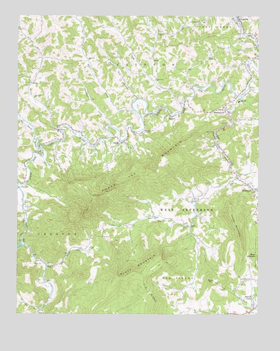
Warrensville, NC USGS Topographic Map
Click on map above to begin viewing in our Map Viewer.

This topographic map contains these locations and features:
Feature Name Type Latitude Longitude GNIS ID View Map
Ashe CountyCivilN36.4344°W81.5005°1008535View Map
Ashley ChapelChurchN36.4829°W81.5251°980330View Map
Beaver CreekPopulated PlaceN36.3773°W81.5023°1019027View Map
Ben Bolen ChurchChurchN36.4021°W81.5904°980977View Map
Ben Bolen CreekStreamN36.3957°W81.6096°980978View Map
Berea ChurchChurchN36.3754°W81.6129°981036View Map
Big BranchStreamN36.3768°W81.6123°981366View Map
Big Laurel CreekStreamN36.4448°W81.6129°1009336View Map
Bluff MountainSummitN36.3910°W81.5715°981646View Map
Buck MountainSummitN36.3893°W81.5232°1019375View Map
Buffalo ChurchChurchN36.4118°W81.5348°982161View Map
Buffalo ChurchChurchN36.4160°W81.5534°982162View Map
Buffalo CreekStreamN36.4657°W81.5109°982170View Map
Claybank CreekStreamN36.4321°W81.5048°983242View Map
CliftonPopulated PlaceN36.4468°W81.5709°1019700View Map
CometPopulated PlaceN36.4821°W81.5546°1019748View Map
Copeland CreekStreamN36.4537°W81.5768°983523View Map
CrestonPopulated PlaceN36.4279°W81.6237°1019857View Map
Creston Post OfficePost OfficeN36.4246°W81.6221°2766586View Map
Creston Volunteer Fire DepartmentBuildingN36.4297°W81.6201°2639707View Map
DresdenPopulated PlaceN36.4582°W81.5457°1020027View Map
FigPopulated PlaceN36.4529°W81.6043°985070View Map
Flat Rock ChurchChurchN36.4512°W81.5562°985184View Map
Friendly Grove ChurchChurchN36.3890°W81.5065°985420View Map
J O Blevens CemeteryCemeteryN36.4985°W81.5125°2611961View Map
LansingPopulated PlaceN36.4993°W81.5109°1012683View Map
Lansing Post OfficePost OfficeN36.4987°W81.5104°2773780View Map
Lansing Volunteer Fire and RescueBuildingN36.4981°W81.5107°2639184View Map
Little Buffalo CreekStreamN36.4335°W81.5107°988561View Map
Long Branch ChurchChurchN36.4973°W81.5307°988935View Map
Long Hope CreekStreamN36.4054°W81.6212°988972View Map
Low Gap ChurchChurchN36.4926°W81.5515°989082View Map
Milam CemeteryCemeteryN36.3960°W81.6112°989841View Map
Mill CreekStreamN36.4607°W81.5643°1013561View Map
Mill Creek ChurchChurchN36.4815°W81.5884°989966View Map
Mount Paddy ChurchChurchN36.4223°W81.5326°990500View Map
Mountain Aire Golf ClubLocaleN36.3765°W81.5307°1007604View Map
Mountain Bogs National Wildlife RefugeParkN36.4147°W81.5657°2776754View Map
North Fork ChurchChurchN36.4737°W81.5534°991220View Map
Northwest High SchoolSchoolN36.4640°W81.5101°991309View Map
Oak Grove ChurchChurchN36.4515°W81.5226°991403View Map
Old Field BranchStreamN36.4987°W81.5118°1014093View Map
Paddy MountainSummitN36.4168°W81.5146°991779View Map
Phoenix ChurchChurchN36.4829°W81.5007°992156View Map
Rich Hill ChurchChurchN36.4776°W81.6134°993289View Map
Rich Hill CreekStreamN36.4532°W81.6029°1014859View Map
Rich Valley ChurchChurchN36.4660°W81.6159°993304View Map
Riverview Missionary Baptist ChurchChurchN36.4521°W81.6031°2548783View Map
Riverview SchoolSchoolN36.4521°W81.6032°993402View Map
RotenPopulated PlaceN36.4715°W81.6173°1022402View Map
SmethportPopulated PlaceN36.4265°W81.5018°994926View Map
Stagg CreekStreamN36.4629°W81.5390°1015777View Map
Sugar Tree BranchStreamN36.4651°W81.5623°995653View Map
Three Top ChurchChurchN36.3960°W81.6090°996082View Map
Three Top CreekStreamN36.4287°W81.6240°996083View Map
Three Top MountainSummitN36.4260°W81.5787°1022943View Map
Town of LansingCivilN36.4989°W81.5098°2405986View Map
Township of CliftonCivilN36.4702°W81.5658°1026380View Map
Township of CrestonCivilN36.3945°W81.6109°1026381View Map
Township of West JeffersonCivilN36.4042°W81.5057°1026397View Map
Tree TopLocaleN36.4162°W81.5540°1023504View Map
TroutPopulated PlaceN36.3951°W81.6093°1022989View Map
WarrensvillePopulated PlaceN36.4607°W81.5190°1023118View Map
Warrensville Post OfficePost OfficeN36.4609°W81.5178°2773779View Map
Warrensville Volunteer Fire and RescueBuildingN36.4598°W81.5165°2639700View Map
Weaver CemeteryCemeteryN36.4893°W81.5183°2414770View Map

Note: Coordinates in the location and feature list above are referenced to NAD83 datum.


Copyright (C) 2008-2024 Ryan Niemi / Sunset Dynamics ... All Rights Reserved