TopoQuest Logo
Do you find TopoQuest useful?
Help keep TopoQuest running and adding new maps/features by donating!
Bitcoin:  19c7KJd3qBynnjoSw5npx9KScwjBe4ifkT
Litecoin:  LXs6TkuXGGXo1vDsWCkWVdjQX94eUKd6ui
Home View Maps Find Maps Find Places Resources & Links


Warren, New Hampshire Topographic Map

USGS Map Title: Warren, NH
USGS Map MRC: 43071H8
DRG (GeoTIFF) Download: o43071h8.tif


Neighboring USGS Topographic Map Quads:


  Newbury, VT  
44072A1
 

  East Haverhill, NH  
44071A8
 

  Mount Moosilauke, NH  
44071A7
 

  Piermont, NH  
43072H1
 

  Warren, NH  
43071H8
 

  Mount Kineo, NH  
43071H7
 

  Smarts Mountain, NH  
43072G1
 

  Wentworth, NH  
43071G8
 

  Rumney, NH  
43071G7


Map MRC Location:

N44°
W72°
N44°
W71°
H8 H7 H6 H5 H4 H3 H2 H1
G8 G7 G6 G5 G4 G3 G2 G1
F8 F7 F6 F5 F4 F3 F2 F1
E8 E7 E6 E5 E4 E3 E2 E1
D8 D7 D6 D5 D4 D3 D2 D1
C8 C7 C6 C5 C4 C3 C2 C1
B8 B7 B6 B5 B4 B3 B2 B1
A8 A7 A6 A5 A4 A3 A2 A1
N43°
W72°
N43°
W71°

Warren, NH USGS 1:24K Topographic Map Preview:
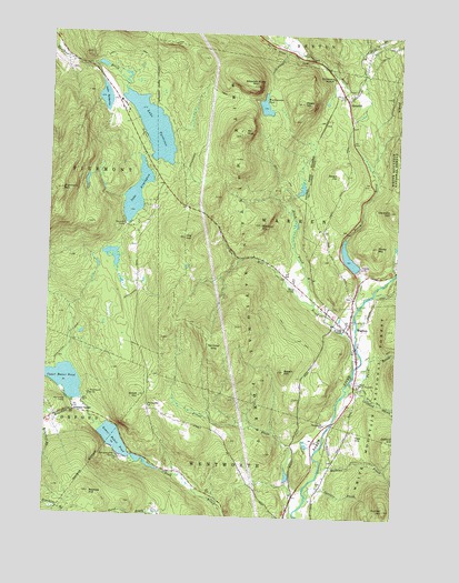
Warren, NH USGS Topographic Map
Click on map above to begin viewing in our Map Viewer.

This topographic map contains these locations and features:
Feature Name Type Latitude Longitude GNIS ID View Map
Atwell HillSummitN43.9051°W71.9659°871411View Map
Baker Floodwater Reservoir SiteReservoirN43.9426°W71.8918°1775171View Map
Baker Floodwater Reservoir Site 2 DamDamN43.9401°W71.8895°1775170View Map
Baker Floodwater Reservoir Site 5 DamDamN43.8817°W71.9112°1775192View Map
Baker Floodwater Reservoir Site 6ReservoirN43.8867°W71.9579°1775191View Map
Baker Floodwater Reservoir Site 6 DamDamN43.8867°W71.9579°1775190View Map
Beech HillSummitN43.9120°W71.9145°871482View Map
Berry BrookStreamN43.9290°W71.8881°871492View Map
Black BrookStreamN43.9295°W71.9040°871514View Map
Brackett BrookStreamN43.8973°W71.9779°871568View Map
Clement HillSummitN43.9542°W71.8773°871697View Map
Currier BrookStreamN43.8790°W71.9051°871754View Map
Currier HillSummitN43.8767°W71.8770°871755View Map
Foote HillSummitN43.9448°W71.8820°871895View Map
Gilmans CornerPopulated PlaceN43.9026°W71.9898°871936View Map
GlencliffPopulated PlaceN43.9828°W71.8934°871942View Map
Glencliff Post OfficePost OfficeN43.9856°W71.8964°1916564View Map
Hildreth DamDamN43.9390°W71.8881°872041View Map
Hurricane BrookStreamN43.9034°W71.8762°872064View Map
Lake ArmingtonReservoirN43.9667°W71.9645°1775578View Map
Lake ArmingtonLakeN43.9583°W71.9685°871403View Map
Lake Armington DamDamN43.9667°W71.9645°1775577View Map
Lake KatherineLakeN43.9832°W71.9803°872122View Map
Lake TarletonReservoirN43.9757°W71.9631°1775757View Map
Lake Tarleton DamDamN43.9851°W71.9729°1775756View Map
Lower Baker PondLakeN43.8939°W71.9731°872227View Map
Maple Grove School (historical)SchoolN43.9203°W71.9079°1916682View Map
Marston HillSummitN43.9501°W71.9243°872257View Map
Martins BrookStreamN43.8862°W71.9009°872259View Map
Merriwood CampPopulated PlaceN43.9034°W71.9912°872282View Map
Moosilauke CampLocaleN43.9051°W71.9840°872321View Map
Mount MistSummitN43.9751°W71.9312°872308View Map
New Hampshire State Fish HatcheryLocaleN43.9070°W71.8870°1916705View Map
Nichols HillSummitN43.8801°W71.9831°872378View Map
Oak HillSummitN43.8956°W71.8881°872421View Map
Oliverian NotchGapN43.9892°W71.8984°872433View Map
Ore HillSummitN43.9465°W71.9512°872435View Map
Ore Hill BrookStreamN43.9137°W71.8890°872437View Map
Patch BrookStreamN43.9070°W71.8904°872461View Map
Pemigewassett CampLocaleN43.8895°W71.9731°872480View Map
Piermont MountainSummitN43.9592°W71.9951°872496View Map
Saint Johns ChapelChurchN43.9231°W71.8929°872609View Map
Sentinel MountainSummitN43.9195°W71.9395°872641View Map
Sentinel Mountain State ForestForestN43.9237°W71.9634°1916815View Map
Slide BrookStreamN43.9962°W71.8879°872675View Map
Still BrookStreamN43.9956°W71.8881°872737View Map
Swain HillSummitN43.9634°W71.8968°872767View Map
Town of WarrenCivilN43.9454°W71.8823°873746View Map
Upper Baker PondLakeN43.9098°W71.9926°872847View Map
Wachipauka PondLakeN43.9815°W71.9230°872856View Map
WarrenPopulated PlaceN43.9231°W71.8920°872863View Map
Warren - Wentworth Ambulance ServiceBuildingN43.9270°W71.8902°2658856View Map
Warren Fire DepartmentBuildingN43.9256°W71.8913°2605031View Map
Warren Methodist ChurchChurchN43.9253°W71.8923°1916875View Map
Warren Police DepartmentBuildingN43.9271°W71.8902°2753025View Map
Warren Post OfficePost OfficeN43.9229°W71.8907°1916876View Map
Warren Village SchoolSchoolN43.9252°W71.8927°2500239View Map
Webster Slide MountainSummitN43.9867°W71.9276°872875View Map
Weeks Crossing (historical)LocaleN43.9570°W71.9079°1916888View Map
Wentworth ChurchChurchN43.9026°W71.9629°872886View Map
Wentworth Elementary SchoolSchoolN43.8991°W71.8994°2500287View Map
Wentworth SchoolSchoolN43.8984°W71.8993°872888View Map
Whitman CampLocaleN43.9501°W71.9718°872929View Map
Wyatt HillSummitN43.9826°W71.9101°871010View Map

Note: Coordinates in the location and feature list above are referenced to NAD83 datum.


Copyright (C) 2008-2024 Ryan Niemi / Sunset Dynamics ... All Rights Reserved