TopoQuest Logo
Do you find TopoQuest useful?
Help keep TopoQuest running and adding new maps/features by donating!
Bitcoin:  19c7KJd3qBynnjoSw5npx9KScwjBe4ifkT
Litecoin:  LXs6TkuXGGXo1vDsWCkWVdjQX94eUKd6ui
Home View Maps Find Maps Find Places Resources & Links


Wacker, Illinois Topographic Map

USGS Map Title: Wacker, IL
USGS Map MRC: 42090A1
DRG (GeoTIFF) Download: o42090a1.tif


Neighboring USGS Topographic Map Quads:


  Blackhawk, IL  
42090B2
 

  Pleasant Valley, IL  
42090B1
 

  Loran, IL  
42089B8
 

  Savanna, IL  
42090A2
 

  Wacker, IL  
42090A1
 

  Mount Carroll, IL  
42089A8
 

  Clinton NW, IA  
41090H2
 

  Thomson, IL  
41090H1
 

  Fair Haven, IL  
41089H8


Map MRC Location:

N43°
W91°
N43°
W90°
H8 H7 H6 H5 H4 H3 H2 H1
G8 G7 G6 G5 G4 G3 G2 G1
F8 F7 F6 F5 F4 F3 F2 F1
E8 E7 E6 E5 E4 E3 E2 E1
D8 D7 D6 D5 D4 D3 D2 D1
C8 C7 C6 C5 C4 C3 C2 C1
B8 B7 B6 B5 B4 B3 B2 B1
A8 A7 A6 A5 A4 A3 A2 A1
N42°
W91°
N42°
W90°

Wacker, IL USGS 1:24K Topographic Map Preview:
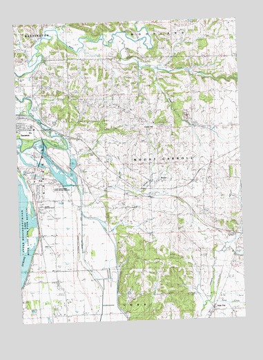
Wacker, IL USGS Topographic Map
Click on map above to begin viewing in our Map Viewer.

This topographic map contains these locations and features:
Feature Name Type Latitude Longitude GNIS ID View Map
Argo CemeteryCemeteryN42.0045°W90.0168°1785394View Map
Argo FayPopulated PlaceN42.0042°W90.0173°424151View Map
AyersPopulated PlaceN42.0539°W90.1157°422426View Map
Ayers Sand Prairie State Nature PreserveParkN42.0542°W90.1062°1705915View Map
BurkePopulated PlaceN42.0511°W90.0368°422516View Map
Camp CreekStreamN42.1220°W90.1012°405456View Map
Carroll CreekStreamN42.1195°W90.0676°424147View Map
Center HillPopulated PlaceN42.0809°W90.0462°405794View Map
Center Hill CemeteryCemeteryN42.0814°W90.0426°1785405View Map
Dysons Lake (historical)LakeN42.0175°W90.0765°1785412View Map
East Johnson CreekStreamN42.0281°W90.0098°407659View Map
Excelsior School (historical)SchoolN42.0986°W90.1151°408142View Map
Hickory GrovePopulated PlaceN42.0597°W90.0676°422804View Map
Hickory Grove School (historical)SchoolN42.0472°W90.0365°410164View Map
Lawrence QuarryMineN42.0717°W90.0896°1983530View Map
Locust Grove School (historical)SchoolN42.0686°W90.0701°412497View Map
Mount Carroll QuarryMineN42.0850°W90.0293°1983531View Map
Old Mill ParkParkN42.1014°W90.1240°1705914View Map
Pleasant Hill School (historical)SchoolN42.0942°W90.0593°415866View Map
Plum Grove School (historical)SchoolN42.0459°W90.0762°415955View Map
Preston Prairie School (historical)SchoolN42.0770°W90.0151°416205View Map
Sand CreekStreamN42.0072°W90.0204°417937View Map
Sandridge School (historical)SchoolN42.0028°W90.1148°417980View Map
Township of Mount CarrollCivilN42.0662°W90.0352°429402View Map
Tri-Township AirportAirportN42.0466°W90.1115°427792View Map
WackerPopulated PlaceN42.0581°W90.0462°420352View Map
Wacker CemeteryCemeteryN42.0578°W90.0468°1785452View Map
Washington School (historical)SchoolN42.1147°W90.1240°420622View Map
Woodland School (historical)SchoolN42.1234°W90.0062°421445View Map

Note: Coordinates in the location and feature list above are referenced to NAD83 datum.


Copyright (C) 2008-2024 Ryan Niemi / Sunset Dynamics ... All Rights Reserved