TopoQuest Logo
Do you find TopoQuest useful?
Help keep TopoQuest running and adding new maps/features by donating!
Bitcoin:  19c7KJd3qBynnjoSw5npx9KScwjBe4ifkT
Litecoin:  LXs6TkuXGGXo1vDsWCkWVdjQX94eUKd6ui
Home View Maps Find Maps Find Places Resources & Links


Union Peak, Oregon Topographic Map

USGS Map Title: Union Peak, OR
USGS Map MRC: 42122G2
DRG (GeoTIFF) Download: o42122g2.tif


Neighboring USGS Topographic Map Quads:


  Thousand Springs, OR  
42122H3
 

  Crater Lake West, OR  
42122H2
 

  Crater Lake East, OR  
42122H1
 

  Red Blanket Mountain, OR  
42122G3
 

  Union Peak, OR  
42122G2
 

  Maklaks Crater, OR  
42122G1
 

  Imnaha Creek, OR  
42122F3
 

  Devils Peak, OR  
42122F2
 

  Mares Egg Spring, OR  
42122F1


Map MRC Location:

N43°
W123°
N43°
W122°
H8 H7 H6 H5 H4 H3 H2 H1
G8 G7 G6 G5 G4 G3 G2 G1
F8 F7 F6 F5 F4 F3 F2 F1
E8 E7 E6 E5 E4 E3 E2 E1
D8 D7 D6 D5 D4 D3 D2 D1
C8 C7 C6 C5 C4 C3 C2 C1
B8 B7 B6 B5 B4 B3 B2 B1
A8 A7 A6 A5 A4 A3 A2 A1
N42°
W123°
N42°
W122°

Union Peak, OR USGS 1:24K Topographic Map Preview:
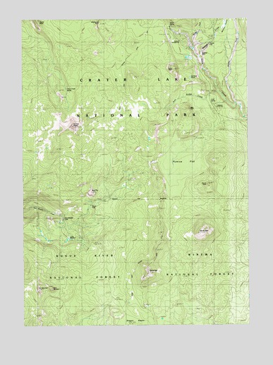
Union Peak, OR USGS Topographic Map
Click on map above to begin viewing in our Map Viewer.

This topographic map contains these locations and features:
Feature Name Type Latitude Longitude GNIS ID View Map
Annie SpringSpringN42.8722°W122.1690°1137226View Map
Arant PointSummitN42.8544°W122.1671°1137282View Map
Bald TopSummitN42.8043°W122.2132°1137465View Map
Bear BluffCliffN42.8382°W122.1584°1137629View Map
Castle PointSummitN42.8746°W122.2430°1139443View Map
Cold SpringSpringN42.8414°W122.1466°1139929View Map
Cold Springs CampgroundLocaleN42.8401°W122.1456°1155201View Map
Duwee FallsFallsN42.8646°W122.1472°1154279View Map
Godfrey Glen and ColonnadesLavaN42.8599°W122.1517°1142795View Map
Goodbye CreekStreamN42.8665°W122.1581°1155204View Map
Goose EggSummitN42.7716°W122.1819°1142853View Map
Goose NestSummitN42.7876°W122.1535°1142858View Map
Jerry MountainSummitN42.7651°W122.2354°1144261View Map
Lodgepole Picnic AreaLocaleN42.8393°W122.1442°1135275View Map
Lucky CampLocaleN42.7857°W122.2253°1156605View Map
Lucky MeadowsFlatN42.7860°W122.2248°1135278View Map
Mazama CampgroundLocaleN42.8665°W122.1650°1156871View Map
Middle Fork Annie CreekStreamN42.8379°W122.1289°1146136View Map
Munson CreekStreamN42.8596°W122.1517°1154309View Map
Munson ValleyValleyN42.8653°W122.1458°1146668View Map
Munson Valley TrailTrailN42.8707°W122.1339°1146669View Map
Pole Bridge CreekStreamN42.8454°W122.1411°1147835View Map
Pumice FlatFlatN42.8165°W122.1678°1148038View Map
Quillwort PondLakeN42.8510°W122.1576°1135274View Map
Red Blanket FallsFallsN42.7930°W122.2285°1135277View Map
Rogue WatershedRidgeN42.7774°W122.1848°1156441View Map
Scoria ConeSummitN42.8073°W122.1487°1149156View Map
Stuart FallsFallsN42.7991°W122.2129°1135276View Map
Stuart Falls CampLocaleN42.7985°W122.2136°1156604View Map
Tom MountainSummitN42.7647°W122.2430°1135279View Map
Union Creek SpringSpringN42.8463°W122.2266°1155235View Map
Union PeakSummitN42.8311°W122.2233°1151653View Map
Union Peak TrailTrailN42.8560°W122.1970°1151654View Map

Note: Coordinates in the location and feature list above are referenced to NAD83 datum.


Copyright (C) 2008-2024 Ryan Niemi / Sunset Dynamics ... All Rights Reserved