TopoQuest Logo
Do you find TopoQuest useful?
Help keep TopoQuest running and adding new maps/features by donating!
Bitcoin:  19c7KJd3qBynnjoSw5npx9KScwjBe4ifkT
Litecoin:  LXs6TkuXGGXo1vDsWCkWVdjQX94eUKd6ui
Home View Maps Find Maps Find Places Resources & Links


Twin Peaks, Utah Topographic Map

USGS Map Title: Twin Peaks, UT
USGS Map MRC: 40111C3
DRG (GeoTIFF) Download: o40111c3.tif


Neighboring USGS Topographic Map Quads:


  Charleston, UT  
40111D4
 

  Center Creek, UT  
40111D3
 

  Heber Mountain, UT  
40111D2
 

  Wallsburg Ridge, UT  
40111C4
 

  Twin Peaks, UT  
40111C3
 

  Co-op Creek, UT  
40111C2
 

  Granger Mountain, UT  
40111B4
 

  Two Tom Hill, UT  
40111B3
 

  Strawberry Reservoir NW, UT  
40111B2


Map MRC Location:

N41°
W112°
N41°
W111°
H8 H7 H6 H5 H4 H3 H2 H1
G8 G7 G6 G5 G4 G3 G2 G1
F8 F7 F6 F5 F4 F3 F2 F1
E8 E7 E6 E5 E4 E3 E2 E1
D8 D7 D6 D5 D4 D3 D2 D1
C8 C7 C6 C5 C4 C3 C2 C1
B8 B7 B6 B5 B4 B3 B2 B1
A8 A7 A6 A5 A4 A3 A2 A1
N40°
W112°
N40°
W111°

Twin Peaks, UT USGS 1:24K Topographic Map Preview:
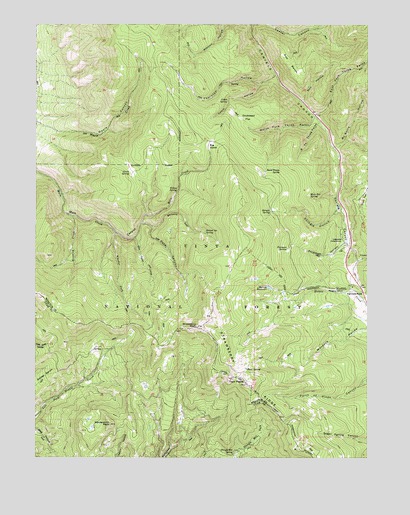
Twin Peaks, UT USGS Topographic Map
Click on map above to begin viewing in our Map Viewer.

This topographic map contains these locations and features:
Feature Name Type Latitude Longitude GNIS ID View Map
Big GladeFlatN40.3397°W111.3107°1438672View Map
Brumley CreekStreamN40.3194°W111.3616°1439181View Map
Buck SpringSpringN40.2755°W111.2960°1439236View Map
Burnt Stump SpringSpringN40.3333°W111.2893°1439366View Map
Cabin HollowValleyN40.3577°W111.2910°1439410View Map
Cabin SpringSpringN40.3531°W111.3034°1439416View Map
Circle SpringSpringN40.3319°W111.3402°1439747View Map
Daniels PassGapN40.2972°W111.2521°1440260View Map
Dock FlatFlatN40.3258°W111.2532°1440483View Map
Dockweed FlatFlatN40.3472°W111.2946°1440486View Map
East Fork Three ForksValleyN40.3494°W111.2699°1440822View Map
Foreman HollowValleyN40.3119°W111.2596°1441164View Map
Foreman SpringSpringN40.3104°W111.2811°1441165View Map
Glen Cabin CreekStreamN40.3133°W111.3380°1441331View Map
Harris ReservoirReservoirN40.2988°W111.2868°1441613View Map
Highline CanalCanalN40.3619°W111.3743°1441766View Map
IndependencePopulated PlaceN40.3029°W111.2569°2547779View Map
Lodge Pole CampgroundLocaleN40.3144°W111.2610°1442832View Map
McGuire HollowValleyN40.3397°W111.2638°1443254View Map
Mule Ear SpringSpringN40.3249°W111.2725°1443728View Map
North Fork Three ForksValleyN40.3480°W111.2713°1443942View Map
Pete CanyonValleyN40.3163°W111.3316°1444292View Map
Row BenchBenchN40.3636°W111.2805°1445194View Map
Row HollowValleyN40.3533°W111.2755°1445195View Map
Second SetValleyN40.3175°W111.3352°1445410View Map
Second Set SpringSpringN40.3152°W111.3119°1445411View Map
Shingle HollowValleyN40.3213°W111.2616°1445533View Map
Shingle SpringSpringN40.3210°W111.2874°1445544View Map
South Fork Three ForksValleyN40.3469°W111.2693°1445883View Map
Strawberry PeakSummitN40.2875°W111.3149°1446186View Map
Thornton HollowValleyN40.3602°W111.2860°1446551View Map
Twin PeaksSummitN40.2730°W111.3030°1446797View Map
Wardsworth PeakSummitN40.2594°W111.3474°1446981View Map
Wheeler ForkStreamN40.3150°W111.3455°1447214View Map
Willow SpringSpringN40.3272°W111.3223°1447436View Map

Note: Coordinates in the location and feature list above are referenced to NAD83 datum.


Copyright (C) 2008-2024 Ryan Niemi / Sunset Dynamics ... All Rights Reserved