TopoQuest Logo
Do you find TopoQuest useful?
Help keep TopoQuest running and adding new maps/features by donating!
Bitcoin:  19c7KJd3qBynnjoSw5npx9KScwjBe4ifkT
Litecoin:  LXs6TkuXGGXo1vDsWCkWVdjQX94eUKd6ui
Home View Maps Find Maps Find Places Resources & Links


Triunfo Pass, California Topographic Map

USGS Map Title: Triunfo Pass, CA
USGS Map MRC: 34118A8
DRG (GeoTIFF) Download: o34118a8.tif


Neighboring USGS Topographic Map Quads:


  Camarillo, CA  
34119B1
 

  Newbury Park, CA  
34118B8
 

  Thousand Oaks, CA  
34118B7


  Triunfo Pass, CA  
34118A8
 

  Point Dume, CA  
34118A7


Map MRC Location:

N35°
W119°
N35°
W118°
H8 H7 H6 H5 H4 H3 H2 H1
G8 G7 G6 G5 G4 G3 G2 G1
F8 F7 F6 F5 F4 F3 F2 F1
E8 E7 E6 E5 E4 E3 E2 E1
D8 D7 D6 D5 D4 D3 D2 D1
C8 C7 C6 C5 C4 C3 C2 C1
B8 B7 B6 B5 B4 B3 B2 B1
A8 A7 A6 A5 A4 A3 A2 A1
N34°
W119°
N34°
W118°

Triunfo Pass, CA USGS 1:24K Topographic Map Preview:
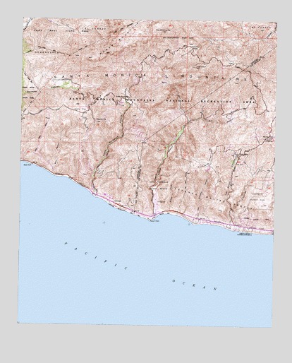
Triunfo Pass, CA USGS Topographic Map
Click on map above to begin viewing in our Map Viewer.

This topographic map contains these locations and features:
Feature Name Type Latitude Longitude GNIS ID View Map
Arroyo SequitStreamN34.0447°W118.9332°255305View Map
Backbone TrailTrailN34.1195°W118.9376°2628413View Map
Barney KnobSummitN34.0775°W118.8787°238994View Map
Bass RockLocaleN34.0653°W118.9954°239036View Map
Boney MountainSummitN34.1117°W118.9593°239555View Map
Boney Mountain State WildernessReserveN34.1158°W118.9786°2741179View Map
Boney PeakSummitN34.1163°W118.9404°2628241View Map
Camp BloomfieldLocaleN34.0764°W118.9254°1733109View Map
Camp MalibuLocaleN34.0817°W118.9218°1733111View Map
Canyon View TrailTrailN34.1109°W118.9292°2628415View Map
Chamberlain RanchLocaleN34.0936°W118.9623°1682663View Map
Chamberlain TrailTrailN34.1135°W118.9521°2628412View Map
Charmlee County ParkParkN34.0514°W118.8859°1733113View Map
Circle X RanchParkN34.1090°W118.9374°2628408View Map
Clarks PeakSummitN34.0833°W118.9634°240673View Map
Deals FlatFlatN34.0881°W118.9712°241333View Map
Decker Canyon Youth CampLocaleN34.0497°W118.8984°1733114View Map
Decker SchoolSchoolN34.0703°W118.8945°241339View Map
Deer CanyonValleyN34.0620°W118.9854°241355View Map
East Fork Arroyo SequitStreamN34.0839°W118.9182°241754View Map
El Matador State BeachParkN34.0381°W118.8829°1702785View Map
El Pescador State BeachParkN34.0389°W118.8918°1702786View Map
Encinal BeachBeachN34.0389°W118.8901°1733115View Map
Exchange PeakSummitN34.1146°W118.9461°2628246View Map
Grotto TrailTrailN34.1023°W118.9345°2628416View Map
Happy HollowValleyN34.0991°W118.9300°2628410View Map
Inspiration PointCliffN34.1167°W118.9432°2628247View Map
La Piedra State BeachParkN34.0386°W118.8870°1702788View Map
Lachusa CanyonValleyN34.0392°W118.8951°244481View Map
Lechuza Patrol Station (historical)LocaleN34.0745°W118.8829°1682637View Map
Leo Carrillo CampgroundLocaleN34.0497°W118.9337°1702790View Map
Leo Carrillo State ParkParkN34.0468°W118.9330°2570606View Map
Leo Carrillo State ParkParkN34.0442°W118.9393°244742View Map
Little Sycamore CanyonValleyN34.0536°W118.9640°255625View Map
Los Alisos CanyonValleyN34.0422°W118.8973°255634View Map
Los Angeles County Fire Department Station 72BuildingN34.0766°W118.8812°244482View Map
Los Angeles County Fire Department Station 99BuildingN34.0399°W118.8836°2665136View Map
Malibu Riding and Tennis ClubLocaleN34.0445°W118.9129°1733124View Map
Malibu Springs TrailTrailN34.0808°W118.9134°1702796View Map
Nicholas Canyon County BeachParkN34.0417°W118.9151°1702797View Map
Nicholas FlatFlatN34.0667°W118.9087°246528View Map
Nicholas Flat Natural PreserveReserveN34.0688°W118.9110°2741288View Map
Nicholas Flat TrailTrailN34.0556°W118.9279°1702798View Map
North BeachBeachN34.0458°W118.9462°1702806View Map
North Beach CampgroundLocaleN34.0453°W118.9423°1702799View Map
San Nicolas CanyonValleyN34.0439°W118.9143°248935View Map
Sandstone PeakSummitN34.1203°W118.9320°249012View Map
Sandstone Peak TrailheadTrailN34.1116°W118.9266°2628411View Map
Santa Monica MountainsRangeN34.1203°W118.9318°1655007View Map
Sequit CanyonValleyN34.0450°W118.9201°254232View Map
Sequit PointCapeN34.0433°W118.9370°1985053View Map
Skull RockSummitN34.1237°W118.9362°2628249View Map
SolromarPopulated PlaceN34.0500°W118.9537°254274View Map
South BeachBeachN34.0458°W118.9309°1702803View Map
Split RockSummitN34.1239°W118.9292°2628407View Map
The GrottoSpringN34.0993°W118.9298°2628409View Map
Tri PeaksSummitN34.1206°W118.9544°2628245View Map
Triunfo LookoutLocaleN34.1061°W118.9148°250625View Map
Triunfo PassGapN34.1133°W118.9165°250626View Map
Triunfo Pass-Point Mugu DivisionCivilN34.0888°W118.9764°1935347View Map
West Fork Arroyo SequitStreamN34.0839°W118.9182°251337View Map
Willow CreekStreamN34.0464°W118.9282°251611View Map
Yerba Buena BeachBeachN34.0517°W118.9607°1702807View Map
Yerba Buena SchoolSchoolN34.0928°W118.9484°251859View Map

Note: Coordinates in the location and feature list above are referenced to NAD83 datum.


Copyright (C) 2008-2024 Ryan Niemi / Sunset Dynamics ... All Rights Reserved