TopoQuest Logo
Do you find TopoQuest useful?
Help keep TopoQuest running and adding new maps/features by donating!
Bitcoin:  19c7KJd3qBynnjoSw5npx9KScwjBe4ifkT
Litecoin:  LXs6TkuXGGXo1vDsWCkWVdjQX94eUKd6ui
Home View Maps Find Maps Find Places Resources & Links


Topatopa Mountains, California Topographic Map

USGS Map Title: Topatopa Mountains, CA
USGS Map MRC: 34119E1
DRG (GeoTIFF) Download: o34119e1.tif


Neighboring USGS Topographic Map Quads:


  San Guillermo Mountain, CA  
34119F2
 

  Lockwood Valley, CA  
34119F1
 

  Alamo Mountain, CA  
34118F8
 

  Lion Canyon, CA  
34119E2
 

  Topatopa Mountains, CA  
34119E1
 

  Devils Heart Peak, CA  
34118E8
 

  Ojai, CA  
34119D2
 

  Santa Paula Peak, CA  
34119D1
 

  Fillmore, CA  
34118D8


Map MRC Location:

N35°
W120°
N35°
W119°
H8 H7 H6 H5 H4 H3 H2 H1
G8 G7 G6 G5 G4 G3 G2 G1
F8 F7 F6 F5 F4 F3 F2 F1
E8 E7 E6 E5 E4 E3 E2 E1
D8 D7 D6 D5 D4 D3 D2 D1
C8 C7 C6 C5 C4 C3 C2 C1
B8 B7 B6 B5 B4 B3 B2 B1
A8 A7 A6 A5 A4 A3 A2 A1
N34°
W120°
N34°
W119°

Topatopa Mountains, CA USGS 1:24K Topographic Map Preview:
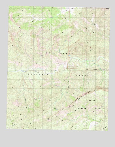
Topatopa Mountains, CA USGS Topographic Map
Click on map above to begin viewing in our Map Viewer.

This topographic map contains these locations and features:
Feature Name Type Latitude Longitude GNIS ID View Map
Bear CanyonValleyN34.5575°W119.1051°239080View Map
Harman CampgroundLocaleN34.5705°W119.0343°276478View Map
Hartman Guard Station (historical)LocaleN34.5700°W119.0345°254375View Map
Hines PeakSummitN34.5108°W119.0759°243489View Map
HorsethiefLocaleN34.5447°W119.0540°276481View Map
Johnston RidgeRidgeN34.6186°W119.0387°1662341View Map
Kerr SpringSpringN34.5594°W119.0921°276477View Map
Kerr SpringSpringN34.5595°W119.0921°254512View Map
Ladybug CampsiteLocaleN34.5219°W119.0676°276483View Map
Ladybug CampsiteLocaleN34.5228°W119.0668°254511View Map
Oak FlatFlatN34.5600°W119.0670°246719View Map
Oak Flat CampgroundLocaleN34.5597°W119.0682°276472View Map
Park CreekStreamN34.5700°W119.0248°247249View Map
Poplar CreekStreamN34.5950°W119.0004°273078View Map
Red Reef CanyonValleyN34.5642°W119.0537°248067View Map
Reed Reef TrailTrailN34.5408°W119.0584°276482View Map
San Rafael PeakSummitN34.6239°W119.0015°248960View Map
Sespe WildernessReserveN34.5857°W119.0208°2035297View Map
Sycamore CreekStreamN34.5672°W119.0518°250203View Map
Ten Sycamore FlatFlatN34.5694°W119.0479°254386View Map
Thatcher Campground (historical)LocaleN34.5705°W119.0484°276480View Map
Timber CreekStreamN34.5572°W119.0704°250494View Map
Topatopa MountainsRangeN34.5292°W119.0426°255764View Map
WilletLocaleN34.5761°W119.0445°276474View Map
Willett Hot SpringsSpringN34.5758°W119.0515°276473View Map
Willett Hot SpringsSpringN34.5758°W119.0509°254513View Map

Note: Coordinates in the location and feature list above are referenced to NAD83 datum.


Copyright (C) 2008-2024 Ryan Niemi / Sunset Dynamics ... All Rights Reserved