TopoQuest Logo
Do you find TopoQuest useful?
Help keep TopoQuest running and adding new maps/features by donating!
Bitcoin:  19c7KJd3qBynnjoSw5npx9KScwjBe4ifkT
Litecoin:  LXs6TkuXGGXo1vDsWCkWVdjQX94eUKd6ui
Home View Maps Find Maps Find Places Resources & Links


Toltec, Wyoming Topographic Map

USGS Map Title: Toltec, WY
USGS Map MRC: 42105C6
DRG (GeoTIFF) Download: o42105c6.tif


Neighboring USGS Topographic Map Quads:


  Warbonnett Peak, WY  
42105D7
 

  School Section Mountain, WY  
42105D6
 

  Saddleback Mountain, WY  
42105D5
 

  Marshall, WY  
42105C7
 

  Toltec, WY  
42105C6
 

  Windy Peak, WY  
42105C5
 

  Rogers Creek, WY  
42105B7
 

  Cottonwood Creek, WY  
42105B6
 

  Cow Creek Mountain, WY  
42105B5


Map MRC Location:

N43°
W106°
N43°
W105°
H8 H7 H6 H5 H4 H3 H2 H1
G8 G7 G6 G5 G4 G3 G2 G1
F8 F7 F6 F5 F4 F3 F2 F1
E8 E7 E6 E5 E4 E3 E2 E1
D8 D7 D6 D5 D4 D3 D2 D1
C8 C7 C6 C5 C4 C3 C2 C1
B8 B7 B6 B5 B4 B3 B2 B1
A8 A7 A6 A5 A4 A3 A2 A1
N42°
W106°
N42°
W105°

Toltec, WY USGS 1:24K Topographic Map Preview:
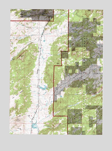
Toltec, WY USGS Topographic Map
Click on map above to begin viewing in our Map Viewer.

This topographic map contains these locations and features:
Feature Name Type Latitude Longitude GNIS ID View Map
Albany Number One ClaimMineN42.2942°W105.6428°1746886View Map
Arrowhead CreekStreamN42.3711°W105.7047°1597808View Map
Bar M Number 2 DamDamN42.2550°W105.6256°1605851View Map
Bar M Number 2 ReservoirReservoirN42.2550°W105.6256°1605852View Map
Beaver Dam CreekStreamN42.2600°W105.7169°1598073View Map
Bell and Scranton Number 1 DamDamN42.3333°W105.6339°1608072View Map
Bell and Scranton Number 1 DamDamN42.2950°W105.7022°1609027View Map
Bell and Scranton Number 1 ReservoirReservoirN42.3333°W105.6339°1608073View Map
Bell and Scranton Number 1 ReservoirReservoirN42.2950°W105.7022°1609028View Map
Blacktail PeakSummitN42.3747°W105.6406°1598234View Map
Brumley CreekStreamN42.3569°W105.7036°1598414View Map
Brumley MountainSummitN42.3689°W105.7361°1598415View Map
Brush CreekStreamN42.3500°W105.7075°1598420View Map
Buck PointSummitN42.3197°W105.6839°1598443View Map
Cold CreekStreamN42.3075°W105.6511°1598845View Map
Deer CreekStreamN42.3405°W105.7014°1599190View Map
Eggleston CreekStreamN42.3102°W105.6392°1599546View Map
Eggleston ReservoirReservoirN42.3175°W105.6305°1599548View Map
Ellison PassGapN42.3491°W105.6297°1599605View Map
Flattop CreekStreamN42.3544°W105.6653°1599760View Map
Flattop MountainSummitN42.3336°W105.6486°1599761View Map
Fortymile CreekStreamN42.3497°W105.7069°1599806View Map
Fortymile FlatFlatN42.3200°W105.7061°1599807View Map
Fortymile PeakSummitN42.3280°W105.7356°1599808View Map
Fortymile SpringSpringN42.3246°W105.7476°1599809View Map
Kafka Number 1 DamDamN42.2716°W105.7139°1605821View Map
Kafka Number 1 ReservoirReservoirN42.2716°W105.7139°1605822View Map
Muddy CreekStreamN42.3044°W105.6681°1601614View Map
Mule Creek PassGapN42.2550°W105.7342°1601631View Map
Phillips Number 1 DamDamN42.2950°W105.6689°1605751View Map
Phillips Number 1 ReservoirReservoirN42.2950°W105.6689°1605752View Map
Pole CreekStreamN42.2561°W105.7108°1602242View Map
Reed PassGapN42.2683°W105.7378°1602473View Map
Reed PlacePopulated PlaceN42.2680°W105.7256°1602474View Map
Smith MountainSummitN42.2641°W105.7392°1602999View Map
Soldier CreekStreamN42.2786°W105.7011°1603064View Map
Soldier Creek ReservoirReservoirN42.2959°W105.7055°1603071View Map
Soldier SpringSpringN42.2975°W105.7117°1603073View Map
Squaw PlacePopulated PlaceN42.3700°W105.7039°1603316View Map
Stove and Timber CreekStreamN42.3097°W105.6386°1603395View Map
ToltecPopulated PlaceN42.3069°W105.6533°1603694View Map
Tuttle CreekStreamN42.3100°W105.6433°1603812View Map

Note: Coordinates in the location and feature list above are referenced to NAD83 datum.


Copyright (C) 2008-2024 Ryan Niemi / Sunset Dynamics ... All Rights Reserved