TopoQuest Logo
Do you find TopoQuest useful?
Help keep TopoQuest running and adding new maps/features by donating!
Bitcoin:  19c7KJd3qBynnjoSw5npx9KScwjBe4ifkT
Litecoin:  LXs6TkuXGGXo1vDsWCkWVdjQX94eUKd6ui
Home View Maps Find Maps Find Places Resources & Links


Suttle, Alabama Topographic Map

USGS Map Title: Suttle, AL
USGS Map MRC: 32087E2
DRG (GeoTIFF) Download: o32087e2.tif


Neighboring USGS Topographic Map Quads:


  Marion North, AL  
32087F3
 

  Sprott, AL  
32087F2
 

  Buck Creek, AL  
32087F1
 

  Marion South, AL  
32087E3
 

  Suttle, AL  
32087E2
 

  Summerfield, AL  
32087E1
 

  Browns, AL  
32087D3
 

  Marion Junction, AL  
32087D2
 

  Selma, AL  
32087D1


Map MRC Location:

N33°
W88°
N33°
W87°
H8 H7 H6 H5 H4 H3 H2 H1
G8 G7 G6 G5 G4 G3 G2 G1
F8 F7 F6 F5 F4 F3 F2 F1
E8 E7 E6 E5 E4 E3 E2 E1
D8 D7 D6 D5 D4 D3 D2 D1
C8 C7 C6 C5 C4 C3 C2 C1
B8 B7 B6 B5 B4 B3 B2 B1
A8 A7 A6 A5 A4 A3 A2 A1
N32°
W88°
N32°
W87°

Suttle, AL USGS 1:24K Topographic Map Preview:
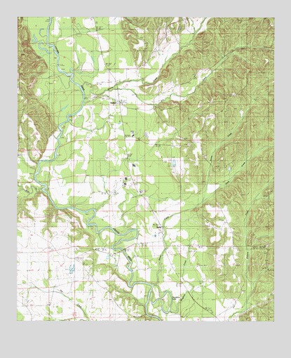
Suttle, AL USGS Topographic Map
Click on map above to begin viewing in our Map Viewer.

This topographic map contains these locations and features:
Feature Name Type Latitude Longitude GNIS ID View Map
Bethany CemeteryCemeteryN32.5812°W87.2047°113988View Map
Bethany ChurchChurchN32.5849°W87.2047°113992View Map
Bethany School (historical)SchoolN32.5843°W87.2050°149881View Map
Bingham CreekStreamN32.5124°W87.1850°114355View Map
Center School (historical)SchoolN32.5474°W87.1847°149882View Map
Dry CreekStreamN32.5946°W87.2033°159523View Map
East Perry High SchoolSchoolN32.5762°W87.1936°165407View Map
Edwards CemeteryCemeteryN32.6157°W87.1897°117878View Map
Holley CreekStreamN32.5474°W87.1622°159788View Map
Lakeland Farms Dam Number NineteenDamN32.6001°W87.2500°130756View Map
Lakeland Farms Pond Number NineteenReservoirN32.6001°W87.2500°130757View Map
Lillie Grove ChurchChurchN32.5229°W87.2181°121618View Map
Lilly Grove School (historical)SchoolN32.5240°W87.2183°149887View Map
Mount Olive ChurchChurchN32.5962°W87.2494°123305View Map
New Hope ChurchChurchN32.6112°W87.1886°123819View Map
Pine Flat ChurchChurchN32.5724°W87.1661°124767View Map
RadfordPopulated PlaceN32.5893°W87.2000°153099View Map
Rice CreekStreamN32.5540°W87.2378°160486View Map
Sand CreekStreamN32.5474°W87.1622°160557View Map
Santa Felix ChurchChurchN32.5446°W87.1825°153328View Map
Silver CreekStreamN32.5154°W87.1847°126848View Map
SuttlePopulated PlaceN32.5362°W87.1797°153614View Map
Suttle CemeteryCemeteryN32.6040°W87.1555°127570View Map
Suttle Post OfficePost OfficeN32.5382°W87.1792°166738View Map
Suttle SchoolSchoolN32.5532°W87.1900°153615View Map
Suttle Volunteer Fire DepartmentBuildingN32.5897°W87.1999°2691349View Map
Vaughans LakeLakeN32.5049°W87.1761°128418View Map
Waters CemeteryCemeteryN32.6237°W87.1683°149851View Map
Waters CreekStreamN32.5957°W87.2186°160806View Map
Waters Store (historical)LocaleN32.5985°W87.2017°146299View Map
Wells CreekStreamN32.6199°W87.2344°160819View Map

Note: Coordinates in the location and feature list above are referenced to NAD83 datum.


Copyright (C) 2008-2024 Ryan Niemi / Sunset Dynamics ... All Rights Reserved