TopoQuest Logo
Do you find TopoQuest useful?
Help keep TopoQuest running and adding new maps/features by donating!
Bitcoin:  19c7KJd3qBynnjoSw5npx9KScwjBe4ifkT
Litecoin:  LXs6TkuXGGXo1vDsWCkWVdjQX94eUKd6ui
Home View Maps Find Maps Find Places Resources & Links


Albion West, Nebraska Topographic Map

USGS Map Title: Albion West, NE
USGS Map MRC: 41098F1
DRG (GeoTIFF) Download: o41098f1.tif


Neighboring USGS Topographic Map Quads:


  Elgin SW, NE  
41098G2
 

  Petersburg, NE  
41098G1
 

  Closter SW, NE  
41097G8
 

  Akron, NE  
41098F2
 

  Albion West, NE  
41098F1
 

  Albion East, NE  
41097F8
 

  Cedar Rapids, NE  
41098E2
 

  Cedar Rapids SE, NE  
41098E1
 

  Saint Edward SW, NE  
41097E8


Map MRC Location:

N42°
W99°
N42°
W98°
H8 H7 H6 H5 H4 H3 H2 H1
G8 G7 G6 G5 G4 G3 G2 G1
F8 F7 F6 F5 F4 F3 F2 F1
E8 E7 E6 E5 E4 E3 E2 E1
D8 D7 D6 D5 D4 D3 D2 D1
C8 C7 C6 C5 C4 C3 C2 C1
B8 B7 B6 B5 B4 B3 B2 B1
A8 A7 A6 A5 A4 A3 A2 A1
N41°
W99°
N41°
W98°

Albion West, NE USGS 1:24K Topographic Map Preview:
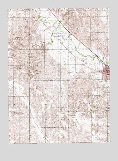
Albion West, NE USGS Topographic Map
Click on map above to begin viewing in our Map Viewer.

This topographic map contains these locations and features:
Feature Name Type Latitude Longitude GNIS ID View Map
AlbionPopulated PlaceN41.6908°W98.0037°826929View Map
AlbionLocaleN41.6958°W98.0042°1880737View Map
Albion Bible ChurchChurchN41.6903°W98.0067°1880749View Map
Albion CemeteryCemeteryN41.6750°W98.0001°826930View Map
Albion City ParkParkN41.6908°W98.0037°1880729View Map
Albion Country ClubLocaleN41.6897°W98.0170°1880754View Map
Albion Dental ClinicHospitalN41.6917°W98.0001°1880738View Map
Albion Municipal AirportAirportN41.7283°W98.0542°837466View Map
Albion Police DepartmentBuildingN41.6940°W98.0019°1880733View Map
Albion Post OfficePost OfficeN41.6922°W98.0002°1880731View Map
Albion Public SchoolsSchoolN41.6881°W98.0031°1880766View Map
Albion Volunteer Fire DepartmentBuildingN41.6915°W98.0028°1880734View Map
Beaver Valley SchoolSchoolN41.7245°W98.0612°827263View Map
Boone CountyCivilN41.7068°W98.0673°835828View Map
Boone County Ambulance ServiceBuildingN41.6914°W98.0017°2553700View Map
Boone County CourthouseBuildingN41.6914°W98.0017°1880736View Map
Boone County FairgroundLocaleN41.6820°W98.0101°1880753View Map
Boone County Health CenterBuildingN41.6831°W98.0056°1880742View Map
Boone County Health CenterHospitalN41.6832°W98.0056°1880743View Map
Boone County Historical MuseumBuildingN41.6908°W98.0037°1880728View Map
Boone County Sheriff's OfficeBuildingN41.6914°W98.0020°1880735View Map
Callahan Chiropractic CenterHospitalN41.6917°W98.0006°1880739View Map
City of Albion - RV CampgroundLocaleN41.6908°W98.0037°1880730View Map
First Baptist ChurchChurchN41.6906°W98.0006°1880745View Map
Fuller ParkParkN41.6828°W98.0067°1880724View Map
KLBN-FM (Albion)TowerN41.6792°W98.0123°837380View Map
Kohtz-City of Albion DamDamN41.6789°W98.0085°1767061View Map
Kohtz-City of Albion ReservoirReservoirN41.6782°W98.0087°1767062View Map
Koinzan DamDamN41.7032°W98.1046°1767065View Map
Koinzan ReservoirReservoirN41.7033°W98.1053°1767066View Map
Maple Hill School (historical)SchoolN41.7417°W98.1223°831044View Map
Palmer Eye Associates CenterHospitalN41.6917°W98.0009°1880740View Map
Saint Michaels Catholic ChurchChurchN41.6922°W98.0034°1880744View Map
Saint Michaels Elementary SchoolSchoolN41.6922°W98.0028°1880752View Map
School Number 2 (historical)SchoolN41.6833°W98.0606°836363View Map
School Number 21 (historical)SchoolN41.6392°W98.0909°836390View Map
School Number 25 (historical)SchoolN41.6475°W98.0420°836463View Map
School Number 44 (historical)SchoolN41.6683°W98.1187°836744View Map
School Number 81 (historical)SchoolN41.6403°W98.0034°837119View Map
Seventh Day Adventist ChurchChurchN41.6883°W98.0073°1880750View Map
Southwest Manchester Election PrecinctCivilN41.6677°W98.0963°1929301View Map
United Church of ChristChurchN41.6908°W98.0026°1880746View Map
United Methodist ChurchChurchN41.6897°W98.0184°1880748View Map
Wolf Memorial Good SamaritanHospitalN41.6806°W98.0051°1880741View Map
Zion Lutheran ChurchChurchN41.6906°W98.0015°1880747View Map

Note: Coordinates in the location and feature list above are referenced to NAD83 datum.


Copyright (C) 2008-2024 Ryan Niemi / Sunset Dynamics ... All Rights Reserved