TopoQuest Logo
Do you find TopoQuest useful?
Help keep TopoQuest running and adding new maps/features by donating!
Bitcoin:  19c7KJd3qBynnjoSw5npx9KScwjBe4ifkT
Litecoin:  LXs6TkuXGGXo1vDsWCkWVdjQX94eUKd6ui
Home View Maps Find Maps Find Places Resources & Links


Albion South, Illinois Topographic Map

USGS Map Title: Albion South, IL
USGS Map MRC: 38088C1
DRG (GeoTIFF) Download: o38088c1.tif


Neighboring USGS Topographic Map Quads:


  Albion NW, IL  
38088D2
 

  Albion North, IL  
38088D1
 

  Bone Gap, IL  
38087D8
 

  Golden Gate, IL  
38088C2
 

  Albion South, IL  
38088C1
 

  Grayville, IL  
38087C8
 

  Centerville, IL  
38088B2
 

  Crossville, IL  
38088B1
 

  New Harmony, IN  
38087B8


Map MRC Location:

N39°
W89°
N39°
W88°
H8 H7 H6 H5 H4 H3 H2 H1
G8 G7 G6 G5 G4 G3 G2 G1
F8 F7 F6 F5 F4 F3 F2 F1
E8 E7 E6 E5 E4 E3 E2 E1
D8 D7 D6 D5 D4 D3 D2 D1
C8 C7 C6 C5 C4 C3 C2 C1
B8 B7 B6 B5 B4 B3 B2 B1
A8 A7 A6 A5 A4 A3 A2 A1
N38°
W89°
N38°
W88°

Albion South, IL USGS 1:24K Topographic Map Preview:
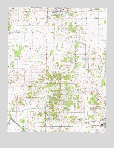
Albion South, IL USGS Topographic Map
Click on map above to begin viewing in our Map Viewer.

This topographic map contains these locations and features:
Feature Name Type Latitude Longitude GNIS ID View Map
Albion East Oil FieldOilfieldN38.3206°W88.0059°424559View Map
Albion Number 3 Election PrecinctCivilN38.3567°W88.0854°1928426View Map
Albion Oil FieldOilfieldN38.3159°W88.0442°424560View Map
Birk Prairie CemeteryCemeteryN38.2956°W88.1003°404464View Map
Birk Prairie Church (historical)ChurchN38.2956°W88.1000°1725482View Map
Browns ChapelChurchN38.2703°W88.0770°404979View Map
Butter CreekStreamN38.3162°W88.1200°405299View Map
Camp CreekStreamN38.2628°W88.1198°405444View Map
Catholic CemeteryCemeteryN38.2623°W88.0134°1725485View Map
Coles CemeteryCemeteryN38.2834°W88.0111°1808140View Map
Dixon Election PrecinctCivilN38.2920°W88.0997°1928471View Map
Dixon School (historical)SchoolN38.2845°W88.1036°1725487View Map
Dixon ShoalsBarN38.2623°W88.1189°407258View Map
Dunk School (historical)SchoolN38.2917°W88.0539°1725488View Map
English PrairieAreaN38.3528°W88.0759°1808148View Map
Flower School (historical)SchoolN38.3492°W88.0664°1725489View Map
French Creek Election PrecinctCivilN38.2986°W88.0096°1928499View Map
Gill School (historical)SchoolN38.3684°W88.1034°1725490View Map
Glover School (historical)SchoolN38.3025°W88.1134°1725491View Map
Gravet CemeteryCemeteryN38.3214°W88.0248°1808154View Map
Grayville High SchoolSchoolN38.2581°W88.0056°1823966View Map
Harper CreekStreamN38.3162°W88.1200°409825View Map
Height ShoalsBarN38.2500°W88.1025°410031View Map
Height Shoals Bridge (historical)BridgeN38.2506°W88.1025°1725538View Map
Jacobs CemeteryCemeteryN38.3006°W88.0148°411018View Map
James Hean Family CemeteryCemeteryN38.3331°W88.0184°1808155View Map
Johnson CemeteryCemeteryN38.2895°W88.0284°411151View Map
Judge School (historical)SchoolN38.3278°W88.0895°1725492View Map
Little Wabash Fire Protection DistrictBuildingN38.2580°W88.0089°2682303View Map
Long PrairieAreaN38.3431°W88.0186°1808159View Map
Mount Zion CemeteryCemeteryN38.3128°W88.0759°1808163View Map
Mount Zion United Methodist ChurchChurchN38.3137°W88.0759°414124View Map
Northside Baptist ChurchChurchN38.2645°W88.0014°1808164View Map
Oak Grove CemeteryCemeteryN38.2639°W88.0039°414769View Map
Olive Congregational Christian ChurchChurchN38.3134°W88.0231°415092View Map
Olive School (historical)SchoolN38.3128°W88.0234°1725497View Map
Onion CreekStreamN38.2606°W88.0211°415126View Map
Red TopPopulated PlaceN38.3720°W88.0261°1808168View Map
Red Top School (historical)SchoolN38.3684°W88.0256°1725499View Map
Ridge Baptist ChurchChurchN38.2656°W88.0631°416634View Map
Ridge CemeteryCemeteryN38.2656°W88.0639°1808169View Map
Ridge School (historical)SchoolN38.2675°W88.0770°1725500View Map
Smith School (historical)SchoolN38.2987°W88.0770°1725502View Map
Stinking CreekStreamN38.2520°W88.1034°419144View Map
Vallette School (historical)SchoolN38.3173°W88.0584°1725503View Map
Wells Elementary SchoolSchoolN38.2581°W88.0039°1823985View Map
West CemeteryCemeteryN38.3356°W88.1006°420801View Map

Note: Coordinates in the location and feature list above are referenced to NAD83 datum.


Copyright (C) 2008-2024 Ryan Niemi / Sunset Dynamics ... All Rights Reserved