TopoQuest Logo
Do you find TopoQuest useful?
Help keep TopoQuest running and adding new maps/features by donating!
Bitcoin:  19c7KJd3qBynnjoSw5npx9KScwjBe4ifkT
Litecoin:  LXs6TkuXGGXo1vDsWCkWVdjQX94eUKd6ui
Home View Maps Find Maps Find Places Resources & Links


Blanton, Texas Topographic Map

USGS Map Title: Blanton, TX
USGS Map MRC: 32097A3
DRG (GeoTIFF) Download: o32097a3.tif


Neighboring USGS Topographic Map Quads:


  Blum, TX  
32097B4
 

  Covington, TX  
32097B3
 

  Itasca, TX  
32097B2
 

  Lakeside Village, TX  
32097A4
 

  Blanton, TX  
32097A3
 

  Hillsboro West, TX  
32097A2
 

  Allen Bend, TX  
31097H4
 

  Whitney, TX  
31097H3
 

  Peoria, TX  
31097H2


Map MRC Location:

N33°
W98°
N33°
W97°
H8 H7 H6 H5 H4 H3 H2 H1
G8 G7 G6 G5 G4 G3 G2 G1
F8 F7 F6 F5 F4 F3 F2 F1
E8 E7 E6 E5 E4 E3 E2 E1
D8 D7 D6 D5 D4 D3 D2 D1
C8 C7 C6 C5 C4 C3 C2 C1
B8 B7 B6 B5 B4 B3 B2 B1
A8 A7 A6 A5 A4 A3 A2 A1
N32°
W98°
N32°
W97°

Blanton, TX USGS 1:24K Topographic Map Preview:
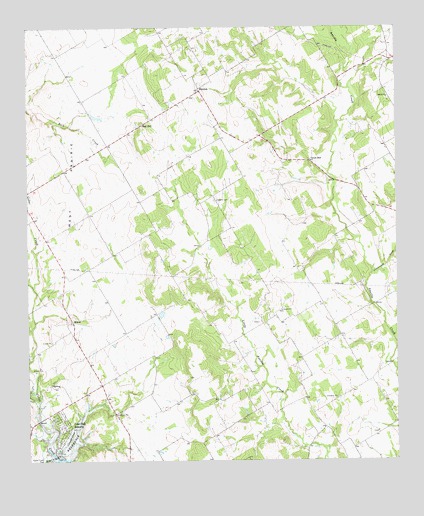
Blanton, TX USGS Topographic Map
Click on map above to begin viewing in our Map Viewer.

This topographic map contains these locations and features:
Feature Name Type Latitude Longitude GNIS ID View Map
2604 Volunteer Fire DepartmentBuildingN32.0110°W97.3741°2552484View Map
Barnstormer AirportAirportN32.0242°W97.2579°2675975View Map
BlantonPopulated PlaceN32.1068°W97.3164°1378019View Map
Cottonwood CreekStreamN32.0543°W97.2586°1333460View Map
Grub HillPopulated PlaceN32.0863°W97.2792°1378391View Map
HuronPopulated PlaceN32.0399°W97.3600°1378474View Map
Jawbone CemeteryCemeteryN32.0752°W97.3117°1338674View Map
Live Oak ResortsPopulated PlaceN32.0104°W97.3625°1340261View Map
Red HillPopulated PlaceN32.0965°W97.3370°1378940View Map
Rocking A AirportAirportN32.0210°W97.3317°2675873View Map
Shiloh ChurchChurchN32.1049°W97.2531°1347054View Map
Soil Conservation Service Site 6 DamDamN32.1068°W97.2803°1863563View Map
Soil Conservation Service Site 6 ReservoirReservoirN32.1068°W97.2803°1863564View Map
Soil Conservation Service Site 7 DamDamN32.0885°W97.2803°1863565View Map
Soil Conservation Service Site 7 ReservoirReservoirN32.0885°W97.2803°1863566View Map
Soil Conservation Service Site 8 DamDamN32.0802°W97.2753°1863066View Map
Soil Conservation Service Site 8 ReservoirReservoirN32.0802°W97.2753°1863067View Map
Soil Conservation Service Site 9 DamDamN32.0802°W97.2736°1863567View Map
Soil Conservation Service Site 9 ReservoirReservoirN32.0802°W97.2736°1863568View Map
West PrairieFlatN32.0810°W97.3611°1349784View Map

Note: Coordinates in the location and feature list above are referenced to NAD83 datum.


Copyright (C) 2008-2024 Ryan Niemi / Sunset Dynamics ... All Rights Reserved