TopoQuest Logo
Do you find TopoQuest useful?
Help keep TopoQuest running and adding new maps/features by donating!
Bitcoin:  19c7KJd3qBynnjoSw5npx9KScwjBe4ifkT
Litecoin:  LXs6TkuXGGXo1vDsWCkWVdjQX94eUKd6ui
Home View Maps Find Maps Find Places Resources & Links


Suches, Georgia Topographic Map

USGS Map Title: Suches, GA
USGS Map MRC: 34084F1
DRG (GeoTIFF) Download: o34084f1.tif


Neighboring USGS Topographic Map Quads:


  Wilscot, GA  
34084G2
 

  Mulky Gap, GA  
34084G1
 

  Coosa Bald, GA  
34083G8
 

  Noontootla, GA  
34084F2
 

  Suches, GA  
34084F1
 

  Neels Gap, GA  
34083F8
 

  Nimblewill, GA  
34084E2
 

  Campbell Mountain, GA  
34084E1
 

  Dahlonega, GA  
34083E8


Map MRC Location:

N35°
W85°
N35°
W84°
H8 H7 H6 H5 H4 H3 H2 H1
G8 G7 G6 G5 G4 G3 G2 G1
F8 F7 F6 F5 F4 F3 F2 F1
E8 E7 E6 E5 E4 E3 E2 E1
D8 D7 D6 D5 D4 D3 D2 D1
C8 C7 C6 C5 C4 C3 C2 C1
B8 B7 B6 B5 B4 B3 B2 B1
A8 A7 A6 A5 A4 A3 A2 A1
N34°
W85°
N34°
W84°

Suches, GA USGS 1:24K Topographic Map Preview:
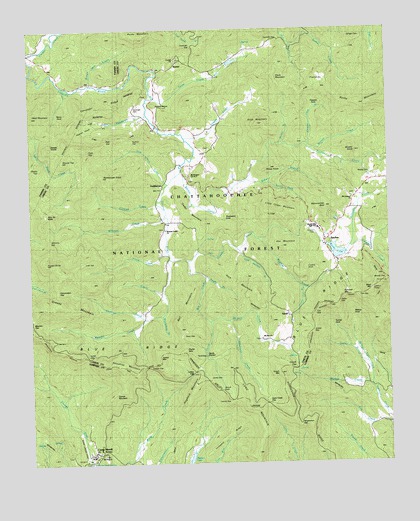
Suches, GA USGS Topographic Map
Click on map above to begin viewing in our Map Viewer.

This topographic map contains these locations and features:
Feature Name Type Latitude Longitude GNIS ID View Map
Abe MountainSummitN34.6873°W84.0377°330587View Map
Abercrombie BaldSummitN34.6990°W84.0219°326910View Map
Baker BranchStreamN34.7065°W84.0491°326993View Map
Ball MountainSummitN34.6681°W84.0724°331085View Map
BaxterPopulated PlaceN34.7387°W84.0746°331107View Map
Big CreekStreamN34.6831°W84.0699°327105View Map
Black MountainSummitN34.6751°W84.0057°327145View Map
Black Mountain Look Out TowerTowerN34.6748°W84.0057°344393View Map
Black Mountain TrailTrailN34.6695°W84.0063°327147View Map
Blackwell CreekStreamN34.6659°W84.0557°327157View Map
Blue Ridge Ranger StationLocaleN34.6823°W84.0185°327175View Map
Brookshire BranchStreamN34.6679°W84.0788°327227View Map
Brookshire GapGapN34.6570°W84.0755°330825View Map
Brown Mill CreekStreamN34.7345°W84.1024°327236View Map
Brushy KnobSummitN34.7148°W84.0113°327244View Map
Burnett CreekStreamN34.7154°W84.0266°327291View Map
Canada CreekStreamN34.6837°W84.0763°327348View Map
Cane Creek GapGapN34.6420°W84.0427°327354View Map
Cavender BridgeBridgeN34.7384°W84.0819°327389View Map
Cavender CemeteryCemeteryN34.7276°W84.0880°330590View Map
Cavender GapGapN34.7451°W84.0674°327391View Map
Cavender MountainSummitN34.7298°W84.0691°331346View Map
Cavender RidgeRidgeN34.7270°W84.0980°355045View Map
Cedar MountainSummitN34.6956°W84.0694°331357View Map
Cochran CreekStreamN34.6679°W84.0791°355212View Map
Conner MountainSummitN34.6440°W84.0977°331448View Map
Cooper CreekStreamN34.7381°W84.1238°355292View Map
Cooper GapGapN34.6531°W84.0841°355293View Map
Corinth CemeteryCemeteryN34.7412°W84.0735°353108View Map
Corinth ChurchChurchN34.7415°W84.0735°355322View Map
Cynthia KnobSummitN34.6809°W84.0288°327582View Map
Davis CreekStreamN34.7306°W84.0807°327605View Map
Davis MountainSummitN34.7370°W84.0396°327608View Map
Deep GapGapN34.6629°W84.0699°327620View Map
Devils KitchenFlatN34.6565°W84.0621°330584View Map
Doff BranchStreamN34.7495°W84.1141°327663View Map
Double KnobsSummitN34.7165°W84.1141°331580View Map
Eagles Nest LakeReservoirN34.7406°W84.0538°339106View Map
Eagles Nest Lake DamDamN34.7401°W84.0549°339105View Map
Edmondson GapGapN34.6748°W84.1155°327743View Map
FlatlandsAreaN34.7348°W84.0232°331728View Map
Flowers CoveValleyN34.7273°W84.0258°327854View Map
Flowers Cove BranchStreamN34.7170°W84.0277°327855View Map
Fort Benning Fire Department Station 36BuildingN34.6277°W84.1017°2604534View Map
Frank CreekStreamN34.6862°W84.0774°327875View Map
Frozen KnobSummitN34.6829°W84.1188°355965View Map
GaddistownPopulated PlaceN34.7040°W84.0788°331783View Map
Gilreath CreekStreamN34.6995°W84.0796°327934View Map
Gooch CreekStreamN34.6743°W84.0785°327959View Map
Gooch GapGapN34.6520°W84.0324°327960View Map
Gooch Gap Trail ShelterLocaleN34.6543°W84.0352°330865View Map
Gooch Lake (historical)ReservoirN34.6748°W84.0824°327962View Map
Gooch MountainSummitN34.6509°W84.0382°327963View Map
Grassy GapGapN34.6629°W84.0266°327990View Map
Grassy Gap BranchStreamN34.6754°W84.0302°327991View Map
Greasy MountainSummitN34.6693°W84.1096°331857View Map
Grizzle CreekStreamN34.7201°W84.0710°328014View Map
Gum Gap School (historical)SchoolN34.7245°W84.0310°353117View Map
Harmony ChurchChurchN34.7068°W84.0038°353119View Map
Harmony Church (historical)ChurchN34.7068°W84.0038°328067View Map
Head MountainSummitN34.7256°W84.1230°328095View Map
Headtown CreekStreamN34.7254°W84.0835°328096View Map
Hidden LakeReservoirN34.6265°W84.0698°328145View Map
Hidden Lake DamDamN34.6254°W84.0705°336686View Map
High TopSummitN34.7156°W84.1041°328155View Map
High Valley AirparkAirportN34.6959°W84.0124°351916View Map
Hogback MountainSummitN34.6479°W84.0680°328183View Map
Horse GapGapN34.6556°W84.1046°328221View Map
Horseshoe RidgeRidgeN34.6343°W84.0277°328228View Map
Hughes GapGapN34.7179°W84.0891°328247View Map
Jacks GapGapN34.6715°W84.0174°328294View Map
Jones GapGapN34.6495°W84.0641°328358View Map
Justus CreekStreamN34.6659°W84.0624°328368View Map
Justus GapGapN34.6518°W84.0677°328369View Map
Justus MountainSummitN34.6559°W84.0802°328370View Map
Kennedy CreekStreamN34.6868°W84.0138°328386View Map
Knight BranchStreamN34.6787°W84.0638°328419View Map
Liss GapGapN34.6684°W84.0260°328518View Map
Little Cedar MountainSummitN34.6976°W84.0424°328528View Map
Locust GapGapN34.6434°W84.0549°328594View Map
Locust GapGapN34.7326°W84.0266°328595View Map
Long MountainSummitN34.6273°W84.0466°328635View Map
Low GapGapN34.6831°W84.1052°328659View Map
Lumpkin RidgeRidgeN34.6318°W84.0591°328673View Map
Mauldin CreekStreamN34.6668°W84.0849°328728View Map
Mauldin GapGapN34.6668°W84.1246°328729View Map
Mount Airy CemeteryCemeteryN34.6606°W84.0449°353134View Map
Mount Airy ChurchChurchN34.6609°W84.0446°328864View Map
Mount Airy CreekStreamN34.6659°W84.0627°328865View Map
Mount Airy School (historical)SchoolN34.6612°W84.0449°353135View Map
Mount Lebanon CemeteryCemeteryN34.7018°W84.0124°353136View Map
Mount Lebanon ChurchChurchN34.7012°W84.0116°328876View Map
Mount Lebanon School (historical)SchoolN34.7023°W84.0110°353137View Map
Mount Pleasant Church Number 2ChurchN34.7079°W84.0685°344302View Map
Mount Pleasant Number 2 CemeteryCemeteryN34.7073°W84.0685°353140View Map
Mount Pleasant School (historical)SchoolN34.7048°W84.0591°353141View Map
Mount Zion ChurchChurchN34.6279°W84.1007°328919View Map
Muddy BranchStreamN34.7173°W84.0369°328945View Map
Peggy Hale School (historical)SchoolN34.7031°W84.0646°353157View Map
Penny CoveSlopeN34.7273°W84.1119°330589View Map
Persimmon GapGapN34.6362°W84.0316°329174View Map
Phyllis SpurRidgeN34.6573°W84.0721°330583View Map
Pilot MountainSummitN34.7231°W84.0449°329208View Map
Pine Tar KnobSummitN34.6968°W84.1194°329226View Map
Pink Davis CreekStreamN34.7059°W84.0763°329239View Map
Pleasant Valley CemeteryCemeteryN34.6926°W84.0780°353169View Map
Pleasant Valley ChurchChurchN34.6926°W84.0774°329268View Map
Pleasant Valley School (historical)SchoolN34.6920°W84.0782°353170View Map
Poplar BranchStreamN34.6537°W84.0080°329293View Map
Poplar CoveValleyN34.7232°W84.0989°329296View Map
Rabbit KnobSummitN34.7284°W84.0819°330588View Map
Ramrock MountainSummitN34.6729°W84.0163°329367View Map
Rattlesnake KnobSummitN34.7079°W84.0991°329372View Map
Rich MountainRidgeN34.6784°W84.0521°329421View Map
Ride-A-Horse BranchStreamN34.7495°W84.1152°329431View Map
Rocky MountainSummitN34.7484°W84.0860°332906View Map
Round TopSummitN34.7120°W84.1130°329539View Map
Ryal GapGapN34.7187°W84.0949°329554View Map
Sally Spillers BranchStreamN34.6865°W84.0524°329576View Map
SarahPopulated PlaceN34.6676°W84.0357°332981View Map
Sassafras MountainSummitN34.6362°W84.0938°330582View Map
Sharp TopSummitN34.7104°W84.1207°329652View Map
Sheep KnobSummitN34.7093°W84.0430°329659View Map
South Fork Baker BranchStreamN34.7059°W84.0413°329766View Map
Spriggs CemeteryCemeteryN34.7479°W84.0080°329787View Map
SuchesPopulated PlaceN34.6890°W84.0221°333148View Map
Suches CreekStreamN34.7090°W84.0719°329876View Map
Suches DivisionCivilN34.7243°W84.0454°1936560View Map
Thompson CoveSlopeN34.6963°W84.0584°330585View Map
Tritt GapGapN34.6731°W84.0119°330054View Map
Tunnel CoveSlopeN34.6640°W84.0188°330586View Map
Turkey CreekStreamN34.7462°W84.0338°330067View Map
Twomile GapGapN34.7473°W84.0369°330093View Map
Union County Fire Department Station 11BuildingN34.7198°W84.0675°2603896View Map
Union County Fire Department Station 5BuildingN34.6934°W84.0237°2604782View Map
Walden CreekStreamN34.6470°W84.0060°330135View Map
Walnut CoveValleyN34.6641°W84.0120°330145View Map
Walnut Cove CreekStreamN34.6470°W84.0060°330146View Map
Ward GapGapN34.6462°W84.0588°330164View Map
Wildhog CreekStreamN34.6893°W84.0452°330281View Map
Williams CreekStreamN34.6959°W84.0780°330296View Map
Williams GapGapN34.6895°W84.1177°330297View Map
Woody CemeteryCemeteryN34.7084°W84.0055°330370View Map
Woody Gap CampgroundLocaleN34.6765°W84.0005°330823View Map
Woody Gap Elementary SchoolSchoolN34.6920°W84.0238°353199View Map
Woody Gap SchoolSchoolN34.6923°W84.0241°330377View Map
Woody LakeReservoirN34.6858°W84.0179°330378View Map
Woody Lake DamDamN34.6876°W84.0213°339134View Map
Woody Lake DamReservoirN34.6834°W84.0332°339135View Map
Y J GapGapN34.6970°W84.0405°330392View Map

Note: Coordinates in the location and feature list above are referenced to NAD83 datum.


Copyright (C) 2008-2024 Ryan Niemi / Sunset Dynamics ... All Rights Reserved