TopoQuest Logo
Do you find TopoQuest useful?
Help keep TopoQuest running and adding new maps/features by donating!
Bitcoin:  19c7KJd3qBynnjoSw5npx9KScwjBe4ifkT
Litecoin:  LXs6TkuXGGXo1vDsWCkWVdjQX94eUKd6ui
Home View Maps Find Maps Find Places Resources & Links


Stockwell, Indiana Topographic Map

USGS Map Title: Stockwell, IN
USGS Map MRC: 40086C7
DRG (GeoTIFF) Download: o40086c7.tif


Neighboring USGS Topographic Map Quads:


  Lafayette West, IN  
40086D8
 

  Lafayette East, IN  
40086D7
 

  Pyrmont, IN  
40086D6
 

  Romney, IN  
40086C8
 

  Stockwell, IN  
40086C7
 

  Mulberry, IN  
40086C6
 

  Linden, IN  
40086B8
 

  Kirkpatrick, IN  
40086B7
 

  Colfax, IN  
40086B6


Map MRC Location:

N41°
W87°
N41°
W86°
H8 H7 H6 H5 H4 H3 H2 H1
G8 G7 G6 G5 G4 G3 G2 G1
F8 F7 F6 F5 F4 F3 F2 F1
E8 E7 E6 E5 E4 E3 E2 E1
D8 D7 D6 D5 D4 D3 D2 D1
C8 C7 C6 C5 C4 C3 C2 C1
B8 B7 B6 B5 B4 B3 B2 B1
A8 A7 A6 A5 A4 A3 A2 A1
N40°
W87°
N40°
W86°

Stockwell, IN USGS 1:24K Topographic Map Preview:
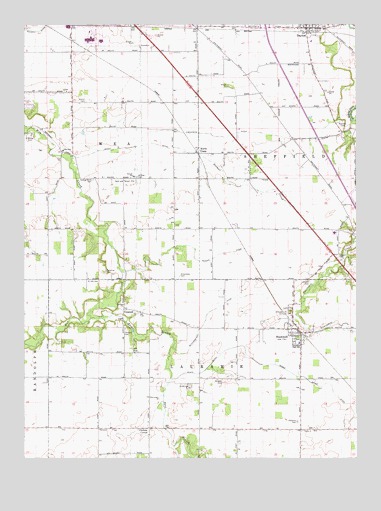
Stockwell, IN USGS Topographic Map
Click on map above to begin viewing in our Map Viewer.

This topographic map contains these locations and features:
Feature Name Type Latitude Longitude GNIS ID View Map
Blickenstaff DitchCanalN40.2939°W86.8011°431183View Map
Conarroe CemeteryCemeteryN40.3042°W86.8442°432844View Map
ConcordPopulated PlaceN40.2934°W86.8375°432847View Map
Concord CemeteryCemeteryN40.2872°W86.8369°432854View Map
Conroe ChurchChurchN40.2942°W86.8378°432901View Map
DaytonPopulated PlaceN40.3742°W86.7689°433370View Map
Dayton Police DepartmentBuildingN40.3735°W86.7813°2758162View Map
Dismal CreekStreamN40.3375°W86.8086°433569View Map
East Branch Wea CreekStreamN40.2906°W86.8500°433866View Map
Fairview CemeteryCemeteryN40.2923°W86.7767°434324View Map
Felix AirportAirportN40.2898°W86.7791°2676915View Map
Gladens CornerPopulated PlaceN40.2586°W86.8283°435097View Map
Ilgenfritz DitchCanalN40.3425°W86.7995°436709View Map
Johnson CemeteryCemeteryN40.3012°W86.7683°437040View Map
Kenny CemeteryCemeteryN40.3529°W86.8519°437249View Map
Kenny DitchCanalN40.3400°W86.8320°437250View Map
Lauramie Township Fire DepartmentBuildingN40.2835°W86.7713°2626130View Map
Moses Baker DitchCanalN40.2728°W86.7689°439486View Map
North CranePopulated PlaceN40.3386°W86.8103°440239View Map
O'Neall CemeteryCemeteryN40.3422°W86.8715°440394View Map
Platt DitchCanalN40.2770°W86.8050°441229View Map
Resser DitchCanalN40.3098°W86.8108°441910View Map
Saint Joe CemeteryCemeteryN40.3011°W86.8472°442556View Map
Salem CemeteryCemeteryN40.3091°W86.7562°442887View Map
Shoemaker CemeteryCemeteryN40.3027°W86.8165°443435View Map
Spring Grove CemeteryCemeteryN40.3303°W86.8491°443980View Map
Stingley CemeteryCemeteryN40.2724°W86.8008°444172View Map
StockwellPopulated PlaceN40.2861°W86.7708°444184View Map
Stockwell Census Designated PlaceCensusN40.2823°W86.7687°2583472View Map
Timber House AirportAirportN40.2852°W86.8580°449237View Map
Township of LauramieCivilN40.2580°W86.7807°453543View Map
Township of SheffieldCivilN40.3451°W86.7521°453843View Map
Township of WeaCivilN40.3448°W86.8664°454043View Map
Wea SchoolSchoolN40.3389°W86.8606°445587View Map
Wea Township Community Fire DepartmentBuildingN40.3450°W86.8684°2625542View Map
Wildcat CemeteryCemeteryN40.3310°W86.8324°446016View Map
Wyandot CemeteryCemeteryN40.3470°W86.7555°446347View Map
Wyandotte AirportAirportN40.3497°W86.7607°2676970View Map
Yorktown CemeteryCemeteryN40.2604°W86.7719°446405View Map

Note: Coordinates in the location and feature list above are referenced to NAD83 datum.


Copyright (C) 2008-2024 Ryan Niemi / Sunset Dynamics ... All Rights Reserved