TopoQuest Logo
Do you find TopoQuest useful?
Help keep TopoQuest running and adding new maps/features by donating!
Bitcoin:  19c7KJd3qBynnjoSw5npx9KScwjBe4ifkT
Litecoin:  LXs6TkuXGGXo1vDsWCkWVdjQX94eUKd6ui
Home View Maps Find Maps Find Places Resources & Links


Steeleville, Illinois Topographic Map

USGS Map Title: Steeleville, IL
USGS Map MRC: 38089A6
DRG (GeoTIFF) Download: o38089a6.tif


Neighboring USGS Topographic Map Quads:


  Baldwin, IL  
38089B7
 

  Tilden, IL  
38089B6
 

  Coulterville, IL  
38089B5
 

  Walsh, IL  
38089A7
 

  Steeleville, IL  
38089A6
 

  Percy, IL  
38089A5
 

  Chester, IL  
37089H7
 

  Welge, IL  
37089H6
 

  Willisville, IL  
37089H5


Map MRC Location:

N39°
W90°
N39°
W89°
H8 H7 H6 H5 H4 H3 H2 H1
G8 G7 G6 G5 G4 G3 G2 G1
F8 F7 F6 F5 F4 F3 F2 F1
E8 E7 E6 E5 E4 E3 E2 E1
D8 D7 D6 D5 D4 D3 D2 D1
C8 C7 C6 C5 C4 C3 C2 C1
B8 B7 B6 B5 B4 B3 B2 B1
A8 A7 A6 A5 A4 A3 A2 A1
N38°
W90°
N38°
W89°

Steeleville, IL USGS 1:24K Topographic Map Preview:
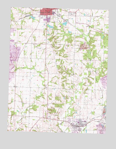
Steeleville, IL USGS Topographic Map
Click on map above to begin viewing in our Map Viewer.

This topographic map contains these locations and features:
Feature Name Type Latitude Longitude GNIS ID View Map
Amity School (historical)SchoolN38.0559°W89.7415°1764814View Map
BlairPopulated PlaceN38.0448°W89.7420°404539View Map
Blair Election PrecinctCivilN38.0442°W89.7426°1928447View Map
Blair School (historical)SchoolN38.0309°W89.7415°1764817View Map
Brick School (historical)SchoolN38.1101°W89.6668°1764818View Map
Brown-Stevenson City ParkParkN38.1167°W89.7107°1820673View Map
Church of the NazareneChurchN38.1248°W89.6943°1820677View Map
Concord School (historical)SchoolN38.0678°W89.6873°1764830View Map
EdenPopulated PlaceN38.1206°W89.6676°407764View Map
First Baptist ChurchChurchN38.1245°W89.7018°1820680View Map
First United Methodist ChurchChurchN38.1242°W89.7040°1820683View Map
Goddard School (historical)SchoolN38.0889°W89.6912°1764838View Map
Grotto School (historical)SchoolN38.0287°W89.6957°1764840View Map
Hopewell School (historical)SchoolN38.0084°W89.7154°1764846View Map
Independent Order of Odd Fellows CemeteryCemeteryN38.0131°W89.6301°1802692View Map
Jollity School (historical)SchoolN38.0595°W89.7232°1764848View Map
Lick BranchStreamN38.0631°W89.6473°412043View Map
Mahnken FarmsLocaleN38.0436°W89.7019°2680993View Map
Maxwell CreekStreamN38.0976°W89.6526°413148View Map
McClinton School (historical)SchoolN38.1181°W89.6312°1764859View Map
MedStar AmbulanceBuildingN38.0114°W89.6637°2674051View Map
Misselhorn Art MuseumBuildingN38.1203°W89.7101°1820691View Map
New Yale School (historical)SchoolN38.0737°W89.6498°1764866View Map
Old City ReservoirReservoirN38.1065°W89.6989°1691645View Map
Old City Reservoir DamDamN38.1050°W89.6951°1691644View Map
Our Lady of Lourdes Roman Catholic ChurchChurchN38.1223°W89.7120°1820694View Map
Park Estates Mobile Home ParkPopulated PlaceN38.1109°W89.7062°1820695View Map
Peace CemeteryCemeteryN38.0178°W89.6587°415483View Map
Peace Lutheran ChurchChurchN38.0084°W89.6568°1820696View Map
Saint Marks Lutheran ChurchChurchN38.0073°W89.6651°1820703View Map
Salem School (historical)SchoolN38.0937°W89.7218°1764885View Map
SpartaPopulated PlaceN38.1231°W89.7018°418880View Map
Sparta Community HospitalHospitalN38.1240°W89.6913°1820704View Map
Sparta Country ClubLocaleN38.1167°W89.7232°1820705View Map
Sparta Election PrecinctCivilN38.1111°W89.6795°1928648View Map
Sparta Fire Department Station 1BuildingN38.1226°W89.7012°2640875View Map
Sparta Fire Department Station 2BuildingN38.1218°W89.7018°2640739View Map
Sparta Historic DistrictParkN38.1203°W89.7045°1820707View Map
Sparta Police DepartmentBuildingN38.1218°W89.7026°2758879View Map
Sparta Post OfficePost OfficeN38.1224°W89.7045°1820708View Map
Sparta Public LibraryBuildingN38.1237°W89.7037°1820710View Map
SteelevillePopulated PlaceN38.0073°W89.6584°419088View Map
Steeleville Election PrecinctCivilN38.0147°W89.6726°1928649View Map
Steeleville Election Precinct (historical)CivilN38.0167°W89.6501°422245View Map
Steeleville Elementary SchoolSchoolN38.0028°W89.6593°1820713View Map
Steeleville Fire DepartmentBuildingN38.0076°W89.6591°2640777View Map
Steeleville High SchoolSchoolN38.0006°W89.6604°1820714View Map
Steeleville Police DepartmentBuildingN38.0076°W89.6590°2759057View Map
Steeleville Post OfficePost OfficeN38.0072°W89.6622°2788899View Map
Steeleville United Methodist ChurchChurchN38.0056°W89.6626°1820715View Map
Trinity United Presbyterian ChurchChurchN38.1225°W89.7059°1820720View Map
Union CemeteryCemeteryN38.0881°W89.7218°420015View Map
Village of SteelevilleCivilN38.0085°W89.6624°2399891View Map
Weldon School (historical)SchoolN38.0401°W89.6437°1764895View Map
WHCO-AM (Sparta)TowerN38.1237°W89.7223°428090View Map

Note: Coordinates in the location and feature list above are referenced to NAD83 datum.


Copyright (C) 2008-2024 Ryan Niemi / Sunset Dynamics ... All Rights Reserved