TopoQuest Logo
Do you find TopoQuest useful?
Help keep TopoQuest running and adding new maps/features by donating!
Bitcoin:  19c7KJd3qBynnjoSw5npx9KScwjBe4ifkT
Litecoin:  LXs6TkuXGGXo1vDsWCkWVdjQX94eUKd6ui
Home View Maps Find Maps Find Places Resources & Links


Steele, Alabama Topographic Map

USGS Map Title: Steele, AL
USGS Map MRC: 33086H2
DRG (GeoTIFF) Download: o33086h2.tif


Neighboring USGS Topographic Map Quads:


  Altoona, AL  
34086A3
 

  Howelton, AL  
34086A2
 

  Gadsden West, AL  
34086A1
 

  Hyatt Gap, AL  
33086H3
 

  Steele, AL  
33086H2
 

  Dunaway Mountain, AL  
33086H1
 

  Ashville, AL  
33086G3
 

  Cox Gap, AL  
33086G2
 

  Ohatchee, AL  
33086G1


Map MRC Location:

N34°
W87°
N34°
W86°
H8 H7 H6 H5 H4 H3 H2 H1
G8 G7 G6 G5 G4 G3 G2 G1
F8 F7 F6 F5 F4 F3 F2 F1
E8 E7 E6 E5 E4 E3 E2 E1
D8 D7 D6 D5 D4 D3 D2 D1
C8 C7 C6 C5 C4 C3 C2 C1
B8 B7 B6 B5 B4 B3 B2 B1
A8 A7 A6 A5 A4 A3 A2 A1
N33°
W87°
N33°
W86°

Steele, AL USGS 1:24K Topographic Map Preview:
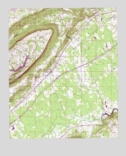
Steele, AL USGS Topographic Map
Click on map above to begin viewing in our Map Viewer.

This topographic map contains these locations and features:
Feature Name Type Latitude Longitude GNIS ID View Map
Ashville DivisionCivilN33.8810°W86.2411°165942View Map
Canoe Creek ValleyValleyN33.8854°W86.1947°164596View Map
Chandler Mountain ChurchChurchN33.9554°W86.2441°165145View Map
Chandler Mountain DamDamN33.9418°W86.2383°164992View Map
Chandler Mountain LakeReservoirN33.9433°W86.2370°165029View Map
Chandler Mountain Volunteer Fire DepartmentBuildingN33.9595°W86.2465°2683353View Map
Chandler Natural BridgeArchN33.9794°W86.2339°165291View Map
City of Rainbow CityCivilN33.9273°W86.1268°2404588View Map
Crews Mill (historical)LocaleN33.9534°W86.1955°165044View Map
Curtiston Elementary SchoolSchoolN33.9990°W86.1261°140511View Map
Deerman Chapel CemeteryCemeteryN33.9131°W86.2300°165049View Map
Deerman's Chapel United Methodist ChurchChurchN33.9145°W86.2322°164627View Map
Dobbs Mill (historical)LocaleN33.9732°W86.1897°165104View Map
Ezell Jenkins DamDamN33.9701°W86.2150°164995View Map
Ezell Jenkins LakeReservoirN33.9722°W86.2132°164994View Map
GallantPopulated PlaceN33.9987°W86.2453°118790View Map
Gallant CemeteryCemeteryN33.9984°W86.2450°140578View Map
Gallant Elementary SchoolSchoolN33.9990°W86.2475°140580View Map
Gallant Missionary Baptist ChurchChurchN33.9990°W86.2453°140579View Map
Gallant Post OfficePost OfficeN33.9979°W86.2476°2789008View Map
Gallant Volunteer Fire DepartmentBuildingN33.9986°W86.2474°2682915View Map
GilbertPopulated PlaceN33.9148°W86.2319°164664View Map
Harmony Church of GodChurchN33.9920°W86.1483°140608View Map
HoodPopulated PlaceN33.8884°W86.1550°165094View Map
Hopewell Baptist ChurchChurchN33.8879°W86.1486°164705View Map
Interchange 174CrossingN33.9334°W86.1939°165334View Map
Lake RumacReservoirN33.8844°W86.2466°165183View Map
Little Canoe CreekStreamN33.8979°W86.1380°164735View Map
Littles DamDamN33.9701°W86.1500°131859View Map
Littles LakeReservoirN33.9714°W86.1511°131860View Map
Millers CreekStreamN33.9994°W86.1478°149082View Map
Pilgrims Rest Primitive Baptist ChurchChurchN33.9948°W86.1347°140678View Map
Pleasant Hill Church (historical)ChurchN33.8773°W86.1286°1805493View Map
Pope DamDamN33.9334°W86.2183°164991View Map
Pope LakeReservoirN33.9341°W86.2193°164990View Map
RamseyPopulated PlaceN33.9923°W86.1491°153109View Map
Red MountainSummitN33.9968°W86.2094°125490View Map
Rumac DamDamN33.8834°W86.2450°164987View Map
Shahan (historical)Populated PlaceN33.9743°W86.1900°140712View Map
ShilohPopulated PlaceN33.9748°W86.1722°149117View Map
Shiloh CemeteryCemeteryN33.9756°W86.1714°1805653View Map
Shiloh Primitive Baptist ChurchChurchN33.9751°W86.1722°153426View Map
Shirley SpringSpringN33.9732°W86.1886°140717View Map
SteelePopulated PlaceN33.9398°W86.2016°164867View Map
Steele Fire DepartmentBuildingN33.9441°W86.1997°2682927View Map
Steele Junior High SchoolSchoolN33.9412°W86.2008°165310View Map
Steele Post OfficePost OfficeN33.9421°W86.1986°167298View Map
Town of SteeleCivilN33.9370°W86.2004°2406664View Map
Wesson DamDamN33.9618°W86.1366°131856View Map
Wessons LakeReservoirN33.9635°W86.1374°131855View Map
WQEN-FM (Gadsden)TowerN33.9532°W86.2166°164921View Map

Note: Coordinates in the location and feature list above are referenced to NAD83 datum.


Copyright (C) 2008-2024 Ryan Niemi / Sunset Dynamics ... All Rights Reserved