TopoQuest Logo
Do you find TopoQuest useful?
Help keep TopoQuest running and adding new maps/features by donating!
Bitcoin:  19c7KJd3qBynnjoSw5npx9KScwjBe4ifkT
Litecoin:  LXs6TkuXGGXo1vDsWCkWVdjQX94eUKd6ui
Home View Maps Find Maps Find Places Resources & Links


Bladon Springs, Alabama Topographic Map

USGS Map Title: Bladon Springs, AL
USGS Map MRC: 31088F2
DRG (GeoTIFF) Download: o31088f2.tif


Neighboring USGS Topographic Map Quads:


  Silas, AL  
31088G3
 

  Coffeeville Lock And Dam, AL  
31088G2
 

  Coffeeville, AL  
31088G1
 

  Millry North, AL  
31088F3
 

  Bladon Springs, AL  
31088F2
 

  Tattlersville, AL  
31088F1
 

  Millry South, AL  
31088E3
 

  Bigbee, AL  
31088E2
 

  Saint Stephens, AL  
31088E1


Map MRC Location:

N32°
W89°
N32°
W88°
H8 H7 H6 H5 H4 H3 H2 H1
G8 G7 G6 G5 G4 G3 G2 G1
F8 F7 F6 F5 F4 F3 F2 F1
E8 E7 E6 E5 E4 E3 E2 E1
D8 D7 D6 D5 D4 D3 D2 D1
C8 C7 C6 C5 C4 C3 C2 C1
B8 B7 B6 B5 B4 B3 B2 B1
A8 A7 A6 A5 A4 A3 A2 A1
N31°
W89°
N31°
W88°

Bladon Springs, AL USGS 1:24K Topographic Map Preview:
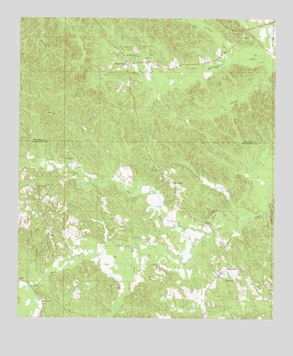
Bladon Springs, AL USGS Topographic Map
Click on map above to begin viewing in our Map Viewer.

This topographic map contains these locations and features:
Feature Name Type Latitude Longitude GNIS ID View Map
Antioch Baptist ChurchChurchN31.7338°W88.1853°113129View Map
BashiPopulated PlaceN31.6596°W88.2347°113542View Map
Bethany ChurchChurchN31.6879°W88.2000°138860View Map
Bladon SpringsSpringN31.7345°W88.1951°149417View Map
Bladon SpringsPopulated PlaceN31.7307°W88.1975°114465View Map
Bladon Springs CemeteryCemeteryN31.7379°W88.2028°139951View Map
Bladon Springs ChurchChurchN31.7318°W88.1975°139952View Map
Bladon Springs State ParkParkN31.7377°W88.1964°114466View Map
C and J ChurchChurchN31.6602°W88.2347°157548View Map
Callier BranchStreamN31.7288°W88.1656°139969View Map
Caney CreekStreamN31.6665°W88.1378°115573View Map
Cedar BranchStreamN31.6427°W88.2395°115736View Map
Cullom SpringsLocaleN31.7288°W88.2095°139989View Map
Dry CreekStreamN31.6571°W88.1653°117557View Map
Everett FordCrossingN31.6618°W88.1408°138893View Map
FrankvillePopulated PlaceN31.6465°W88.1475°157957View Map
Frankville CemeteryCemeteryN31.6477°W88.1469°157566View Map
Frankville ChurchChurchN31.6465°W88.1467°138901View Map
Frankville Post OfficePost OfficeN31.6443°W88.1514°166948View Map
Frankville School (historical)SchoolN31.6427°W88.1514°138903View Map
Frankville Volunteer Fire DepartmentBuildingN31.6301°W88.1585°2691450View Map
Friendship Baptist ChurchChurchN31.6871°W88.1814°118670View Map
Friendship CemeteryCemeteryN31.6874°W88.1822°157567View Map
Friendship School (historical)SchoolN31.6874°W88.1814°138906View Map
Goodwill ChurchChurchN31.7282°W88.1883°154710View Map
Grenade CemeteryCemeteryN31.6440°W88.1517°157569View Map
Koen Burn (historical)LocaleN31.6793°W88.1347°138936View Map
McDowell CemeteryCemeteryN31.7293°W88.1678°122528View Map
Mount Bethel Baptist ChurchChurchN31.6410°W88.1445°152396View Map
Mount Bethel CemeteryCemeteryN31.6407°W88.1436°157587View Map
New True Light Baptist ChurchChurchN31.6796°W88.2358°123912View Map
Pine Barren CreekStreamN31.6552°W88.2006°124756View Map
Pleasant Hill Baptist ChurchChurchN31.6313°W88.2375°124983View Map
Pleasant Hill CemeteryCemeteryN31.6313°W88.2375°157600View Map
Pool BranchStreamN31.6788°W88.1858°125127View Map
Rocky FordCrossingN31.6657°W88.1370°138810View Map
Salt PondLakeN31.6877°W88.1367°138823View Map
ServiceLocaleN31.7452°W88.1431°126553View Map
Silver CrossPopulated PlaceN31.6810°W88.1742°157062View Map
Thompson CreekStreamN31.7338°W88.1450°127905View Map
True Light Baptist ChurchChurchN31.6913°W88.2278°128093View Map

Note: Coordinates in the location and feature list above are referenced to NAD83 datum.


Copyright (C) 2008-2024 Ryan Niemi / Sunset Dynamics ... All Rights Reserved