TopoQuest Logo
Do you find TopoQuest useful?
Help keep TopoQuest running and adding new maps/features by donating!
Bitcoin:  19c7KJd3qBynnjoSw5npx9KScwjBe4ifkT
Litecoin:  LXs6TkuXGGXo1vDsWCkWVdjQX94eUKd6ui
Home View Maps Find Maps Find Places Resources & Links


Albion, Maine Topographic Map

USGS Map Title: Albion, ME
USGS Map MRC: 44069E4
DRG (GeoTIFF) Download: o44069e4.tif


Neighboring USGS Topographic Map Quads:


  Clinton, ME  
44069F5
 

  Burnham, ME  
44069F4
 

  Unity Pond, ME  
44069F3
 

  Fairfield, ME  
44069E5
 

  Albion, ME  
44069E4
 

  Unity, ME  
44069E3
 

  China Lake, ME  
44069D5
 

  Palermo, ME  
44069D4
 

  Liberty, ME  
44069D3


Map MRC Location:

N45°
W70°
N45°
W69°
H8 H7 H6 H5 H4 H3 H2 H1
G8 G7 G6 G5 G4 G3 G2 G1
F8 F7 F6 F5 F4 F3 F2 F1
E8 E7 E6 E5 E4 E3 E2 E1
D8 D7 D6 D5 D4 D3 D2 D1
C8 C7 C6 C5 C4 C3 C2 C1
B8 B7 B6 B5 B4 B3 B2 B1
A8 A7 A6 A5 A4 A3 A2 A1
N44°
W70°
N44°
W69°

Albion, ME USGS 1:24K Topographic Map Preview:
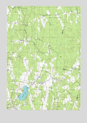
Albion, ME USGS Topographic Map
Click on map above to begin viewing in our Map Viewer.

This topographic map contains these locations and features:
Feature Name Type Latitude Longitude GNIS ID View Map
Abbott CemeteryCemeteryN44.5362°W69.4856°561050View Map
AlbionPopulated PlaceN44.5323°W69.4425°561116View Map
Albion Elementary SchoolSchoolN44.5309°W69.4405°2737980View Map
Albion Fire DepartmentBuildingN44.5326°W69.4416°2552828View Map
Albion Post OfficePost OfficeN44.5330°W69.4387°2768941View Map
Albion Public LibraryBuildingN44.5322°W69.4403°2738488View Map
East BentonPopulated PlaceN44.5834°W69.4717°565521View Map
Fifteenmile StreamStreamN44.6231°W69.4773°566135View Map
Foss HillSummitN44.5626°W69.4945°566438View Map
Fowler BogSwampN44.5609°W69.4089°566497View Map
Fowler BrookStreamN44.5676°W69.4370°566498View Map
Fowler CemeteryCemeteryN44.5512°W69.3880°566502View Map
Gridiron BridgeBridgeN44.6017°W69.4685°567330View Map
Lovejoy PondLakeN44.5196°W69.4702°570443View Map
Maple Grove CemeteryCemeteryN44.5139°W69.4214°2736742View Map
Mill StreamReservoirN44.5384°W69.4478°1774254View Map
Mill StreamStreamN44.5503°W69.4389°571356View Map
Mill Stream DamDamN44.5388°W69.4450°1774253View Map
Number Four HillCemeteryN44.5354°W69.4092°572194View Map
Pratt StreamStreamN44.5176°W69.4195°573763View Map
Puddledock BridgeBridgeN44.5134°W69.4191°573857View Map
Puddledock HallBuildingN44.5003°W69.4131°573858View Map
Quaker Hill CemeteryCemeteryN44.5109°W69.3931°573922View Map
Shaw CemeteryCemeteryN44.5026°W69.4939°575320View Map
Shore HillSummitN44.5592°W69.4700°575429View Map
South AlbionPopulated PlaceN44.5028°W69.4856°579709View Map
Town of AlbionCivilN44.5170°W69.4412°582317View Map
Unorganized Territory of UnityCivilN44.6173°W69.4267°2378266View Map
Whitaker CemeteryCemeteryN44.5445°W69.4604°578336View Map

Note: Coordinates in the location and feature list above are referenced to NAD83 datum.


Copyright (C) 2008-2024 Ryan Niemi / Sunset Dynamics ... All Rights Reserved