TopoQuest Logo
Do you find TopoQuest useful?
Help keep TopoQuest running and adding new maps/features by donating!
Bitcoin:  19c7KJd3qBynnjoSw5npx9KScwjBe4ifkT
Litecoin:  LXs6TkuXGGXo1vDsWCkWVdjQX94eUKd6ui
Home View Maps Find Maps Find Places Resources & Links


Squaw Lakes, Oregon Topographic Map

USGS Map Title: Squaw Lakes, OR
USGS Map MRC: 42123A1
DRG (GeoTIFF) Download: o42123a1.tif


Neighboring USGS Topographic Map Quads:


  Tallowbox Mountain, OR  
42123B2
 

  Ruch, OR  
42123B1
 

  Sterling Creek, OR  
42122B8
 

  Carberry Creek, OR  
42123A2
 

  Squaw Lakes, OR  
42123A1
 

  Dutchman Peak, OR  
42122A8
 

  Kangaroo Mountain, CA  
41123H2
 

  Dutch Creek, CA  
41123H1
 

  Condrey Mountain, CA  
41122H8


Map MRC Location:

N43°
W124°
N43°
W123°
H8 H7 H6 H5 H4 H3 H2 H1
G8 G7 G6 G5 G4 G3 G2 G1
F8 F7 F6 F5 F4 F3 F2 F1
E8 E7 E6 E5 E4 E3 E2 E1
D8 D7 D6 D5 D4 D3 D2 D1
C8 C7 C6 C5 C4 C3 C2 C1
B8 B7 B6 B5 B4 B3 B2 B1
A8 A7 A6 A5 A4 A3 A2 A1
N42°
W124°
N42°
W123°

Squaw Lakes, OR USGS 1:24K Topographic Map Preview:
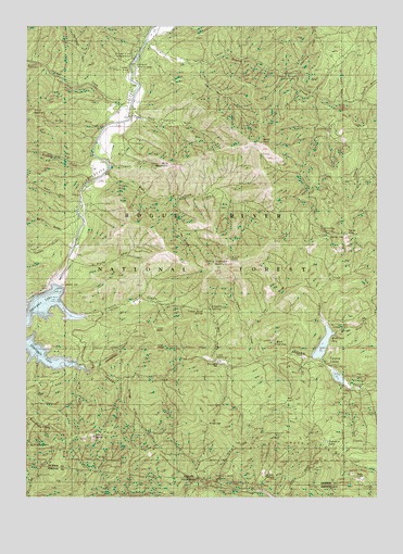
Squaw Lakes, OR USGS Topographic Map
Click on map above to begin viewing in our Map Viewer.

This topographic map contains these locations and features:
Feature Name Type Latitude Longitude GNIS ID View Map
Applegate DamDamN42.0562°W123.1151°1155515View Map
Armstrong GulchValleyN42.1132°W123.0328°1137295View Map
Ash FlatFlatN42.0257°W123.0339°1116519View Map
Baldy PeakSummitN42.0938°W123.0425°1137478View Map
Beaver CreekStreamN42.1204°W123.0845°1137813View Map
Beaver Sulphur Recreation SiteLocaleN42.1107°W123.0339°1137850View Map
Billys GulchValleyN42.0982°W123.1009°1138129View Map
Black GulchValleyN42.0790°W123.1095°1116515View Map
Brushy GulchValleyN42.0618°W123.1098°1138728View Map
Calsh TrailTrailN42.0431°W123.1100°2083994View Map
Carlton PastureFlatN42.0071°W123.0417°1139379View Map
Charlie Buck GulchValleyN42.1135°W123.0650°1139575View Map
Collings GulchValleyN42.0310°W123.0898°1139997View Map
Curiosity SpringSpringN42.0698°W123.0181°1140560View Map
Daffodil MineMineN42.0046°W123.0589°1140587View Map
Daffodil MineMineN42.0037°W123.0587°221968View Map
Dividend BarLocaleN42.0365°W123.0628°1141073View Map
Doe HollowValleyN42.0457°W123.0453°1141114View Map
Elliott Creek RidgeRidgeN42.0148°W123.0478°1141830View Map
Flumet Flat Recreation SiteLocaleN42.1173°W123.0881°1116518View Map
French GulchValleyN42.0510°W123.1159°1142468View Map
French Gulch DivideGapN42.0490°W123.0631°1142470View Map
French Gulch Recreation SiteLocaleN42.0485°W123.1012°1167153View Map
Hanley GapGapN42.0693°W123.0187°1116514View Map
Hanley GulchValleyN42.1040°W123.0225°1143266View Map
Harr Point Recreation SiteLocaleN42.0335°W123.1112°1156628View Map
Hole in the GroundValleyN42.0798°W123.0717°1143658View Map
Iron HandSummitN42.0395°W123.0798°1144115View Map
Iron KnobSummitN42.0442°W123.0804°1144116View Map
Jackson Recreation SiteLocaleN42.1143°W123.0881°1116516View Map
Kanaka GulchValleyN42.0671°W123.1137°1144483View Map
Kilgore GulchValleyN42.0379°W123.0598°1144601View Map
Kilgore SpringSpringN42.0500°W123.0610°1144602View Map
Kinney CreekStreamN42.0882°W123.1050°1144630View Map
Latgawa Cove Recreation SiteLocaleN42.0473°W123.1139°1156632View Map
Little Grayback MountainSummitN42.0630°W123.0546°1145175View Map
Lyman CreekStreamN42.0365°W123.0456°1145690View Map
Mallard GulchValleyN42.0039°W123.0653°227980View Map
Mingo GapGapN42.0193°W123.0614°1116513View Map
Mud SpringSpringN42.0407°W123.0377°1116510View Map
Mule CreekStreamN42.0860°W123.0989°1146625View Map
Mule MountainSummitN42.0887°W123.0750°1146638View Map
Mulligan BayBayN42.0432°W123.0170°1116511View Map
Mulligan Bay Campground (historical)LocaleN42.0446°W123.0137°1116512View Map
Mulligan GulchValleyN42.0435°W123.0156°1146654View Map
Oak FlatsFlatN42.0057°W123.0067°1147112View Map
Palmer CreekStreamN42.1037°W123.0900°1147369View Map
Placer MineMineN42.1090°W123.1045°1147789View Map
Placer Recreation SiteLocaleN42.1135°W123.0895°1116517View Map
Rock GulchValleyN42.1012°W123.0873°1148611View Map
Slickear CreekStreamN42.0454°W123.0192°1149689View Map
Sourdough GulchValleyN42.1112°W123.1100°1149888View Map
Spring GulchValleyN42.0346°W123.1064°1155366View Map
Squaw CreekStreamN42.0345°W123.1067°1150245View Map
Squaw LakesLakeN42.0405°W123.0203°1150280View Map
Squaw Lakes DamDamN42.0368°W123.0239°1155659View Map
Squaw Lakes Recreation SiteLocaleN42.0360°W123.0220°1167155View Map
Squaw PeakSummitN42.0696°W123.0120°1150291View Map
Stein ButteSummitN42.0158°W123.1022°1150399View Map
Stein GulchValleyN42.0004°W123.1053°235435View Map
Stringtown GulchValleyN42.0357°W123.1014°1150496View Map
Stringtown Recreation SiteLocaleN42.0360°W123.1012°1167154View Map
Summit LakeLakeN42.0146°W123.0193°1150620View Map
Swayne ViewpointLocaleN42.0554°W123.1192°1167178View Map
Texter GulchValleyN42.1057°W123.0067°1150994View Map
Tipsu Tyee Recreation SiteLocaleN42.0348°W123.1245°1156627View Map
United States Forest Service French Gulch Boat RampLocaleN42.0479°W123.1064°2699910View Map
Water GulchValleyN42.0704°W123.1134°1151937View Map
Wright (historical)LocaleN42.0901°W123.0970°1153289View Map
Wright Post Office (historical)Post OfficeN42.0901°W123.0970°1166215View Map

Note: Coordinates in the location and feature list above are referenced to NAD83 datum.


Copyright (C) 2008-2024 Ryan Niemi / Sunset Dynamics ... All Rights Reserved