TopoQuest Logo
Do you find TopoQuest useful?
Help keep TopoQuest running and adding new maps/features by donating!
Bitcoin:  19c7KJd3qBynnjoSw5npx9KScwjBe4ifkT
Litecoin:  LXs6TkuXGGXo1vDsWCkWVdjQX94eUKd6ui
Home View Maps Find Maps Find Places Resources & Links


Blacks Ferry, Kentucky Topographic Map

USGS Map Title: Blacks Ferry, KY
USGS Map MRC: 36085F4
DRG (GeoTIFF) Download: o36085f4.tif


Neighboring USGS Topographic Map Quads:


  Dubre, KY  
36085G5
 

  Waterview, KY  
36085G4
 

  Burkesville, KY  
36085G3
 

  Vernon, KY  
36085F5
 

  Blacks Ferry, KY  
36085F4
 

  Frogue, KY  
36085F3
 

  Celina, TN  
36085E5
 

  Dale Hollow Dam, TN  
36085E4
 

  Dale Hollow Reservoir SE, TN  
36085E3


Map MRC Location:

N37°
W86°
N37°
W85°
H8 H7 H6 H5 H4 H3 H2 H1
G8 G7 G6 G5 G4 G3 G2 G1
F8 F7 F6 F5 F4 F3 F2 F1
E8 E7 E6 E5 E4 E3 E2 E1
D8 D7 D6 D5 D4 D3 D2 D1
C8 C7 C6 C5 C4 C3 C2 C1
B8 B7 B6 B5 B4 B3 B2 B1
A8 A7 A6 A5 A4 A3 A2 A1
N36°
W86°
N36°
W85°

Blacks Ferry, KY USGS 1:24K Topographic Map Preview:
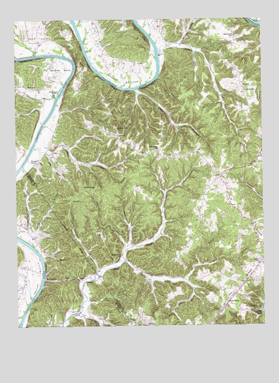
Blacks Ferry, KY USGS Topographic Map
Click on map above to begin viewing in our Map Viewer.

This topographic map contains these locations and features:
Feature Name Type Latitude Longitude GNIS ID View Map
Ashlock RidgeRidgeN36.6284°W85.4461°486103View Map
Bear Wallow Ridge (historical)Populated PlaceN36.6962°W85.4287°2742605View Map
Bearwallow SchoolSchoolN36.6965°W85.4269°486593View Map
Biggerstaff BarBarN36.7204°W85.4770°487293View Map
Blacks FerryLocaleN36.6923°W85.4889°487422View Map
Blythe BranchStreamN36.6570°W85.4408°487569View Map
Broad BranchStreamN36.7259°W85.4261°487925View Map
Butler BranchStreamN36.7184°W85.4786°488505View Map
Coe SchoolSchoolN36.6762°W85.4672°489768View Map
Crawford BranchStreamN36.6465°W85.4594°490303View Map
Dodson HollowValleyN36.6652°W85.4941°490963View Map
Elbow BendBendN36.7295°W85.4755°491609View Map
Elbow SchoolSchoolN36.7231°W85.4941°491611View Map
Gaines Hill SchoolSchoolN36.7431°W85.3880°492650View Map
Galloway CreekStreamN36.7209°W85.4372°492658View Map
Glassock BranchStreamN36.7337°W85.4989°492883View Map
Guffey HollowValleyN36.6959°W85.4846°493460View Map
Guthrie RidgeRidgeN36.7224°W85.3895°2742613View Map
Guthries SchoolSchoolN36.7212°W85.3827°493507View Map
Hendricks Creek DockLocaleN36.6323°W85.3769°494046View Map
Hickory Grove ChurchChurchN36.7059°W85.4472°494126View Map
Hood BranchStreamN36.7365°W85.4072°494489View Map
Jones CemeteryCemeteryN36.6642°W85.4955°495463View Map
JudioPopulated PlaceN36.6959°W85.4808°508361View Map
Judio CreekStreamN36.6981°W85.4905°495543View Map
Judio FlatsFlatN36.7008°W85.4876°2742616View Map
Kelly Scott BranchStreamN36.6428°W85.4155°495633View Map
Kettle Creek SchoolSchoolN36.6309°W85.4694°495699View Map
Kettle Creek SchoolSchoolN36.6537°W85.4461°495700View Map
LittrellPopulated PlaceN36.6859°W85.3964°508480View Map
Logan BranchStreamN36.6659°W85.4255°496976View Map
Long CemeteryCemeteryN36.6623°W85.4583°497085View Map
Low GapGapN36.6443°W85.4748°497230View Map
MartinsburgPopulated PlaceN36.6459°W85.4852°508548View Map
Mary Scott BranchStreamN36.6343°W85.4669°497648View Map
McFarland CreekStreamN36.6289°W85.4980°497849View Map
Mitchell BranchStreamN36.6498°W85.4075°498444View Map
Murphy BranchStreamN36.6570°W85.4914°499106View Map
Pea RidgeRidgeN36.6709°W85.3855°500305View Map
Perry Cary HollowValleyN36.7121°W85.4777°500421View Map
PeytonsburgPopulated PlaceN36.6342°W85.3927°508812View Map
Philpot CemeteryCemeteryN36.7301°W85.4319°500544View Map
Poplar Grove (historical)Populated PlaceN36.6693°W85.4072°2742623View Map
Potters CreekStreamN36.7365°W85.4250°501203View Map
Pruitt BranchStreamN36.6428°W85.4155°501389View Map
RaydurePopulated PlaceN36.6523°W85.4791°508905View Map
Short CemeteryCemeteryN36.6281°W85.4589°503439View Map
Smith CreekStreamN36.6305°W85.4685°503784View Map
Spears SchoolSchoolN36.6501°W85.3769°504045View Map
StalcupPopulated PlaceN36.7028°W85.4466°509118View Map
TanbarkPopulated PlaceN36.7223°W85.3844°509183View Map
The NarrowsGapN36.7334°W85.4661°505134View Map
Vernon BottomBendN36.6448°W85.4894°506022View Map
Warsaw BranchStreamN36.7384°W85.4161°506242View Map
Washes BottomBendN36.7248°W85.4433°506246View Map
Wells CreekStreamN36.6510°W85.4450°506379View Map
Wilburn BarBarN36.7357°W85.4271°506718View Map
Xerxes SchoolSchoolN36.6312°W85.3969°507185View Map
Zeketown BranchStreamN36.6561°W85.4440°507272View Map
Zeketown RidgeRidgeN36.6828°W85.4516°507273View Map

Note: Coordinates in the location and feature list above are referenced to NAD83 datum.


Copyright (C) 2008-2024 Ryan Niemi / Sunset Dynamics ... All Rights Reserved