TopoQuest Logo
Do you find TopoQuest useful?
Help keep TopoQuest running and adding new maps/features by donating!
Bitcoin:  19c7KJd3qBynnjoSw5npx9KScwjBe4ifkT
Litecoin:  LXs6TkuXGGXo1vDsWCkWVdjQX94eUKd6ui
Home View Maps Find Maps Find Places Resources & Links


South Six-shooter Peak, Utah Topographic Map

USGS Map Title: South Six-shooter Peak, UT
USGS Map MRC: 38109A6
DRG (GeoTIFF) Download: o38109a6.tif


Neighboring USGS Topographic Map Quads:


  The Loop, UT  
38109B7
 

  North Six-shooter Peak, UT  
38109B6
 

  Harts Point North, UT  
38109B5
 

  Druid Arch, UT  
38109A7
 

  South Six-shooter Peak, UT  
38109A6
 

  Harts Point South, UT  
38109A5
 

  House Park Butte, UT  
37109H7
 

  Cathedral Butte, UT  
37109H6
 

  Shay Mountain, UT  
37109H5


Map MRC Location:

N39°
W110°
N39°
W109°
H8 H7 H6 H5 H4 H3 H2 H1
G8 G7 G6 G5 G4 G3 G2 G1
F8 F7 F6 F5 F4 F3 F2 F1
E8 E7 E6 E5 E4 E3 E2 E1
D8 D7 D6 D5 D4 D3 D2 D1
C8 C7 C6 C5 C4 C3 C2 C1
B8 B7 B6 B5 B4 B3 B2 B1
A8 A7 A6 A5 A4 A3 A2 A1
N38°
W110°
N38°
W109°

South Six-shooter Peak, UT USGS 1:24K Topographic Map Preview:
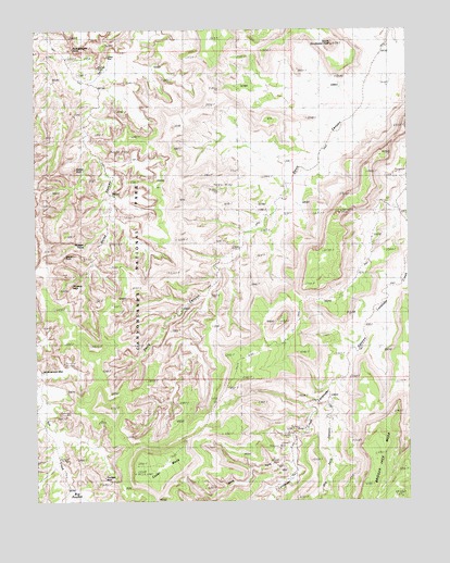
South Six-shooter Peak, UT USGS Topographic Map
Click on map above to begin viewing in our Map Viewer.

This topographic map contains these locations and features:
Feature Name Type Latitude Longitude GNIS ID View Map
Anchor ArchArchN38.1025°W109.7362°1679082View Map
Castle ArchArchN38.0642°W109.7340°1450282View Map
Caterpillar ArchArchN38.0139°W109.6690°1679076View Map
Cedar MesaSummitN38.0074°W109.7178°2786974View Map
Dry Fork CanyonValleyN38.0271°W109.6525°1440628View Map
Fisheye ArchArchN38.0067°W109.7279°1450357View Map
Fortress ArchArchN38.0572°W109.7379°1450359View Map
Gothic ArchArchN38.0883°W109.7362°1435597View Map
Gunsight Natural BridgeArchN38.0203°W109.7112°1679078View Map
Hand Hold ArchArchN38.0153°W109.6657°1450438View Map
Horse CanyonValleyN38.1242°W109.7487°1428833View Map
Keyhole RuinsLocaleN38.1161°W109.7296°1435818View Map
Long ArchArchN38.0042°W109.6940°1679077View Map
Natural ArchArchN38.0100°W109.7410°1450439View Map
Paul Bunyans PottyArchN38.1200°W109.7373°1450461View Map
South Sixshooter PeakSummitN38.1208°W109.6507°1432758View Map
Thirteen FacesPillarN38.0689°W109.7346°1450527View Map
Tower RuinLocaleN38.1205°W109.7212°1454630View Map
West Fork Lavender CreekStreamN38.0105°W109.6668°1449171View Map

Note: Coordinates in the location and feature list above are referenced to NAD83 datum.


Copyright (C) 2008-2024 Ryan Niemi / Sunset Dynamics ... All Rights Reserved