TopoQuest Logo
Do you find TopoQuest useful?
Help keep TopoQuest running and adding new maps/features by donating!
Bitcoin:  19c7KJd3qBynnjoSw5npx9KScwjBe4ifkT
Litecoin:  LXs6TkuXGGXo1vDsWCkWVdjQX94eUKd6ui
Home View Maps Find Maps Find Places Resources & Links


Sapello, New Mexico Topographic Map

USGS Map Title: Sapello, NM
USGS Map MRC: 35105G3
DRG (GeoTIFF) Download: o35105g3.tif


Neighboring USGS Topographic Map Quads:


  Gascon, NM  
35105H4
 

  Mora, NM  
35105H3
 

  Rainsville, NM  
35105H2
 

  Rociada, NM  
35105G4
 

  Sapello, NM  
35105G3
 

  Lake Isabel, NM  
35105G2
 

  El Porvenir, NM  
35105F4
 

  Montezuma, NM  
35105F3
 

  Las Vegas NW, NM  
35105F2


Map MRC Location:

N36°
W106°
N36°
W105°
H8 H7 H6 H5 H4 H3 H2 H1
G8 G7 G6 G5 G4 G3 G2 G1
F8 F7 F6 F5 F4 F3 F2 F1
E8 E7 E6 E5 E4 E3 E2 E1
D8 D7 D6 D5 D4 D3 D2 D1
C8 C7 C6 C5 C4 C3 C2 C1
B8 B7 B6 B5 B4 B3 B2 B1
A8 A7 A6 A5 A4 A3 A2 A1
N35°
W106°
N35°
W105°

Sapello, NM USGS 1:24K Topographic Map Preview:
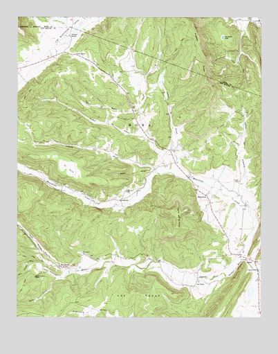
Sapello, NM USGS Topographic Map
Click on map above to begin viewing in our Map Viewer.

This topographic map contains these locations and features:
Feature Name Type Latitude Longitude GNIS ID View Map
Brother of Jesus MissionChurchN35.7667°W105.3661°904094View Map
Caņada de RocioStreamN35.8100°W105.3028°904420View Map
Caņon de CantorValleyN35.8103°W105.3061°904573View Map
Canon de DuranValleyN35.8112°W105.2886°904543View Map
Caņon de HornoValleyN35.8125°W105.2967°904580View Map
Caņon de MedioValleyN35.8248°W105.3067°904583View Map
Caņon del AngostoValleyN35.7975°W105.2595°904569View Map
CanoncitoPopulated PlaceN35.7989°W105.3225°904700View Map
Cerro de la CruzSummitN35.7948°W105.2939°904927View Map
Deer CreekStreamN35.7664°W105.3528°905689View Map
Don Tomas (historical)LocaleN35.8723°W105.2520°933961View Map
El ValleAreaN35.8120°W105.3495°906104View Map
Fragoso RidgeRidgeN35.8706°W105.2847°906371View Map
La CanadaValleyN35.7728°W105.3308°899325View Map
Las DispensasLocaleN35.7509°W105.3575°928323View Map
Las TusasPopulated PlaceN35.7653°W105.2831°907884View Map
ManuelitasPopulated PlaceN35.8006°W105.2786°908392View Map
Manuelitas CreekStreamN35.7742°W105.2586°908393View Map
PeņaLocaleN35.8709°W105.3483°928378View Map
Peņasco BlancoPopulated PlaceN35.8673°W105.3489°909545View Map
Rito ChavezStreamN35.7728°W105.3689°910296View Map
Rito ColoradoStreamN35.7700°W105.3492°915888View Map
San IgnacioPopulated PlaceN35.7711°W105.3545°910623View Map
San Ignacio CemeteryCemeteryN35.7768°W105.3424°910624View Map
San Ignacio Post Office (historical)Post OfficeN35.7711°W105.3545°938073View Map
San Isidro CemeteryCemeteryN35.8198°W105.2962°910629View Map
San Isidro LakeLakeN35.8667°W105.2702°910630View Map
San Miguel County Fire District Sapello Rociada Fire DepartmentBuildingN35.8181°W105.2969°2657877View Map
Sanchez CanyonValleyN35.8723°W105.3506°910715View Map
Santa Niņo CemeteryCemeteryN35.8025°W105.3200°910785View Map
SapelloPopulated PlaceN35.7728°W105.2533°910814View Map
Sapello Elementary SchoolSchoolN35.7728°W105.2533°933906View Map
Sapello Post OfficePost OfficeN35.7728°W105.2533°937766View Map
Soledad CemeteryCemeteryN35.8066°W105.2614°911201View Map
Tierra MontePopulated PlaceN35.8592°W105.3475°911704View Map
WoodsLocaleN35.8709°W105.2625°928408View Map

Note: Coordinates in the location and feature list above are referenced to NAD83 datum.


Copyright (C) 2008-2024 Ryan Niemi / Sunset Dynamics ... All Rights Reserved