TopoQuest Logo
Do you find TopoQuest useful?
Help keep TopoQuest running and adding new maps/features by donating!
Bitcoin:  19c7KJd3qBynnjoSw5npx9KScwjBe4ifkT
Litecoin:  LXs6TkuXGGXo1vDsWCkWVdjQX94eUKd6ui
Home View Maps Find Maps Find Places Resources & Links


Santa Margarita, California Topographic Map

USGS Map Title: Santa Margarita, CA
USGS Map MRC: 35120D5
DRG (GeoTIFF) Download: o35120d5.tif


Neighboring USGS Topographic Map Quads:


  Templeton, CA  
35120E6
 

  Creston, CA  
35120E5
 

  Shedd Canyon, CA  
35120E4
 

  Atascadero, CA  
35120D6
 

  Santa Margarita, CA  
35120D5
 

  Wilson Corner, CA  
35120D4
 

  San Luis Obispo, CA  
35120C6
 

  Lopez Mountain, CA  
35120C5
 

  Santa Margarita Lake, CA  
35120C4


Map MRC Location:

N36°
W121°
N36°
W120°
H8 H7 H6 H5 H4 H3 H2 H1
G8 G7 G6 G5 G4 G3 G2 G1
F8 F7 F6 F5 F4 F3 F2 F1
E8 E7 E6 E5 E4 E3 E2 E1
D8 D7 D6 D5 D4 D3 D2 D1
C8 C7 C6 C5 C4 C3 C2 C1
B8 B7 B6 B5 B4 B3 B2 B1
A8 A7 A6 A5 A4 A3 A2 A1
N35°
W121°
N35°
W120°

Santa Margarita, CA USGS 1:24K Topographic Map Preview:
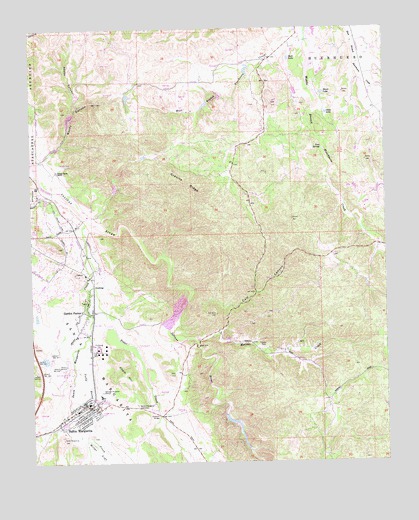
Santa Margarita, CA USGS Topographic Map
Click on map above to begin viewing in our Map Viewer.

This topographic map contains these locations and features:
Feature Name Type Latitude Longitude GNIS ID View Map
Adobe CanyonValleyN35.4769°W120.6107°238422View Map
Asistencia de Santa MargaritaLocaleN35.4008°W120.6118°238808View Map
Beck LakeLakeN35.4912°W120.5344°239135View Map
Calf CanyonValleyN35.4208°W120.5716°240003View Map
California Department of Forestry and Fire Protection Station 40 ParkhillBuildingN35.4074°W120.5458°2664818View Map
Chalk HillSummitN35.4008°W120.5941°1660467View Map
Clear LakeLakeN35.4754°W120.5215°240682View Map
CushingPopulated PlaceN35.4261°W120.6041°1660529View Map
Eaglet (historical)Populated PlaceN35.4561°W120.6238°1670559View Map
Garden FarmsPopulated PlaceN35.4180°W120.6063°242598View Map
Garden Farms Bible ChapelChurchN35.4178°W120.6057°1872381View Map
Garden Farms Census Designated PlaceCensusN35.4158°W120.6140°2583022View Map
Granite RidgeRidgeN35.4555°W120.5741°242919View Map
Happy Valley RanchLocaleN35.4589°W120.6168°243194View Map
Hart Ranch AirportAirportN35.4051°W120.5230°1653978View Map
Holy Angels Catholic ChurchChurchN35.3889°W120.6093°1872387View Map
Iron SpringSpringN35.4654°W120.5230°243897View Map
Kaiser - Santa Margarita QuarryMineN35.4175°W120.5758°2703881View Map
Moreno CreekStreamN35.4105°W120.5702°255641View Map
Onemile BridgeBridgeN35.3886°W120.5821°252072View Map
Parkhill School (historical)SchoolN35.4041°W120.5296°1670569View Map
Rocky CanyonValleyN35.4630°W120.6202°248305View Map
Santa MargaritaPopulated PlaceN35.3900°W120.6091°249075View Map
Santa Margarita Branch San Luis Obispo City-County LibraryBuildingN35.3880°W120.6085°1872402View Map
Santa Margarita CemeteryCemeteryN35.3915°W120.5893°249077View Map
Santa Margarita Census Designated PlaceCensusN35.3894°W120.6082°2583128View Map
Santa Margarita Community ChurchChurchN35.3880°W120.6088°1872403View Map
Santa Margarita Community ParkParkN35.3925°W120.6043°1872404View Map
Santa Margarita CreekStreamN35.4444°W120.6063°249078View Map
Santa Margarita Elementary SchoolSchoolN35.3940°W120.6019°1872405View Map
Santa Margarita Fire Control StationLocaleN35.4078°W120.5463°249079View Map
Santa Margarita Post OfficePost OfficeN35.3917°W120.6082°1872406View Map
Santa Margarita RanchLocaleN35.4022°W120.6129°1872407View Map
Santa Margarita Volunteer Fire DepartmentBuildingN35.3913°W120.6079°2664529View Map
Silver LakeLakeN35.4812°W120.5229°249475View Map
Trout CreekStreamN35.4414°W120.6077°250640View Map
Yerba Buena CreekStreamN35.4114°W120.6060°251857View Map

Note: Coordinates in the location and feature list above are referenced to NAD83 datum.


Copyright (C) 2008-2024 Ryan Niemi / Sunset Dynamics ... All Rights Reserved