TopoQuest Logo
Do you find TopoQuest useful?
Help keep TopoQuest running and adding new maps/features by donating!
Bitcoin:  19c7KJd3qBynnjoSw5npx9KScwjBe4ifkT
Litecoin:  LXs6TkuXGGXo1vDsWCkWVdjQX94eUKd6ui
Home View Maps Find Maps Find Places Resources & Links


Albany, Wisconsin Topographic Map

USGS Map Title: Albany, WI
USGS Map MRC: 42089F4
DRG (GeoTIFF) Download: o42089f4.tif


Neighboring USGS Topographic Map Quads:


  Belleville, WI  
42089G5
 

  Attica, WI  
42089G4
 

  Evansville, WI  
42089G3
 

  Monticello, WI  
42089F5
 

  Albany, WI  
42089F4
 

  Orfordville, WI  
42089F3
 

  Juda, WI  
42089E5
 

  Brodhead West, WI  
42089E4
 

  Brodhead East, WI  
42089E3


Map MRC Location:

N43°
W90°
N43°
W89°
H8 H7 H6 H5 H4 H3 H2 H1
G8 G7 G6 G5 G4 G3 G2 G1
F8 F7 F6 F5 F4 F3 F2 F1
E8 E7 E6 E5 E4 E3 E2 E1
D8 D7 D6 D5 D4 D3 D2 D1
C8 C7 C6 C5 C4 C3 C2 C1
B8 B7 B6 B5 B4 B3 B2 B1
A8 A7 A6 A5 A4 A3 A2 A1
N42°
W90°
N42°
W89°

Albany, WI USGS 1:24K Topographic Map Preview:
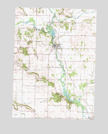
Albany, WI USGS Topographic Map
Click on map above to begin viewing in our Map Viewer.

This topographic map contains these locations and features:
Feature Name Type Latitude Longitude GNIS ID View Map
Abrahams Woods State Natural AreaParkN42.6847°W89.4837°1989578View Map
AlbanyPopulated PlaceN42.7078°W89.4371°1560726View Map
Albany AirportAirportN42.7174°W89.4249°1581852View Map
Albany Community Middle SchoolSchoolN42.7071°W89.4340°2716194View Map
Albany DamDamN42.7083°W89.4396°1792154View Map
Albany Elementary SchoolSchoolN42.7073°W89.4340°2716279View Map
Albany Emergency Medical ServicesBuildingN42.7099°W89.4389°2698419View Map
Albany Fire DepartmentBuildingN42.7099°W89.4386°2698032View Map
Albany High SchoolSchoolN42.7069°W89.4340°1838266View Map
Albany LakeReservoirN42.7176°W89.4404°1560727View Map
Albany Police DepartmentBuildingN42.7098°W89.4388°2759672View Map
Allen CreekStreamN42.7411°W89.4404°1560770View Map
Brodhead DamDamN42.6450°W89.4101°1791920View Map
County of Green LandfillLocaleN42.6281°W89.4633°2635472View Map
DecaturPopulated PlaceN42.6343°W89.4116°2760452View Map
Decatur CemeteryCemeteryN42.6264°W89.4104°1563793View Map
Decatur LakeReservoirN42.6517°W89.4169°1563794View Map
Decatur SchoolSchoolN42.6331°W89.4468°1563795View Map
Dunphy BranchStreamN42.7403°W89.4098°1577383View Map
Gap ChurchChurchN42.6786°W89.4812°1565394View Map
Hillcrest CemeteryCemeteryN42.7016°W89.4420°1566427View Map
Liberty CreekStreamN42.7403°W89.4118°1568013View Map
Little Sugar RiverStreamN42.7233°W89.4443°1568436View Map
Marsh CreekStreamN42.6917°W89.4323°1577298View Map
Mineral PointPopulated PlaceN42.7120°W89.4668°1577730View Map
Moores CemeteryCemeteryN42.6289°W89.4651°1569706View Map
Muralt Bluff Prairie State Natural AreaParkN42.6986°W89.4921°1989587View Map
Norwegian CreekStreamN42.6445°W89.3973°1570558View Map
Oliver Prairie State Natural AreaParkN42.6870°W89.4987°1989638View Map
Oliver QuarryMineN42.7006°W89.4694°2633155View Map
Peebles SchoolSchoolN42.7203°W89.3932°1571148View Map
Searles CreekStreamN42.6531°W89.4218°1573864View Map
Smiley SchoolSchoolN42.6972°W89.4662°1574290View Map
Town of AlbanyCivilN42.7267°W89.4265°1582666View Map
Town of DecaturCivilN42.6410°W89.4288°1583057View Map
Village of AlbanyCivilN42.7069°W89.4367°1582665View Map
Ward Swartz Decatur Woods State Natural AreaParkN42.6450°W89.4154°1989640View Map

Note: Coordinates in the location and feature list above are referenced to NAD83 datum.


Copyright (C) 2008-2024 Ryan Niemi / Sunset Dynamics ... All Rights Reserved