TopoQuest Logo
Do you find TopoQuest useful?
Help keep TopoQuest running and adding new maps/features by donating!
Bitcoin:  19c7KJd3qBynnjoSw5npx9KScwjBe4ifkT
Litecoin:  LXs6TkuXGGXo1vDsWCkWVdjQX94eUKd6ui
Home View Maps Find Maps Find Places Resources & Links


Saint Maries, Idaho Topographic Map

USGS Map Title: Saint Maries, ID
USGS Map MRC: 47116C5
DRG (GeoTIFF) Download: o47116c5.tif


Neighboring USGS Topographic Map Quads:


  Black Lake, ID  
47116D6
 

  Medimont, ID  
47116D5
 

  Rochat Peak, ID  
47116D4
 

  Benewah Lake, ID  
47116C6
 

  Saint Maries, ID  
47116C5
 

  Saint Joe Baldy, ID  
47116C4
 

  Alder Creek Flats, ID  
47116B6
 

  Lindstrom Peak, ID  
47116B5
 

  Santa, ID  
47116B4


Map MRC Location:

N48°
W117°
N48°
W116°
H8 H7 H6 H5 H4 H3 H2 H1
G8 G7 G6 G5 G4 G3 G2 G1
F8 F7 F6 F5 F4 F3 F2 F1
E8 E7 E6 E5 E4 E3 E2 E1
D8 D7 D6 D5 D4 D3 D2 D1
C8 C7 C6 C5 C4 C3 C2 C1
B8 B7 B6 B5 B4 B3 B2 B1
A8 A7 A6 A5 A4 A3 A2 A1
N47°
W117°
N47°
W116°

Saint Maries, ID USGS 1:24K Topographic Map Preview:
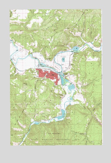
Saint Maries, ID USGS Topographic Map
Click on map above to begin viewing in our Map Viewer.

This topographic map contains these locations and features:
Feature Name Type Latitude Longitude GNIS ID View Map
Bells LakeReservoirN47.3391°W116.5373°377337View Map
Benewah Community HospitalHospitalN47.3145°W116.5672°2721860View Map
Benewah Community Hospital HeliportAirportN47.3141°W116.5674°400920View Map
Benewah County Sheriff's OfficeBuildingN47.3151°W116.5670°2722422View Map
Canyon CreekStreamN47.2799°W116.5166°378867View Map
Cedar DrawValleyN47.3455°W116.5121°379099View Map
Chat'u'washa'lqs BluffPopulated PlaceN47.3341°W116.6035°2082024View Map
Cherry CreekStreamN47.3238°W116.6193°379231View Map
City of Saint MariesCivilN47.3146°W116.5722°2411762View Map
Cottonwood PointBendN47.3310°W116.6182°395258View Map
Heyburn Elementary SchoolSchoolN47.3157°W116.5746°401381View Map
Hnmlmulsh GroveLocaleN47.3280°W116.5722°2082026View Map
Kings PeakSummitN47.3049°W116.6054°397835View Map
KOFE-AM (Saint Maries)TowerN47.3205°W116.5482°401751View Map
?q'e'ykwe' RapidRapidsN47.3055°W116.5512°2082025View Map
MeadowhurstPopulated PlaceN47.3221°W116.5613°394806View Map
MilltownPopulated PlaceN47.3241°W116.5432°400209View Map
Mullen Trail Park Historical MonumentParkN47.3188°W116.5838°394813View Map
Mutch CreekStreamN47.3207°W116.5824°387428View Map
Porrett LakeLakeN47.3273°W116.5776°388781View Map
Potlatch Corporation Fire DepartmentBuildingN47.3204°W116.5750°2619085View Map
RiverdalePopulated PlaceN47.3296°W116.5557°395005View Map
Saint MariesPopulated PlaceN47.3144°W116.5627°398082View Map
Saint Maries AmbulanceBuildingN47.3146°W116.5684°2642797View Map
Saint Maries Christian SchoolSchoolN47.3177°W116.5684°401162View Map
Saint Maries Country ClubLocaleN47.3124°W116.5363°400300View Map
Saint Maries Fire Protection District Station 1BuildingN47.3146°W116.5629°2618965View Map
Saint Maries High SchoolSchoolN47.3288°W116.5745°395908View Map
Saint Maries Middle SchoolSchoolN47.3140°W116.5735°401681View Map
Saint Maries PeakSummitN47.3144°W116.5488°398083View Map
Saint Maries Police DepartmentBuildingN47.3154°W116.5659°2722431View Map
Saint Maries Post OfficePost OfficeN47.3147°W116.5662°2766846View Map
Saint Maries Ranger StationLocaleN47.3163°W116.5702°394642View Map
Saint Maries RiverStreamN47.3160°W116.5554°389839View Map
Saint Maries River AccessLocaleN47.3005°W116.5352°398506View Map
Saint Maries River Access AreaLocaleN47.3074°W116.5421°401671View Map
Saint Maries Wildlife Management AreaReserveN47.2630°W116.5513°401672View Map
Sharp TopSummitN47.3560°W116.5479°398115View Map
St Maries Municipal AirportAirportN47.3257°W116.5762°400918View Map
Stickney GulchValleyN47.2719°W116.5941°391458View Map
Swan LakeReservoirN47.3286°W116.5526°391724View Map
Syringa CreekStreamN47.2760°W116.5135°391793View Map
Thomas CreekStreamN47.3430°W116.5229°392022View Map
Thorn CreekStreamN47.2894°W116.5427°392055View Map
Wolf DrawValleyN47.3005°W116.5354°393627View Map
Woodlawn CemeteryCemeteryN47.3168°W116.5874°399670View Map

Note: Coordinates in the location and feature list above are referenced to NAD83 datum.


Copyright (C) 2008-2024 Ryan Niemi / Sunset Dynamics ... All Rights Reserved