TopoQuest Logo
Do you find TopoQuest useful?
Help keep TopoQuest running and adding new maps/features by donating!
Bitcoin:  19c7KJd3qBynnjoSw5npx9KScwjBe4ifkT
Litecoin:  LXs6TkuXGGXo1vDsWCkWVdjQX94eUKd6ui
Home View Maps Find Maps Find Places Resources & Links


Albany, Ohio Topographic Map

USGS Map Title: Albany, OH
USGS Map MRC: 39082B2
DRG (GeoTIFF) Download: o39082b2.tif


Neighboring USGS Topographic Map Quads:


  Mineral, OH  
39082C3
 

  The Plains, OH  
39082C2
 

  Athens, OH  
39082C1
 

  Vales Mills, OH  
39082B3
 

  Albany, OH  
39082B2
 

  Shade, OH  
39082B1
 

  Wilkesville, OH  
39082A3
 

  Rutland, OH  
39082A2
 

  Pomeroy, OH  
39082A1


Map MRC Location:

N40°
W83°
N40°
W82°
H8 H7 H6 H5 H4 H3 H2 H1
G8 G7 G6 G5 G4 G3 G2 G1
F8 F7 F6 F5 F4 F3 F2 F1
E8 E7 E6 E5 E4 E3 E2 E1
D8 D7 D6 D5 D4 D3 D2 D1
C8 C7 C6 C5 C4 C3 C2 C1
B8 B7 B6 B5 B4 B3 B2 B1
A8 A7 A6 A5 A4 A3 A2 A1
N39°
W83°
N39°
W82°

Albany, OH USGS 1:24K Topographic Map Preview:
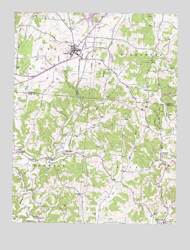
Albany, OH USGS Topographic Map
Click on map above to begin viewing in our Map Viewer.

This topographic map contains these locations and features:
Feature Name Type Latitude Longitude GNIS ID View Map
AlbanyPopulated PlaceN39.2276°W82.2024°1060817View Map
Albany Area Volunteer Fire DepartmentBuildingN39.2244°W82.2018°2549478View Map
Albany Baptist ChurchChurchN39.2256°W82.2029°1065577View Map
Albany Post OfficePost OfficeN39.2279°W82.2026°1958889View Map
Alexander Elementary SchoolSchoolN39.2256°W82.2065°1058841View Map
Alexander High SchoolSchoolN39.2415°W82.1851°1058842View Map
Boyd Allen Dairy FarmLocaleN39.2369°W82.2081°2704642View Map
CarpenterPopulated PlaceN39.1629°W82.2193°1038830View Map
Carpenter Freewill Baptist ChurchChurchN39.1623°W82.2193°1069838View Map
Carpenter Post Office (historical)Post OfficeN39.1626°W82.2199°1083309View Map
Columbia Elementary SchoolSchoolN39.1676°W82.2443°1081164View Map
Columbia Township Volunteer Fire and Emergency Medical Services DepartmentBuildingN39.1678°W82.2460°2550521View Map
Crossroads CemeteryCemeteryN39.2162°W82.1760°1039495View Map
Diamond Number 1 QuarryMineN39.2139°W82.2133°2634701View Map
Diamond Stone QuarryMineN39.2136°W82.2403°2634700View Map
DyesvillePopulated PlaceN39.1281°W82.2299°1039914View Map
Dyesville Community ChurchChurchN39.1281°W82.2301°1069833View Map
Dyesville Post Office (historical)Post OfficeN39.1279°W82.2304°2036277View Map
Fivemile RunStreamN39.1617°W82.2199°1040489View Map
Goose CreekStreamN39.1770°W82.1271°1048392View Map
Gotschall CemeteryCemeteryN39.1356°W82.2085°1040984View Map
Haning CemeteryCemeteryN39.2045°W82.1481°1041283View Map
HarrisonvillePopulated PlaceN39.1265°W82.1338°1048820View Map
Harrisonville Elementary SchoolSchoolN39.1254°W82.1357°1071039View Map
Harrisonville Post OfficePost OfficeN39.1270°W82.1332°2036283View Map
Harrisonville Presbyterian ChurchChurchN39.1259°W82.1332°1069832View Map
Lake SnowdenReservoirN39.2495°W82.1868°1046407View Map
Margaret Creek Watershed Project Number One DamDamN39.2267°W82.1749°1079273View Map
Martin CemeteryCemeteryN39.2170°W82.2480°1080307View Map
Mount Union ChurchChurchN39.1423°W82.1974°1043635View Map
North Branch Margaret CreekStreamN39.2476°W82.1646°1043918View Map
Ogden CemeteryCemeteryN39.1273°W82.2493°1044073View Map
Ogden RunStreamN39.1267°W82.2351°1044074View Map
Ohio State Agriculture StationLocaleN39.1673°W82.2104°1080308View Map
Ohio University Airport Snyder FieldAirportN39.2117°W82.2228°1082470View Map
PagevillePopulated PlaceN39.1667°W82.1365°1049051View Map
Pearl ChapelChurchN39.1945°W82.1474°1080309View Map
Rawlings CemeteryCemeteryN39.1351°W82.2276°1044871View Map
School Lot CemeteryCemeteryN39.1626°W82.2365°1046013View Map
Scipio High School (historical)SchoolN39.1254°W82.1357°1069831View Map
Scipio Township Volunteer Fire DepartmentBuildingN39.1283°W82.1320°2550565View Map
Scipio Township Volunteer Fire Department Station 2BuildingN39.1661°W82.1364°2549621View Map
Shipman CemeteryCemeteryN39.1301°W82.1415°1046225View Map
Sisson RunStreamN39.1426°W82.2404°1058018View Map
Southeast Ohio Emergency Medical Services Station 5 AlbanyBuildingN39.2302°W82.1995°2550683View Map
Southeastern Ohio Test FarmLocaleN39.1676°W82.2099°1052368View Map
Town House CemeteryCemeteryN39.2467°W82.2354°1699546View Map
Townhouse ChurchChurchN39.2467°W82.2360°1047108View Map
Township of AlexanderCivilN39.2412°W82.1315°1085748View Map
Township of LeeCivilN39.2463°W82.2262°1085755View Map
Township of ScipioCivilN39.1522°W82.1401°1086618View Map
Valley FordPopulated PlaceN39.1667°W82.2446°1049265View Map
Valleyford Post Office (historical)Post OfficeN39.1667°W82.2443°1083310View Map
Village of AlbanyCivilN39.2244°W82.1977°2397922View Map
Wells CemeteryCemeteryN39.1598°W82.1324°1047672View Map
WelshPopulated PlaceN39.1506°W82.1729°1049303View Map
Welsh Post Office (historical)Post OfficeN39.1501°W82.1735°1083313View Map
Woods LakeLakeN39.2177°W82.1317°1048111View Map
WoodyardLocaleN39.1970°W82.1485°1058845View Map
Woodyard CemeteryCemeteryN39.1974°W82.1490°1048130View Map

Note: Coordinates in the location and feature list above are referenced to NAD83 datum.


Copyright (C) 2008-2024 Ryan Niemi / Sunset Dynamics ... All Rights Reserved