TopoQuest Logo
Do you find TopoQuest useful?
Help keep TopoQuest running and adding new maps/features by donating!
Bitcoin:  19c7KJd3qBynnjoSw5npx9KScwjBe4ifkT
Litecoin:  LXs6TkuXGGXo1vDsWCkWVdjQX94eUKd6ui
Home View Maps Find Maps Find Places Resources & Links


Rogue River, Oregon Topographic Map

USGS Map Title: Rogue River, OR
USGS Map MRC: 42123D2
DRG (GeoTIFF) Download: o42123d2.tif


Neighboring USGS Topographic Map Quads:


  Sexton Mountain, OR  
42123E3
 

  Wimer, OR  
42123E2
 

  McConville Peak, OR  
42123E1
 

  Grants Pass, OR  
42123D3
 

  Rogue River, OR  
42123D2
 

  Gold Hill, OR  
42123D1
 

  Murphy, OR  
42123C3
 

  Applegate, OR  
42123C2
 

  Mount Isabelle, OR  
42123C1


Map MRC Location:

N43°
W124°
N43°
W123°
H8 H7 H6 H5 H4 H3 H2 H1
G8 G7 G6 G5 G4 G3 G2 G1
F8 F7 F6 F5 F4 F3 F2 F1
E8 E7 E6 E5 E4 E3 E2 E1
D8 D7 D6 D5 D4 D3 D2 D1
C8 C7 C6 C5 C4 C3 C2 C1
B8 B7 B6 B5 B4 B3 B2 B1
A8 A7 A6 A5 A4 A3 A2 A1
N42°
W124°
N42°
W123°

Rogue River, OR USGS 1:24K Topographic Map Preview:
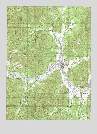
Rogue River, OR USGS Topographic Map
Click on map above to begin viewing in our Map Viewer.

This topographic map contains these locations and features:
Feature Name Type Latitude Longitude GNIS ID View Map
Bear GulchValleyN42.3801°W123.1887°1135249View Map
Bee CreekStreamN42.4118°W123.2206°1135245View Map
Big Bald SpotSlopeN42.3860°W123.1914°1135251View Map
Birdseye CreekStreamN42.4068°W123.1526°1117732View Map
Bolt Post Office (historical)Post OfficeN42.4054°W123.1401°1164936View Map
Boyd CreekStreamN42.4496°W123.1259°1135240View Map
Briar GulchValleyN42.4248°W123.2248°1159265View Map
Briar GulchValleyN42.4498°W123.1262°1159011View Map
Buena (historical)LocaleN42.4154°W123.1292°1166456View Map
City of Rogue RiverCivilN42.4355°W123.1682°2410984View Map
Classick Bicentennial ParkParkN42.4404°W123.1709°2091186View Map
Cold Springs CreekStreamN42.4029°W123.2239°1135254View Map
Cold Springs ReservoirReservoirN42.4000°W123.2235°1135255View Map
Colvig (historical)LocaleN42.4112°W123.1470°1166458View Map
Coyote Evans WaysideParkN42.4318°W123.1734°1161962View Map
Coyote Evans Wayside City Boat RampLocaleN42.4316°W123.1716°2700112View Map
Evans CreekStreamN42.4326°W123.1767°1141926View Map
Evans Creek LateralCanalN42.4296°W123.1928°1135238View Map
Fall CreekStreamN42.4296°W123.2437°1135244View Map
Fielder CreekStreamN42.4723°W123.1845°1120701View Map
Fielder MountainSummitN42.4467°W123.2161°1120702View Map
Fleming Memorial ParkParkN42.4312°W123.1720°2091197View Map
Foots CemeteryCemeteryN42.3906°W123.1376°1129936View Map
Foots CreekPopulated PlaceN42.4048°W123.1389°1135246View Map
Foots CreekStreamN42.4057°W123.1428°1120870View Map
Foots Creek Census Designated PlaceCensusN42.3845°W123.1408°2611730View Map
Foots Creek ChapelChurchN42.3929°W123.1412°1120871View Map
Foots Creek Post Office (historical)Post OfficeN42.4048°W123.1389°1165264View Map
Fort Birdseye (historical)LocaleN42.4068°W123.1484°1132460View Map
Gold GulchValleyN42.3915°W123.1373°1135726View Map
Gold River Post Office (historical)Post OfficeN42.4207°W123.2287°1164380View Map
Left Fork BirdseyeStreamN42.3873°W123.1595°1132812View Map
Left Fork Fielder CreekStreamN42.4715°W123.2081°1123031View Map
Little Bald SpotSlopeN42.3812°W123.1934°1135250View Map
Little Savage CreekStreamN42.4182°W123.2098°1123276View Map
Lucy GulchValleyN42.3943°W123.2303°1129937View Map
Maple CreekStreamN42.4623°W123.1748°1132459View Map
Maple GulchValleyN42.4735°W123.1970°1132463View Map
Martin SpringSpringN42.4354°W123.2417°1135243View Map
McCollum ReservoirReservoirN42.4277°W123.1257°1130286View Map
Millers GulchValleyN42.4085°W123.1256°1124212View Map
Oak GulchValleyN42.3860°W123.1734°1132458View Map
Old BaldySummitN42.4905°W123.2317°1124955View Map
Owl HollowValleyN42.3901°W123.2026°1135252View Map
Owl Hollow MineMineN42.3907°W123.2012°1125086View Map
Palmerton ParkParkN42.4401°W123.1734°1161960View Map
Pearce Riffle Park Boat RampLocaleN42.4231°W123.2426°2668241View Map
Pierce Riffle County ParkParkN42.4237°W123.2434°1987640View Map
Ponderosa ParkParkN42.4387°W123.1651°2091219View Map
Reservoir GulchValleyN42.3776°W123.1928°1135247View Map
Right Fork Fielder CreekStreamN42.4718°W123.2076°1126014View Map
Right Fork Foots CreekStreamN42.3807°W123.1434°1126015View Map
River's Edge Academy Charter SchoolSchoolN42.4388°W123.1735°2440103View Map
Rogue RiverPopulated PlaceN42.4360°W123.1720°1166706View Map
Rogue River Branch LibraryBuildingN42.4323°W123.1656°2699745View Map
Rogue River City HallBuildingN42.4344°W123.1680°2699746View Map
Rogue River Elementary SchoolSchoolN42.4363°W123.1698°2440092View Map
Rogue River Elementary SchoolSchoolN42.4366°W123.1707°1161961View Map
Rogue River High SchoolSchoolN42.4561°W123.1681°1161959View Map
Rogue River Municipal CourtBuildingN42.4344°W123.1680°2699747View Map
Rogue River Police DepartmentBuildingN42.4342°W123.1679°2737648View Map
Rogue River Post OfficePost OfficeN42.4316°W123.1629°1165877View Map
Rogue River Public Works Department OfficeBuildingN42.4344°W123.1680°2699749View Map
Rogue River Rural Fire Protection DistrictBuildingN42.4299°W123.1612°2576621View Map
Rogue River Sewage Treatment PlantLocaleN42.4308°W123.1875°2697053View Map
Savage CreekStreamN42.4182°W123.2198°1149085View Map
Savage RapidsRapidsN42.4218°W123.2328°1126614View Map
Savage Rapids Boat RampLocaleN42.4189°W123.2197°2699796View Map
Savage Rapids County ParkParkN42.4187°W123.2212°1987703View Map
Savage Rapids Crossing (historical)LocaleN42.4246°W123.2317°1166471View Map
Savage Rapids Dam (historical)DamN42.4201°W123.2295°1126615View Map
Schieffelin GulchValleyN42.4137°W123.1656°1126641View Map
Seaman BarBarN42.4196°W123.1984°1135242View Map
Shasta MineMineN42.4010°W123.2117°1135253View Map
Smith ReservoirReservoirN42.4748°W123.1624°1129934View Map
South Fork Trimble CreekStreamN42.4990°W123.1581°1135241View Map
Starvation HeightsPopulated PlaceN42.4854°W123.1681°1136786View Map
Sugarpine GulchValleyN42.4540°W123.1706°1132462View Map
Trimble CreekStreamN42.4998°W123.1612°1128226View Map
Turner SpringSpringN42.4176°W123.2309°1135234View Map
Valley of the Rogue State ParkParkN42.4110°W123.1498°1135248View Map
Valley of the Rogue State Park Boat RampLocaleN42.4120°W123.1265°2699670View Map
Ward CreekStreamN42.4293°W123.1712°1128633View Map
White Spring BranchStreamN42.4123°W123.1470°1132461View Map
Woodville CemeteryCemeteryN42.4344°W123.1600°1129935View Map
Woodville MuseumBuildingN42.4352°W123.1690°2699974View Map

Note: Coordinates in the location and feature list above are referenced to NAD83 datum.


Copyright (C) 2008-2024 Ryan Niemi / Sunset Dynamics ... All Rights Reserved