TopoQuest Logo
Do you find TopoQuest useful?
Help keep TopoQuest running and adding new maps/features by donating!
Bitcoin:  19c7KJd3qBynnjoSw5npx9KScwjBe4ifkT
Litecoin:  LXs6TkuXGGXo1vDsWCkWVdjQX94eUKd6ui
Home View Maps Find Maps Find Places Resources & Links


Red Ridge, Utah Topographic Map

USGS Map Title: Red Ridge, UT
USGS Map MRC: 38112F4
DRG (GeoTIFF) Download: o38112f4.tif


Neighboring USGS Topographic Map Quads:


  Sixmile Point, UT  
38112G5
 

  Kanosh, UT  
38112G4
 

  Sunset Peak, UT  
38112G3
 

  Dog Valley Peak, UT  
38112F5
 

  Red Ridge, UT  
38112F4
 

  Joseph Peak, UT  
38112F3
 

  Cove Fort, UT  
38112E5
 

  Trail Mountain, UT  
38112E4
 

  Marysvale Canyon, UT  
38112E3


Map MRC Location:

N39°
W113°
N39°
W112°
H8 H7 H6 H5 H4 H3 H2 H1
G8 G7 G6 G5 G4 G3 G2 G1
F8 F7 F6 F5 F4 F3 F2 F1
E8 E7 E6 E5 E4 E3 E2 E1
D8 D7 D6 D5 D4 D3 D2 D1
C8 C7 C6 C5 C4 C3 C2 C1
B8 B7 B6 B5 B4 B3 B2 B1
A8 A7 A6 A5 A4 A3 A2 A1
N38°
W113°
N38°
W112°

Red Ridge, UT USGS 1:24K Topographic Map Preview:
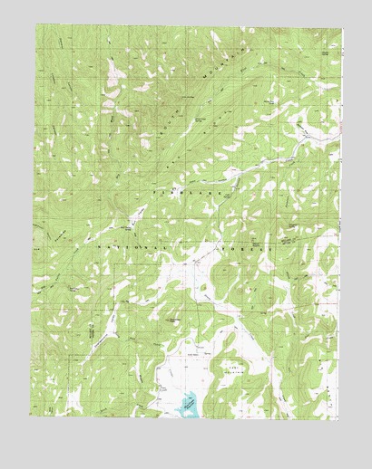
Red Ridge, UT USGS Topographic Map
Click on map above to begin viewing in our Map Viewer.

This topographic map contains these locations and features:
Feature Name Type Latitude Longitude GNIS ID View Map
Big Oaks HollowValleyN38.7016°W112.4174°1438709View Map
Birch CreekStreamN38.6277°W112.4380°1438784View Map
Bull ValleyBasinN38.6889°W112.4602°1439287View Map
Bull Valley SpringSpringN38.6856°W112.4598°1439291View Map
Burnt Tree PondLakeN38.7259°W112.4024°1448212View Map
Charlesworth ValleyValleyN38.6600°W112.4652°1439642View Map
Cold SpringSpringN38.6794°W112.4199°1448289View Map
East MountainSummitN38.6425°W112.4152°1448367View Map
Ferguson CreekStreamN38.7144°W112.3899°1441024View Map
Ferguson SpringSpringN38.6868°W112.3963°1448392View Map
First Creek SpringSpringN38.7201°W112.4347°1448400View Map
Gardner HollowValleyN38.6519°W112.3785°1441272View Map
Granddad PeakSummitN38.6561°W112.4441°1441405View Map
Grass CreekStreamN38.6364°W112.3983°1441422View Map
Herdhouse WashStreamN38.7150°W112.3877°1448465View Map
Magpie CreekStreamN38.6327°W112.4483°1443077View Map
Marys NipplesSummitN38.6830°W112.4108°1455890View Map
North CreekStreamN38.6405°W112.4408°1443870View Map
North Fork Three CreeksStreamN38.6333°W112.4383°1448746View Map
Pahvant Guard StationLocaleN38.6444°W112.4322°1451318View Map
Pavant Ranger StationLocaleN38.6441°W112.4319°1444250View Map
Red Cedar SpringSpringN38.6669°W112.4866°1444784View Map
Red RidgeRidgeN38.7144°W112.4344°1444831View Map
Skunk CreekStreamN38.6505°W112.3924°1445645View Map
South MountainSummitN38.7275°W112.4385°1449033View Map
Staples SpringSpringN38.7418°W112.3836°1449063View Map
The PyramidsSummitN38.6775°W112.4985°1446496View Map
Three Creeks DamDamN38.6261°W112.4324°1447727View Map
Three Creeks ReservoirReservoirN38.6283°W112.4350°1447726View Map

Note: Coordinates in the location and feature list above are referenced to NAD83 datum.


Copyright (C) 2008-2024 Ryan Niemi / Sunset Dynamics ... All Rights Reserved