TopoQuest Logo
Do you find TopoQuest useful?
Help keep TopoQuest running and adding new maps/features by donating!
Bitcoin:  19c7KJd3qBynnjoSw5npx9KScwjBe4ifkT
Litecoin:  LXs6TkuXGGXo1vDsWCkWVdjQX94eUKd6ui
Home View Maps Find Maps Find Places Resources & Links


Rector, Arkansas Topographic Map

USGS Map Title: Rector, AR
USGS Map MRC: 36090C3
DRG (GeoTIFF) Download: o36090c3.tif


Neighboring USGS Topographic Map Quads:


  McDougal, AR  
36090D4
 

  Pollard, AR  
36090D3
 

  Piggott, AR  
36090D2
 

  Boydsville, AR  
36090C4
 

  Rector, AR  
36090C3
 

  Greenway, AR  
36090C2
 

  Marmaduke, AR  
36090B4
 

  Mounds, AR  
36090B3
 

  Senath, MO  
36090B2


Map MRC Location:

N37°
W91°
N37°
W90°
H8 H7 H6 H5 H4 H3 H2 H1
G8 G7 G6 G5 G4 G3 G2 G1
F8 F7 F6 F5 F4 F3 F2 F1
E8 E7 E6 E5 E4 E3 E2 E1
D8 D7 D6 D5 D4 D3 D2 D1
C8 C7 C6 C5 C4 C3 C2 C1
B8 B7 B6 B5 B4 B3 B2 B1
A8 A7 A6 A5 A4 A3 A2 A1
N36°
W91°
N36°
W90°

Rector, AR USGS 1:24K Topographic Map Preview:
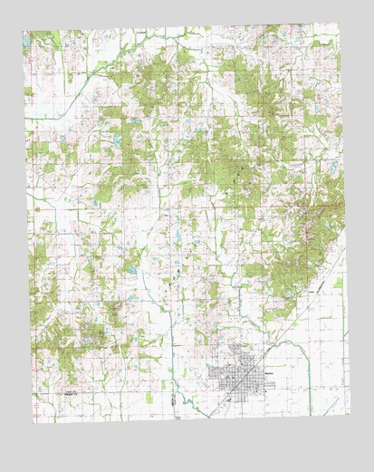
Rector, AR USGS Topographic Map
Click on map above to begin viewing in our Map Viewer.

This topographic map contains these locations and features:
Feature Name Type Latitude Longitude GNIS ID View Map
Big CreekStreamN36.3476°W90.3612°46539View Map
Blooming Grove CemeteryCemeteryN36.3148°W90.2915°82606View Map
Blooming Grove ChurchChurchN36.3145°W90.2920°46727View Map
Blooming Grove School (historical)SchoolN36.3148°W90.2920°82607View Map
City of RectorCivilN36.2645°W90.2931°2404599View Map
Clay County Central High SchoolSchoolN36.2634°W90.2987°62496View Map
Copeland LakeReservoirN36.3217°W90.2589°80085View Map
Copeland Lake DamDamN36.3217°W90.2584°80084View Map
Easterwood LakeReservoirN36.2917°W90.3334°81231View Map
Easterwood Lake DamDamN36.2917°W90.3334°81230View Map
Ebenezer ChurchChurchN36.2890°W90.3643°82620View Map
Ebenezer ChurchChurchN36.2853°W90.3643°48807View Map
Fair View School (historical)SchoolN36.3020°W90.3107°82621View Map
Forty-Four School (historical)SchoolN36.3517°W90.2657°82622View Map
Glass School (historical)SchoolN36.3106°W90.3640°82625View Map
Gravel Hill ChurchLocaleN36.3487°W90.2776°49589View Map
Gravel Hill Church (historical)ChurchN36.3484°W90.2779°82626View Map
Harmony ChurchChurchN36.3748°W90.2676°82629View Map
Hopewell Missionary Baptist ChurchChurchN36.2520°W90.3565°77219View Map
Johnson CemeteryCemeteryN36.3385°W90.3573°50685View Map
Johnson Chapel (historical)ChurchN36.3381°W90.3568°82642View Map
Liberty Hill CemeteryCemeteryN36.3281°W90.3184°82645View Map
Liberty Hill ChurchChurchN36.3267°W90.3182°51120View Map
Mars Hill ChurchChurchN36.3642°W90.3284°82814View Map
Mary School (historical)SchoolN36.2887°W90.2654°82649View Map
Marys CemeteryCemeteryN36.2923°W90.2832°82815View Map
Marys ChapelLocaleN36.2917°W90.2657°51720View Map
Myer Hill CemeteryCemeteryN36.3634°W90.3282°82651View Map
Pleasant Grove CemeteryCemeteryN36.2545°W90.3632°82707View Map
Pleasant Grove ChurchChurchN36.2531°W90.3637°53552View Map
Post Oak CreekStreamN36.2826°W90.3201°53719View Map
PrattPopulated PlaceN36.2884°W90.2659°62513View Map
RectorPopulated PlaceN36.2631°W90.2926°58468View Map
Rector Ambulance ServiceBuildingN36.2593°W90.2938°2119199View Map
Rector Elementary SchoolSchoolN36.2633°W90.2999°2039029View Map
Rector High SchoolSchoolN36.2632°W90.2987°2039030View Map
Rector Police DepartmentBuildingN36.2634°W90.2918°2118540View Map
Rector Volunteer Fire DepartmentBuildingN36.2588°W90.2920°2117019View Map
South Fork Big CreekStreamN36.3717°W90.3165°55019View Map
Township of Bradshaw-HaywoodCivilN36.3460°W90.2745°2063356View Map
Township of Oak Bluff (historical)CivilN36.2834°W90.2626°63727View Map
Township of West Oak BluffCivilN36.2707°W90.3139°2063366View Map
Trovillon CemeteryCemeteryN36.3384°W90.2843°55662View Map
Underwood CemeteryCemeteryN36.3656°W90.2640°55778View Map
Vancel CreekStreamN36.2945°W90.2959°55886View Map
Williams CemeteryCemeteryN36.3744°W90.2689°56392View Map
Woodland CemeteryCemeteryN36.2726°W90.3040°56519View Map

Note: Coordinates in the location and feature list above are referenced to NAD83 datum.


Copyright (C) 2008-2024 Ryan Niemi / Sunset Dynamics ... All Rights Reserved