TopoQuest Logo
Do you find TopoQuest useful?
Help keep TopoQuest running and adding new maps/features by donating!
Bitcoin:  19c7KJd3qBynnjoSw5npx9KScwjBe4ifkT
Litecoin:  LXs6TkuXGGXo1vDsWCkWVdjQX94eUKd6ui
Home View Maps Find Maps Find Places Resources & Links


Rainbow Point, Utah Topographic Map

USGS Map Title: Rainbow Point, UT
USGS Map MRC: 37112D2
DRG (GeoTIFF) Download: o37112d2.tif


Neighboring USGS Topographic Map Quads:


  Tropic Reservoir, UT  
37112E3
 

  Bryce Point, UT  
37112E2
 

  Cannonville, UT  
37112E1
 

  Podunk Creek, UT  
37112D3
 

  Rainbow Point, UT  
37112D2
 

  Bull Valley Gorge, UT  
37112D1
 

  Skutumpah Creek, UT  
37112C3
 

  Deer Spring Point, UT  
37112C2
 

  Deer Range Point, UT  
37112C1


Map MRC Location:

N38°
W113°
N38°
W112°
H8 H7 H6 H5 H4 H3 H2 H1
G8 G7 G6 G5 G4 G3 G2 G1
F8 F7 F6 F5 F4 F3 F2 F1
E8 E7 E6 E5 E4 E3 E2 E1
D8 D7 D6 D5 D4 D3 D2 D1
C8 C7 C6 C5 C4 C3 C2 C1
B8 B7 B6 B5 B4 B3 B2 B1
A8 A7 A6 A5 A4 A3 A2 A1
N37°
W113°
N37°
W112°

Rainbow Point, UT USGS 1:24K Topographic Map Preview:
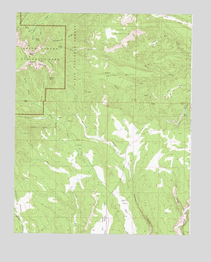
Rainbow Point, UT USGS Topographic Map
Click on map above to begin viewing in our Map Viewer.

This topographic map contains these locations and features:
Feature Name Type Latitude Longitude GNIS ID View Map
Birch SpringSpringN37.4842°W112.2466°1438801View Map
Bristlecone Loop TrailTrailN37.4728°W112.2433°1448190View Map
Bullberry SpringSpringN37.4619°W112.2258°1439297View Map
Bullrush HollowValleyN37.4046°W112.1655°1439315View Map
Corral HollowValleyN37.4474°W112.2324°1439972View Map
Crawford CanyonValleyN37.3853°W112.2471°1440135View Map
Dry ValleyBasinN37.3755°W112.1846°1438083View Map
Horse HollowValleyN37.4389°W112.2223°1441883View Map
Horse MountainSummitN37.4903°W112.1705°1441887View Map
Iron SpringSpringN37.4915°W112.2440°1442055View Map
Lonely ParkParkN37.4814°W112.2153°2678904View Map
Lonely SpringSpringN37.4808°W112.2173°1442884View Map
Lower Crawford CreekStreamN37.3805°W112.2455°1451288View Map
Mutton HollowValleyN37.4503°W112.2405°1443751View Map
North Fork Black Birch CanyonValleyN37.4976°W112.2279°1443890View Map
Papoose CreekStreamN37.4597°W112.1619°1450458View Map
Pine SpringSpringN37.4432°W112.1306°1444405View Map
Ponderosa RidgeRidgeN37.4779°W112.2338°1444572View Map
Rainbow PointCliffN37.4766°W112.2408°1444718View Map
Rainbow Point OverlookLocaleN37.4700°W112.2369°1451337View Map
Riggs SpringSpringN37.4500°W112.2414°1444906View Map
Riggs Spring Loop TrailTrailN37.4505°W112.2430°1448916View Map
South Fork Black Birch CanyonValleyN37.4917°W112.2353°1445828View Map
Squaw BenchBenchN37.4642°W112.1766°1446068View Map
Squaw CreekStreamN37.4653°W112.1382°1446070View Map
Swallow Park RanchLocaleN37.3947°W112.1738°1446269View Map
Tank CanyonValleyN37.3881°W112.1297°1446327View Map
The PromontoryCliffN37.4667°W112.2244°1446495View Map
Twin HillsSummitN37.4563°W112.2009°1446782View Map
Yovimpa PointCliffN37.4725°W112.2405°1447579View Map
Yovimpa Point OverlookLocaleN37.4733°W112.2408°1449215View Map

Note: Coordinates in the location and feature list above are referenced to NAD83 datum.


Copyright (C) 2008-2024 Ryan Niemi / Sunset Dynamics ... All Rights Reserved