TopoQuest Logo
Do you find TopoQuest useful?
Help keep TopoQuest running and adding new maps/features by donating!
Bitcoin:  19c7KJd3qBynnjoSw5npx9KScwjBe4ifkT
Litecoin:  LXs6TkuXGGXo1vDsWCkWVdjQX94eUKd6ui
Home View Maps Find Maps Find Places Resources & Links


Rafter, Tennessee Topographic Map

USGS Map Title: Rafter, TN
USGS Map MRC: 35084D2
DRG (GeoTIFF) Download: o35084d2.tif


Neighboring USGS Topographic Map Quads:


  Madisonville, TN  
35084E3
 

  Vonore, TN  
35084E2
 

  Tallassee, TN  
35084E1
 

  Mount Vernon, TN  
35084D3
 

  Rafter, TN  
35084D2
 

  Whiteoak Flats, TN  
35084D1
 

  Tellico Plains, TN  
35084C3
 

  Bald River Falls, TN  
35084C2
 

  Big Junction, TN  
35084C1


Map MRC Location:

N36°
W85°
N36°
W84°
H8 H7 H6 H5 H4 H3 H2 H1
G8 G7 G6 G5 G4 G3 G2 G1
F8 F7 F6 F5 F4 F3 F2 F1
E8 E7 E6 E5 E4 E3 E2 E1
D8 D7 D6 D5 D4 D3 D2 D1
C8 C7 C6 C5 C4 C3 C2 C1
B8 B7 B6 B5 B4 B3 B2 B1
A8 A7 A6 A5 A4 A3 A2 A1
N35°
W85°
N35°
W84°

Rafter, TN USGS 1:24K Topographic Map Preview:
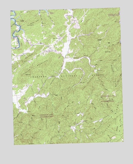
Rafter, TN USGS Topographic Map
Click on map above to begin viewing in our Map Viewer.

This topographic map contains these locations and features:
Feature Name Type Latitude Longitude GNIS ID View Map
AcornPopulated PlaceN35.4676°W84.2255°1314560View Map
Amerine BranchStreamN35.4170°W84.2283°1275659View Map
Antioch Baptist ChurchChurchN35.4837°W84.1488°1304848View Map
Antioch School (historical)SchoolN35.4840°W84.1480°1308277View Map
Ball Play Furnace (historical)LocaleN35.4887°W84.1841°1308279View Map
Ball Play Volunteer Fire DepartmentBuildingN35.4630°W84.2065°2654584View Map
BallplayPopulated PlaceN35.4640°W84.2055°1646993View Map
Ballplay SchoolSchoolN35.4620°W84.2069°1304945View Map
Birchfield MountainSummitN35.4873°W84.2244°1277495View Map
Bivens BranchStreamN35.4117°W84.1432°1277533View Map
Burris School (historical)SchoolN35.4565°W84.1944°1308281View Map
Cagle BranchStreamN35.4923°W84.2491°1279285View Map
Cane Creek MountainSummitN35.4101°W84.1852°1279528View Map
Canebrake MountainSummitN35.4709°W84.1524°1279543View Map
Carden BranchStreamN35.4073°W84.2346°1279651View Map
Cherokee Wildlife Management AreaParkN35.3834°W84.1332°1641141View Map
Chestnut ValleyValleyN35.4454°W84.1914°1280427View Map
Chestnut ValleyPopulated PlaceN35.4309°W84.1738°1314832View Map
Chestnut Valley School (historical)SchoolN35.4309°W84.1732°1308284View Map
Chickasaw School (historical)SchoolN35.4620°W84.2294°1308285View Map
Commissioner District 3CivilN35.3874°W84.2100°2464179View Map
Cowmire BranchStreamN35.3815°W84.2310°1641402View Map
Ebenezer Ballplay ChurchChurchN35.4729°W84.1944°1283458View Map
Farrs ChapelChurchN35.4556°W84.1669°1284164View Map
Farrs Chapel CemeteryCemeteryN35.4634°W84.1513°1284165View Map
Friends ChurchChurchN35.3956°W84.1688°1284919View Map
Giles CemeteryCemeteryN35.3917°W84.1732°1285380View Map
Giles CemeteryCemeteryN35.4884°W84.1796°1285381View Map
Glenn RidgeRidgeN35.4937°W84.1505°1285519View Map
Glenndale School (historical)SchoolN35.4848°W84.1807°1308296View Map
Hampton BranchStreamN35.4187°W84.1599°1286695View Map
Harding CreekStreamN35.4029°W84.2032°1286845View Map
Harlan MountainSummitN35.4404°W84.2349°1641390View Map
Harris BranchStreamN35.4873°W84.2449°1286949View Map
Hells Hole BranchStreamN35.4681°W84.1255°1287343View Map
Hells Hole GapGapN35.4590°W84.1438°1287344View Map
Huckleberry RidgeRidgeN35.4034°W84.2132°1288594View Map
Kilpatrick School (historical)SchoolN35.4306°W84.2138°1308307View Map
King GapGapN35.4673°W84.1399°1290219View Map
Kitchens School (historical)SchoolN35.4629°W84.1516°1308308View Map
Lost Cove BranchStreamN35.4329°W84.1505°1292071View Map
Lynn Carden MountainSummitN35.4873°W84.2305°1292347View Map
Miller RidgeRidgeN35.3898°W84.1432°1269805View Map
Milligan Church (historical)ChurchN35.4531°W84.1749°1308321View Map
Millsaps BranchStreamN35.4995°W84.2460°1293996View Map
Mose MountainSummitN35.3959°W84.2444°1294479View Map
Mount Isabel CemeteryCemeteryN35.3753°W84.2102°1294649View Map
Nickels BranchStreamN35.3984°W84.1896°1295742View Map
Oak Grove ChurchChurchN35.4617°W84.2099°1296086View Map
Peaked TopSummitN35.4404°W84.2349°1297067View Map
Pearson BranchStreamN35.4737°W84.1830°1297075View Map
Quaker Church (historical)ChurchN35.3954°W84.1544°1308329View Map
RafterPopulated PlaceN35.3926°W84.1782°1315780View Map
Rafter School (historical)SchoolN35.3923°W84.1785°1317921View Map
Rafter Volunteer Fire DepartmentBuildingN35.3918°W84.1782°2654826View Map
Ramsey BranchStreamN35.4204°W84.2052°1298884View Map
Red MountainSummitN35.4567°W84.2296°1299074View Map
Shaw CemeteryCemeteryN35.4059°W84.2335°1269932View Map
Shingletree BranchStreamN35.4012°W84.2296°1270109View Map
Sloan BridgeBridgeN35.4756°W84.2424°1308332View Map
Sloan Bridge Boat Launching RampLocaleN35.4756°W84.2433°1308333View Map
Stratton BranchStreamN35.4826°W84.2394°1271576View Map
Tanyard BranchStreamN35.4967°W84.1810°1304002View Map
TariffvillePopulated PlaceN35.4867°W84.1785°1314376View Map
Tellico CemeteryCemeteryN35.4765°W84.2419°1317930View Map
Tellico ChurchChurchN35.4765°W84.2410°1304035View Map
Turkeypen MountainSummitN35.4901°W84.2394°1304200View Map
Tyler MountainSummitN35.4242°W84.1696°1641391View Map
Williams BranchStreamN35.4451°W84.1557°1274626View Map
Williamsburg CemeteryCemeteryN35.4420°W84.1524°1274718View Map
Williamsburg ChurchChurchN35.4537°W84.1788°1304610View Map

Note: Coordinates in the location and feature list above are referenced to NAD83 datum.


Copyright (C) 2008-2024 Ryan Niemi / Sunset Dynamics ... All Rights Reserved