TopoQuest Logo
Do you find TopoQuest useful?
Help keep TopoQuest running and adding new maps/features by donating!
Bitcoin:  19c7KJd3qBynnjoSw5npx9KScwjBe4ifkT
Litecoin:  LXs6TkuXGGXo1vDsWCkWVdjQX94eUKd6ui
Home View Maps Find Maps Find Places Resources & Links


Big Craggies, Oregon Topographic Map

USGS Map Title: Big Craggies, OR
USGS Map MRC: 42124C1
DRG (GeoTIFF) Download: o42124c1.tif


Neighboring USGS Topographic Map Quads:


  Quosatana Butte, OR  
42124D2
 

  Horse Sign Butte, OR  
42124D1
 

  Silver Peak, OR  
42123D8
 

  Collier Butte, OR  
42124C2
 

  Big Craggies, OR  
42124C1
 

  Tincup Peak, OR  
42123C8
 

  Bosley Butte, OR  
42124B2
 

  Quail Prairie Mountain, OR  
42124B1
 

  Chetco Peak, OR  
42123B8


Map MRC Location:

N43°
W125°
N43°
W124°
H8 H7 H6 H5 H4 H3 H2 H1
G8 G7 G6 G5 G4 G3 G2 G1
F8 F7 F6 F5 F4 F3 F2 F1
E8 E7 E6 E5 E4 E3 E2 E1
D8 D7 D6 D5 D4 D3 D2 D1
C8 C7 C6 C5 C4 C3 C2 C1
B8 B7 B6 B5 B4 B3 B2 B1
A8 A7 A6 A5 A4 A3 A2 A1
N42°
W125°
N42°
W124°

Big Craggies, OR USGS 1:24K Topographic Map Preview:
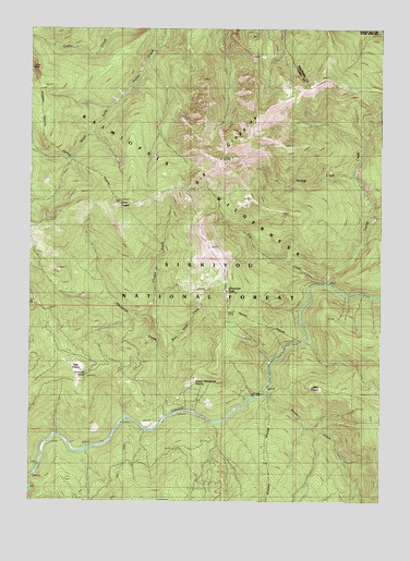
Big Craggies, OR USGS Topographic Map
Click on map above to begin viewing in our Map Viewer.

This topographic map contains these locations and features:
Feature Name Type Latitude Longitude GNIS ID View Map
Big CraggiesSummitN42.3402°W124.0586°1137999View Map
Big Craggies Botanical AreaAreaN42.3423°W124.0565°1156466View Map
Blue Slide CreekStreamN42.2868°W124.0773°1138334View Map
Collier CreekStreamN42.3696°W124.1106°1139992View Map
Craggie CreekStreamN42.2987°W124.0840°1140355View Map
Darling CreekStreamN42.3354°W124.0106°1140637View Map
Fall CreekStreamN42.3090°W124.0195°1141962View Map
Green CraggieSummitN42.3285°W124.0954°1143025View Map
High PrairieFlatN42.2857°W124.1093°1143574View Map
Humboldt SpringSpringN42.2835°W124.1059°1155724View Map
Humboldt SpringSpringN42.2835°W124.1059°1116474View Map
Humboldt Spring Camp (historical)LocaleN42.2887°W124.1095°1154830View Map
Jacks CampLocaleN42.3004°W124.0554°1116473View Map
Lately PrairieFlatN42.2801°W124.0242°1144852View Map
Mislatnah CreekStreamN42.2712°W124.0779°1146360View Map
Mislatnah Lookout (historical)LocaleN42.3051°W124.0556°1146361View Map
Mislatnah PeakSummitN42.3054°W124.0562°1116472View Map
Tincup CreekStreamN42.3073°W124.0195°1151267View Map
Tolman CreekStreamN42.2693°W124.1165°1154833View Map
Tolman RanchLocaleN42.2704°W124.0837°1151305View Map
Upper Mislatnah PrairieAreaN42.2818°W124.0637°1116475View Map

Note: Coordinates in the location and feature list above are referenced to NAD83 datum.


Copyright (C) 2008-2024 Ryan Niemi / Sunset Dynamics ... All Rights Reserved