TopoQuest Logo
Do you find TopoQuest useful?
Help keep TopoQuest running and adding new maps/features by donating!
Bitcoin:  19c7KJd3qBynnjoSw5npx9KScwjBe4ifkT
Litecoin:  LXs6TkuXGGXo1vDsWCkWVdjQX94eUKd6ui
Home View Maps Find Maps Find Places Resources & Links


Powderhorn, Colorado Topographic Map

USGS Map Title: Powderhorn, CO
USGS Map MRC: 38107C1
DRG (GeoTIFF) Download: o38107c1.tif


Neighboring USGS Topographic Map Quads:


  Carpenter Ridge, CO  
38107D2
 

  Big Mesa, CO  
38107D1
 

  Iris NW, CO  
38106D8
 

  Gateview, CO  
38107C2
 

  Powderhorn, CO  
38107C1
 

  Spring Hill Creek, CO  
38106C8
 

  Powderhorn Lakes, CO  
38107B2
 

  Rudolph Hill, CO  
38107B1
 

  Rock Creek Park, CO  
38106B8


Map MRC Location:

N39°
W108°
N39°
W107°
H8 H7 H6 H5 H4 H3 H2 H1
G8 G7 G6 G5 G4 G3 G2 G1
F8 F7 F6 F5 F4 F3 F2 F1
E8 E7 E6 E5 E4 E3 E2 E1
D8 D7 D6 D5 D4 D3 D2 D1
C8 C7 C6 C5 C4 C3 C2 C1
B8 B7 B6 B5 B4 B3 B2 B1
A8 A7 A6 A5 A4 A3 A2 A1
N38°
W108°
N38°
W107°

Powderhorn, CO USGS 1:24K Topographic Map Preview:
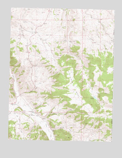
Powderhorn, CO USGS Topographic Map
Click on map above to begin viewing in our Map Viewer.

This topographic map contains these locations and features:
Feature Name Type Latitude Longitude GNIS ID View Map
Aaberlite MinesMineN38.2825°W107.0814°1745589View Map
Beaver Creek MineMineN38.2561°W107.0464°1745590View Map
Cebolla Creek Titaneferous Iron DepositMineN38.2850°W107.0984°1745591View Map
Cebolla Hot SpringsSpringN38.2738°W107.0987°188346View Map
Chimney MineMineN38.3383°W107.0087°1735721View Map
Deldorado CreekStreamN38.2578°W107.0753°188352View Map
Dry Powderhorn CreekStreamN38.2767°W107.1206°188344View Map
Good Hope MineMineN38.3383°W107.0087°1735719View Map
Howard RanchLocaleN38.2592°W107.0753°188350View Map
Huntsman GulchValleyN38.2680°W107.0811°188351View Map
Huntsman MesaSummitN38.2794°W107.0203°188354View Map
Iron HillSummitN38.2533°W107.0534°188353View Map
Iron Hill Area MineMineN38.2561°W107.0428°1745592View Map
Iron Hill Columbium DepositMineN38.2603°W107.0556°1745594View Map
Iron Hills Manganese District MineMineN38.2550°W107.1034°1745593View Map
Ironcap MineMineN38.3453°W107.0837°188364View Map
Little Camp CreekStreamN38.3633°W107.0195°188359View Map
Little Willow CreekStreamN38.3714°W107.0359°188361View Map
Mammoth MineMineN38.3383°W107.0087°1735720View Map
Midway (historical)Populated PlaceN38.3439°W107.0539°188362View Map
Milkranch GulchValleyN38.2923°W107.1123°188357View Map
Ninemile HillSummitN38.3592°W107.0834°188363View Map
Old Lot MineMineN38.3205°W107.0937°188358View Map
PowderhornPopulated PlaceN38.2769°W107.0959°204752View Map
Powderhorn CreekStreamN38.2905°W107.1142°188342View Map
Powderhorn MineMineN38.2611°W107.0225°1745595View Map
Powderhorn SchoolSchoolN38.2703°W107.0845°188348View Map
Rare Earth Mining Company MineMineN38.3278°W107.0712°1745596View Map
Seventy-six Shaft MineMineN38.3155°W107.1017°1745598View Map
Smith GulchValleyN38.2680°W107.0898°188343View Map
Soderquist DamDamN38.2928°W107.0237°199872View Map
Soderquist ReservoirReservoirN38.2912°W107.0218°188355View Map
SpencerLocaleN38.3547°W107.1123°188365View Map
Stone GulchValleyN38.2780°W107.0975°188349View Map
Sunset MineMineN38.3422°W107.0123°1745597View Map
Vulcan (historical)Populated PlaceN38.3455°W107.0014°188360View Map
Vulcan MineMineN38.3383°W107.0087°1735718View Map
Watts DrawValleyN38.2980°W107.0261°188356View Map
Youmans RanchLocaleN38.2730°W107.0892°188347View Map

Note: Coordinates in the location and feature list above are referenced to NAD83 datum.


Copyright (C) 2008-2024 Ryan Niemi / Sunset Dynamics ... All Rights Reserved