TopoQuest Logo
Do you find TopoQuest useful?
Help keep TopoQuest running and adding new maps/features by donating!
Bitcoin:  19c7KJd3qBynnjoSw5npx9KScwjBe4ifkT
Litecoin:  LXs6TkuXGGXo1vDsWCkWVdjQX94eUKd6ui
Home View Maps Find Maps Find Places Resources & Links


Potlatch, Idaho Topographic Map

USGS Map Title: Potlatch, ID
USGS Map MRC: 46116H8
DRG (GeoTIFF) Download: o46116h8.tif


Neighboring USGS Topographic Map Quads:


  Farmington, WA  
47117A1
 

  Mission Mountain, ID  
47116A8
 

  Sanders, ID  
47116A7
 

  Palouse, WA  
46117H1
 

  Potlatch, ID  
46116H8
 

  Princeton, ID  
46116H7
 

  Viola, ID  
46117G1
 

  Robinson Lake, ID  
46116G8
 

  Moscow Mountain, ID  
46116G7


Map MRC Location:

N47°
W117°
N47°
W116°
H8 H7 H6 H5 H4 H3 H2 H1
G8 G7 G6 G5 G4 G3 G2 G1
F8 F7 F6 F5 F4 F3 F2 F1
E8 E7 E6 E5 E4 E3 E2 E1
D8 D7 D6 D5 D4 D3 D2 D1
C8 C7 C6 C5 C4 C3 C2 C1
B8 B7 B6 B5 B4 B3 B2 B1
A8 A7 A6 A5 A4 A3 A2 A1
N46°
W117°
N46°
W116°

Potlatch, ID USGS 1:24K Topographic Map Preview:
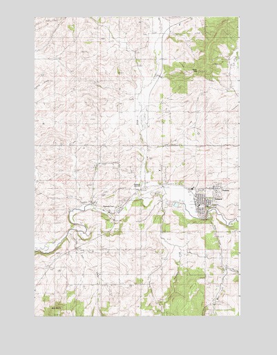
Potlatch, ID USGS Topographic Map
Click on map above to begin viewing in our Map Viewer.

This topographic map contains these locations and features:
Feature Name Type Latitude Longitude GNIS ID View Map
Anderson-Plummer Airport (historical)AirportN46.9243°W116.9585°400905View Map
Ball ButteSummitN46.8777°W116.9877°396067View Map
City of OnawayCivilN46.9282°W116.8896°2411322View Map
City of PotlatchCivilN46.9236°W116.8978°2411478View Map
Deep CreekStreamN46.9243°W116.9379°380393View Map
East Fork Rock CreekStreamN46.8946°W116.8868°381165View Map
Farber PointSummitN46.9774°W116.9013°396478View Map
Flannigan CreekStreamN46.9238°W116.9227°381816View Map
FreezePopulated PlaceN46.9618°W116.9427°399482View Map
Freeze CemeteryCemeteryN46.9635°W116.9496°2019046View Map
Gnat CreekStreamN46.9096°W116.9804°382304View Map
Kennedy FordLocaleN46.9221°W116.9657°384166View Map
Mendenhall CemeteryCemeteryN46.9314°W116.8753°2014648View Map
OnawayPopulated PlaceN46.9282°W116.8910°397963View Map
Palouse District Ranger StationLocaleN46.9307°W116.9129°394700View Map
PotlatchPopulated PlaceN46.9216°W116.8982°397063View Map
Potlatch Elementary SchoolSchoolN46.9210°W116.8950°401062View Map
Potlatch JunctionPopulated PlaceN46.9293°W116.9335°397064View Map
Potlatch Junior - Senior High SchoolSchoolN46.9282°W116.9041°401063View Map
Potlatch Post OfficePost OfficeN46.9213°W116.9000°2779564View Map
Potlatch Rural Fire DistrictBuildingN46.9205°W116.9001°2618990View Map
Rock CreekStreamN46.9177°W116.8943°389479View Map
Rock Creek CemeteryCemeteryN46.8915°W116.8951°2014650View Map
West Fork Rock CreekStreamN46.8946°W116.8866°393184View Map

Note: Coordinates in the location and feature list above are referenced to NAD83 datum.


Copyright (C) 2008-2024 Ryan Niemi / Sunset Dynamics ... All Rights Reserved