TopoQuest Logo
Do you find TopoQuest useful?
Help keep TopoQuest running and adding new maps/features by donating!
Bitcoin:  19c7KJd3qBynnjoSw5npx9KScwjBe4ifkT
Litecoin:  LXs6TkuXGGXo1vDsWCkWVdjQX94eUKd6ui
Home View Maps Find Maps Find Places Resources & Links


Plaskett Meadows, California Topographic Map

USGS Map Title: Plaskett Meadows, CA
USGS Map MRC: 39122F7
DRG (GeoTIFF) Download: o39122f7.tif


Neighboring USGS Topographic Map Quads:


  Mendocino Pass, CA  
39122G8
 

  Log Spring, CA  
39122G7
 

  Hall Ridge, CA  
39122G6
 

  Plaskett Ridge, CA  
39122F8
 

  Plaskett Meadows, CA  
39122F7
 

  Alder Springs, CA  
39122F6
 

  Hull Mountain, CA  
39122E8
 

  Kneecap Ridge, CA  
39122E7
 

  Felkner Hill, CA  
39122E6


Map MRC Location:

N40°
W123°
N40°
W122°
H8 H7 H6 H5 H4 H3 H2 H1
G8 G7 G6 G5 G4 G3 G2 G1
F8 F7 F6 F5 F4 F3 F2 F1
E8 E7 E6 E5 E4 E3 E2 E1
D8 D7 D6 D5 D4 D3 D2 D1
C8 C7 C6 C5 C4 C3 C2 C1
B8 B7 B6 B5 B4 B3 B2 B1
A8 A7 A6 A5 A4 A3 A2 A1
N39°
W123°
N39°
W122°

Plaskett Meadows, CA USGS 1:24K Topographic Map Preview:
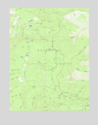
Plaskett Meadows, CA USGS Topographic Map
Click on map above to begin viewing in our Map Viewer.

This topographic map contains these locations and features:
Feature Name Type Latitude Longitude GNIS ID View Map
Barb RidgeRidgeN39.6871°W122.8703°256504View Map
Black ButteSummitN39.7265°W122.8722°257100View Map
Board Tree CampgroundLocaleN39.6543°W122.8361°257303View Map
Brownell CampLocaleN39.6499°W122.8033°257498View Map
Brushy MountainSummitN39.6646°W122.8525°257547View Map
Buck RidgeRidgeN39.6379°W122.8156°257587View Map
Charlies RockPillarN39.7304°W122.8242°258220View Map
Chimney RockPillarN39.7096°W122.8386°258290View Map
Copper CityPopulated PlaceN39.7229°W122.8094°1658316View Map
Copper City Campground (historical)LocaleN39.7229°W122.8092°1666642View Map
Cottonwood CreekStreamN39.7015°W122.8128°258758View Map
Cottonwood GladeFlatN39.7004°W122.8108°258769View Map
Cottonwood Glade Campground (historical)LocaleN39.6993°W122.8089°1666643View Map
Elk RidgeRidgeN39.7235°W122.7844°259857View Map
Ford HillSummitN39.6743°W122.8094°1658558View Map
French RidgeRidgeN39.6427°W122.8686°260404View Map
Frolic SpringSpringN39.7471°W122.8072°1666645View Map
Garnett CampLocaleN39.6921°W122.8456°260491View Map
Grouse SpringSpringN39.6408°W122.7826°260964View Map
Hardin RidgeRidgeN39.7474°W122.7719°261087View Map
Hunter RidgeRidgeN39.6646°W122.8669°261645View Map
Ice SpringSpringN39.7270°W122.7927°261677View Map
Jenks PlacePopulated PlaceN39.7085°W122.8483°1658857View Map
Keeran CampLocaleN39.6899°W122.8550°262095View Map
Kill Dry RidgeRidgeN39.7446°W122.8275°262174View Map
Lone StarPopulated PlaceN39.7093°W122.8092°1659002View Map
Lone Star Campground (historical)LocaleN39.7096°W122.8100°1666649View Map
Markham RidgeRidgeN39.6368°W122.8386°263217View Map
Masterson CampgroundLocaleN39.7346°W122.8431°263261View Map
Mendocino National ForestForestN39.6283°W122.8488°255942View Map
Middle RidgeRidgeN39.6460°W122.7678°263546View Map
O'Neil GladeFlatN39.7410°W122.7717°264270View Map
Ocean ViewLocaleN39.6635°W122.8544°264304View Map
Plaskett CreekStreamN39.7082°W122.8256°264838View Map
Plaskett MeadowsFlatN39.7268°W122.8428°264839View Map
Plaskett Recreation SiteLocaleN39.7263°W122.8475°276321View Map
Plaskett StationLocaleN39.7335°W122.8444°264841View Map
Rockwell RidgeRidgeN39.6729°W122.7639°265522View Map
Salt Log RidgeRidgeN39.6860°W122.7622°265786View Map
Shepherd RidgeRidgeN39.6979°W122.7614°266098View Map
Slapjack SpringSpringN39.6319°W122.7546°266263View Map
Snow BasinBasinN39.7349°W122.8617°267304View Map
Snow Basin CreekStreamN39.7107°W122.8558°267305View Map
Spanish RidgeRidgeN39.6407°W122.8578°267556View Map
Squaw CampLocaleN39.6563°W122.8094°267618View Map
Walker CabinLocaleN39.7152°W122.7969°276322View Map
Yellow Jacket GladeFlatN39.7174°W122.8667°269345View Map

Note: Coordinates in the location and feature list above are referenced to NAD83 datum.


Copyright (C) 2008-2024 Ryan Niemi / Sunset Dynamics ... All Rights Reserved