TopoQuest Logo
Do you find TopoQuest useful?
Help keep TopoQuest running and adding new maps/features by donating!
Bitcoin:  19c7KJd3qBynnjoSw5npx9KScwjBe4ifkT
Litecoin:  LXs6TkuXGGXo1vDsWCkWVdjQX94eUKd6ui
Home View Maps Find Maps Find Places Resources & Links


Piute Peak, California Topographic Map

USGS Map Title: Piute Peak, CA
USGS Map MRC: 35118D4
DRG (GeoTIFF) Download: o35118d4.tif


Neighboring USGS Topographic Map Quads:


  Miracle Hot Springs, CA  
35118E5
 

  Lake Isabella South, CA  
35118E4
 

  Woolstalf Creek, CA  
35118E3
 

  Breckenridge Mountain, CA  
35118D5
 

  Piute Peak, CA  
35118D4
 

  Claraville, CA  
35118D3
 

  Oiler Peak, CA  
35118C5
 

  Loraine, CA  
35118C4
 

  Emerald Mountain, CA  
35118C3


Map MRC Location:

N36°
W119°
N36°
W118°
H8 H7 H6 H5 H4 H3 H2 H1
G8 G7 G6 G5 G4 G3 G2 G1
F8 F7 F6 F5 F4 F3 F2 F1
E8 E7 E6 E5 E4 E3 E2 E1
D8 D7 D6 D5 D4 D3 D2 D1
C8 C7 C6 C5 C4 C3 C2 C1
B8 B7 B6 B5 B4 B3 B2 B1
A8 A7 A6 A5 A4 A3 A2 A1
N35°
W119°
N35°
W118°

Piute Peak, CA USGS 1:24K Topographic Map Preview:
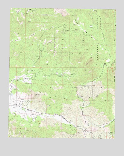
Piute Peak, CA USGS Topographic Map
Click on map above to begin viewing in our Map Viewer.

This topographic map contains these locations and features:
Feature Name Type Latitude Longitude GNIS ID View Map
Beartrap CreekStreamN35.4400°W118.4534°269765View Map
Bluebird MineMineN35.4897°W118.3795°275921View Map
Bracchi SpringSpringN35.4145°W118.4139°269996View Map
Brown MeadowFlatN35.4830°W118.4062°270032View Map
Brown PeakSummitN35.4844°W118.4240°270035View Map
Burton MillLocaleN35.4347°W118.3948°275920View Map
Burton Mill MineMineN35.4975°W118.4051°275897View Map
Cannon RanchLocaleN35.4197°W118.4995°275900View Map
Cholly CanyonValleyN35.3966°W118.4481°270447View Map
Cold SpringSpringN35.4668°W118.3967°270540View Map
Horshoe MineMineN35.4863°W118.4801°243679View Map
Jacksons HoleValleyN35.4305°W118.3754°271758View Map
Joe Walker MineMineN35.4216°W118.4943°271793View Map
Johns PeakSummitN35.4155°W118.4681°271799View Map
Kennedy SpringSpringN35.3806°W118.3783°271866View Map
Kern County Fire Department Station 78 PiuteBuildingN35.3834°W118.4118°2665346View Map
King Solomons MineMineN35.4980°W118.4765°271900View Map
King Solomons RidgeRidgeN35.4936°W118.4276°271901View Map
Loco Bill CanyonValleyN35.3863°W118.3881°272152View Map
Mills RanchLocaleN35.3994°W118.4934°275844View Map
North Fork Walker Basin CreekStreamN35.4347°W118.4809°272705View Map
Piute (historical)Populated PlaceN35.4000°W118.4009°252210View Map
Piute MountainsRangeN35.4482°W118.3847°2790702View Map
Piute PeakSummitN35.4511°W118.3917°273040View Map
Piute SpringSpringN35.4469°W118.3898°273041View Map
Red MountainRidgeN35.4722°W118.4862°273240View Map
Setimo CreekStreamN35.3894°W118.4037°273638View Map
Shadow Mountain Airstrip (historical)AirportN35.3980°W118.4840°1653302View Map
Skinner FlatFlatN35.4136°W118.4195°273732View Map
Thompson CreekStreamN35.4400°W118.4534°274114View Map
Thompson SpringSpringN35.4349°W118.4429°274121View Map
Walser RanchLocaleN35.3908°W118.4268°275843View Map
Yates Hot SpringsSpringN35.4321°W118.4823°274586View Map

Note: Coordinates in the location and feature list above are referenced to NAD83 datum.


Copyright (C) 2008-2024 Ryan Niemi / Sunset Dynamics ... All Rights Reserved