TopoQuest Logo
Do you find TopoQuest useful?
Help keep TopoQuest running and adding new maps/features by donating!
Bitcoin:  19c7KJd3qBynnjoSw5npx9KScwjBe4ifkT
Litecoin:  LXs6TkuXGGXo1vDsWCkWVdjQX94eUKd6ui
Home View Maps Find Maps Find Places Resources & Links


Piney Peak, Colorado Topographic Map

USGS Map Title: Piney Peak, CO
USGS Map MRC: 39106G4
DRG (GeoTIFF) Download: o39106g4.tif


Neighboring USGS Topographic Map Quads:


  Radium, CO  
39106H5
 

  Sheephorn Mountain, CO  
39106H4
 

  King Creek, CO  
39106H3
 

  Lava Creek, CO  
39106G5
 

  Piney Peak, CO  
39106G4
 

  Mount Powell, CO  
39106G3
 

  Edwards, CO  
39106F5
 

  Vail West, CO  
39106F4
 

  Vail East, CO  
39106F3


Map MRC Location:

N40°
W107°
N40°
W106°
H8 H7 H6 H5 H4 H3 H2 H1
G8 G7 G6 G5 G4 G3 G2 G1
F8 F7 F6 F5 F4 F3 F2 F1
E8 E7 E6 E5 E4 E3 E2 E1
D8 D7 D6 D5 D4 D3 D2 D1
C8 C7 C6 C5 C4 C3 C2 C1
B8 B7 B6 B5 B4 B3 B2 B1
A8 A7 A6 A5 A4 A3 A2 A1
N39°
W107°
N39°
W106°

Piney Peak, CO USGS 1:24K Topographic Map Preview:
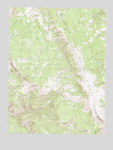
Piney Peak, CO USGS Topographic Map
Click on map above to begin viewing in our Map Viewer.

This topographic map contains these locations and features:
Feature Name Type Latitude Longitude GNIS ID View Map
Beaver Dam LakeLakeN39.8473°W106.4924°1947738View Map
Big Hole CreekStreamN39.8425°W106.4534°196486View Map
Big ParkFlatN39.7997°W106.4959°175660View Map
Blue LakeLakeN39.8402°W106.4221°175624View Map
Chimney RockSummitN39.7975°W106.4670°1947733View Map
East Fork Three Licks CreekStreamN39.8272°W106.4606°175629View Map
Gore RangeRangeN39.8333°W106.4173°175656View Map
Horseshoe CreekStreamN39.7714°W106.4745°1947731View Map
Jenkins CreekStreamN39.8555°W106.4564°1947741View Map
Lone Lick CreekStreamN39.8655°W106.4723°175628View Map
Lone Lick LakesLakeN39.8454°W106.4989°202313View Map
Long ParkParkN39.8461°W106.4681°1947739View Map
Mahan LakeLakeN39.8158°W106.3881°175648View Map
Mather SpringSpringN39.8533°W106.4295°1947743View Map
McPhee CreekStreamN39.8422°W106.4478°1947740View Map
Meridian PeakSummitN39.7675°W106.3850°1947729View Map
North Fork Piney RiverStreamN39.7658°W106.4900°175651View Map
Petty MountainSummitN39.7533°W106.3989°1947728View Map
Piney Lake TrailTrailN39.7800°W106.4078°202315View Map
Piney PeakSummitN39.8189°W106.4975°175659View Map
Piney Peak SpringSpringN39.8122°W106.4973°1947735View Map
Sheep Drive TrailTrailN39.8728°W106.4106°175619View Map
Slate CreekStreamN39.8692°W106.4734°175658View Map
Slate MountainSummitN39.7611°W106.4284°175641View Map
Slough Grass LakeLakeN39.8434°W106.4595°1947737View Map
Soda CreekStreamN39.7908°W106.4325°175650View Map
Soda LakesLakeN39.7778°W106.4148°1947730View Map
Soda SpringsSpringN39.7747°W106.4050°175649View Map
Three Licks CreekStreamN39.8514°W106.4545°175630View Map
Twin LakesLakeN39.8066°W106.4730°1947734View Map

Note: Coordinates in the location and feature list above are referenced to NAD83 datum.


Copyright (C) 2008-2024 Ryan Niemi / Sunset Dynamics ... All Rights Reserved