TopoQuest Logo
Do you find TopoQuest useful?
Help keep TopoQuest running and adding new maps/features by donating!
Bitcoin:  19c7KJd3qBynnjoSw5npx9KScwjBe4ifkT
Litecoin:  LXs6TkuXGGXo1vDsWCkWVdjQX94eUKd6ui
Home View Maps Find Maps Find Places Resources & Links


Pine Flat Dam, California Topographic Map

USGS Map Title: Pine Flat Dam, CA
USGS Map MRC: 36119G3
DRG (GeoTIFF) Download: o36119g3.tif


Neighboring USGS Topographic Map Quads:


  Humphreys Station, CA  
36119H4
 

  Trimmer, CA  
36119H3
 

  Sacate Ridge, CA  
36119H2
 

  Piedra, CA  
36119G4
 

  Pine Flat Dam, CA  
36119G3
 

  Luckett Mountain, CA  
36119G2
 

  Wahtoke, CA  
36119F4
 

  Orange Cove North, CA  
36119F3
 

  Tucker Mountain, CA  
36119F2


Map MRC Location:

N37°
W120°
N37°
W119°
H8 H7 H6 H5 H4 H3 H2 H1
G8 G7 G6 G5 G4 G3 G2 G1
F8 F7 F6 F5 F4 F3 F2 F1
E8 E7 E6 E5 E4 E3 E2 E1
D8 D7 D6 D5 D4 D3 D2 D1
C8 C7 C6 C5 C4 C3 C2 C1
B8 B7 B6 B5 B4 B3 B2 B1
A8 A7 A6 A5 A4 A3 A2 A1
N36°
W120°
N36°
W119°

Pine Flat Dam, CA USGS 1:24K Topographic Map Preview:
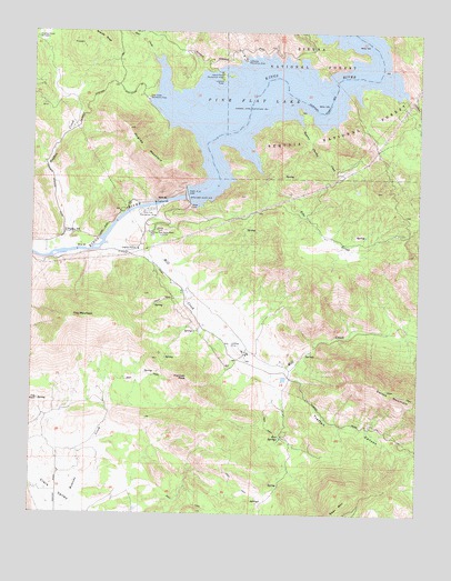
Pine Flat Dam, CA USGS Topographic Map
Click on map above to begin viewing in our Map Viewer.

This topographic map contains these locations and features:
Feature Name Type Latitude Longitude GNIS ID View Map
Clark ValleyBasinN36.7544°W119.3676°258407View Map
Deer CreekStreamN36.8683°W119.3371°259214View Map
Deer Creek Recreation AreaLocaleN36.8577°W119.3390°259225View Map
Five SpringsSpringN36.7697°W119.2951°260181View Map
Harmon PeakSummitN36.7852°W119.3251°261097View Map
Hughes Creek CemeteryCemeteryN36.8730°W119.3748°261598View Map
Hughes MountainSummitN36.8405°W119.3335°261599View Map
Island Park Recreation AreaLocaleN36.8633°W119.3148°261834View Map
Jug RockPillarN36.7794°W119.3737°262034View Map
Lakeview Recreation AreaLocaleN36.8677°W119.3076°262303View Map
Lefever CreekStreamN36.8583°W119.2551°262407View Map
Mill CreekStreamN36.8202°W119.3518°267009View Map
Piedra Post OfficePost OfficeN36.8229°W119.3649°264708View Map
Pine FlatFlatN36.8536°W119.3107°1670113View Map
Pine Flat DamDamN36.8323°W119.3261°264755View Map
Pine Flat Dam HeadquartersLocaleN36.8224°W119.3373°1654380View Map
Pine Flat LakeReservoirN36.8571°W119.2838°252091View Map
Pine Flat Recreation AreaLocaleN36.8286°W119.3385°264757View Map
Pine Grove School (historical)SchoolN36.8558°W119.3135°1670114View Map
Russian Charley CreekStreamN36.8505°W119.2890°265693View Map
Sunnyside MineMineN36.8727°W119.3623°1670115View Map
Tivy MountainSummitN36.8005°W119.3590°268306View Map
Tretten CanyonValleyN36.7872°W119.2937°268402View Map
Wonder ValleyBasinN36.7999°W119.3051°252272View Map
Wonder Valley Airport (historical)AirportN36.7919°W119.3101°1653947View Map
Zebe CreekStreamN36.8383°W119.3012°269390View Map

Note: Coordinates in the location and feature list above are referenced to NAD83 datum.


Copyright (C) 2008-2024 Ryan Niemi / Sunset Dynamics ... All Rights Reserved