TopoQuest Logo
Do you find TopoQuest useful?
Help keep TopoQuest running and adding new maps/features by donating!
Bitcoin:  19c7KJd3qBynnjoSw5npx9KScwjBe4ifkT
Litecoin:  LXs6TkuXGGXo1vDsWCkWVdjQX94eUKd6ui
Home View Maps Find Maps Find Places Resources & Links


Oscawana Lake, New York Topographic Map

USGS Map Title: Oscawana Lake, NY
USGS Map MRC: 41073D7
DRG (GeoTIFF) Download: o41073d7.tif


Neighboring USGS Topographic Map Quads:


  Wappingers Falls, NY  
41073E8
 

  Hopewell Junction, NY  
41073E7
 

  Poughquag, NY  
41073E6
 

  West Point, NY  
41073D8
 

  Oscawana Lake, NY  
41073D7
 

  Lake Carmel, NY  
41073D6
 

  Peekskill, NY  
41073C8
 

  Mohegan Lake, NY  
41073C7
 

  Croton Falls, NY  
41073C6


Map MRC Location:

N42°
W74°
N42°
W73°
H8 H7 H6 H5 H4 H3 H2 H1
G8 G7 G6 G5 G4 G3 G2 G1
F8 F7 F6 F5 F4 F3 F2 F1
E8 E7 E6 E5 E4 E3 E2 E1
D8 D7 D6 D5 D4 D3 D2 D1
C8 C7 C6 C5 C4 C3 C2 C1
B8 B7 B6 B5 B4 B3 B2 B1
A8 A7 A6 A5 A4 A3 A2 A1
N41°
W74°
N41°
W73°

Oscawana Lake, NY USGS 1:24K Topographic Map Preview:
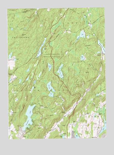
Oscawana Lake, NY USGS Topographic Map
Click on map above to begin viewing in our Map Viewer.

This topographic map contains these locations and features:
Feature Name Type Latitude Longitude GNIS ID View Map
Austin Road Elementary SchoolSchoolN41.3922°W73.7739°2072217View Map
Bailey CemeteryCemeteryN41.4452°W73.7563°2420629View Map
Bailey HillSummitN41.4686°W73.7656°2628348View Map
Barrett CemeteryCemeteryN41.4178°W73.7565°950657View Map
Barrett HillSummitN41.4067°W73.7758°2726328View Map
Black Ash SwampSwampN41.4572°W73.7911°2628350View Map
Black Pond BrookStreamN41.4726°W73.7621°969891View Map
Bryant HillSummitN41.3868°W73.8021°944992View Map
Bryant PondLakeN41.3767°W73.8047°944995View Map
Bullet HolePopulated PlaceN41.3904°W73.7893°945140View Map
Bushy RidgeRidgeN41.4440°W73.8299°945333View Map
California HillSummitN41.4373°W73.7762°945461View Map
Camp WiccopeeLocaleN41.4795°W73.8543°945684View Map
Candlewood HillSummitN41.4159°W73.8493°945762View Map
Canopus LakeLakeN41.4615°W73.8332°945794View Map
Christian CornersLocaleN41.4048°W73.8340°946628View Map
Clarence Fahnestock Memorial State ParkParkN41.4515°W73.8196°973634View Map
Clear LakeLakeN41.4295°W73.8409°946815View Map
Cold Spring InstituteSchoolN41.4329°W73.8671°947077View Map
Cranberry SwampSwampN41.4406°W73.7858°2628351View Map
DennytownPopulated PlaceN41.4265°W73.8682°972377View Map
Dick HillSummitN41.4617°W73.7814°2628349View Map
Dicktown (historical)Populated PlaceN41.4758°W73.7750°2628347View Map
Fahnestock CornersLocaleN41.4365°W73.8699°949798View Map
Fahnestock Ski SlopeLocaleN41.4754°W73.8179°974380View Map
Foshay CornersLocaleN41.4797°W73.7778°2072237View Map
German FlatsFlatN41.4047°W73.7561°2726330View Map
Gilbert CornersPopulated PlaceN41.3990°W73.8696°951090View Map
Granite MountainSummitN41.3787°W73.8376°951502View Map
Hill CemeteryCemeteryN41.3847°W73.7608°952826View Map
HortontownPopulated PlaceN41.4987°W73.7951°953260View Map
Houseman CornersLocaleN41.3976°W73.7754°953299View Map
John PondLakeN41.4921°W73.7770°954082View Map
Jordan PondLakeN41.4512°W73.8655°954198View Map
Kent CliffsPopulated PlaceN41.4551°W73.7540°954533View Map
Kent Volunteer Fire DepartmentBuildingN41.4725°W73.7598°2735157View Map
Kiah HillSummitN41.4143°W73.8307°954581View Map
Kirk LakeLakeN41.3862°W73.7521°954707View Map
Lake OssiLakeN41.4162°W73.7607°959517View Map
Lake TibetLakeN41.4524°W73.7794°967504View Map
Mahopac Airport (historical)AirportN41.3820°W73.7643°978128View Map
Mahopac Falls Volunteer Fire Department Station 2BuildingN41.3975°W73.7749°2735158View Map
Mahopac MinesPopulated PlaceN41.3981°W73.7590°974234View Map
Meads CornersPopulated PlaceN41.4837°W73.7685°956892View Map
Moose HillSummitN41.4259°W73.7843°957618View Map
Mud LakeLakeN41.4238°W73.8431°958016View Map
Nokomis CampLocaleN41.3779°W73.8024°958642View Map
Oscawana CornersPopulated PlaceN41.3784°W73.8560°959507View Map
Oscawana LakeLakeN41.3961°W73.8488°959509View Map
Pelton PondLakeN41.4607°W73.8289°960124View Map
Prospect HillSummitN41.3965°W73.8221°961163View Map
Prospect HillSummitN41.4133°W73.7539°2726329View Map
Putnam Golf and Tennis ClubLocaleN41.3881°W73.7635°974828View Map
Putnam Valley Fire Department Station 2BuildingN41.3980°W73.8026°2716111View Map
Red Mills Shopping CenterLocaleN41.3753°W73.7625°2074536View Map
RichardsvillePopulated PlaceN41.4637°W73.7751°962464View Map
Roaring BrookStreamN41.4143°W73.7801°962623View Map
Roaring Brook LakeReservoirN41.4389°W73.8075°962639View Map
Sagamore LakeReservoirN41.4732°W73.7808°963224View Map
Sand Spring BrookStreamN41.4340°W73.8746°970579View Map
Schoolhouse Number 2 (historical)SchoolN41.4389°W73.7589°2628353View Map
Secor LakeLakeN41.3766°W73.7872°964789View Map
Sheep MountainSummitN41.4803°W73.7636°2628346View Map
Sheep MountainSummitN41.4506°W73.7622°2628352View Map
Split Rock CascadeStreamN41.4713°W73.7863°2761960View Map
Spruce HillSummitN41.3845°W73.8368°966121View Map
Stillwater PondLakeN41.4440°W73.8213°966443View Map
SunnybrookPopulated PlaceN41.3851°W73.8604°966807View Map
Tinker HillSummitN41.3940°W73.8293°967544View Map
Tompkins CornersPopulated PlaceN41.3990°W73.8021°967637View Map
Tompkins Corners CemeteryCemeteryN41.4117°W73.7830°967639View Map
Tompkins Corners Methodist ChurchChurchN41.4000°W73.8011°2597929View Map
Town of Putnam ValleyCivilN41.3979°W73.8368°979403View Map
Trout CreekStreamN41.4968°W73.8371°967873View Map
Union and Halstead CemeteryCemeteryN41.4800°W73.7690°968145View Map
West Branch Canopus CreekStreamN41.3856°W73.8729°969109View Map
Wiccopee BrookStreamN41.3981°W73.7996°971207View Map
Wiccopee PassGapN41.4745°W73.8560°971209View Map
Wiccopee ReservoirReservoirN41.4173°W73.8198°971210View Map

Note: Coordinates in the location and feature list above are referenced to NAD83 datum.


Copyright (C) 2008-2024 Ryan Niemi / Sunset Dynamics ... All Rights Reserved