TopoQuest Logo
Do you find TopoQuest useful?
Help keep TopoQuest running and adding new maps/features by donating!
Bitcoin:  19c7KJd3qBynnjoSw5npx9KScwjBe4ifkT
Litecoin:  LXs6TkuXGGXo1vDsWCkWVdjQX94eUKd6ui
Home View Maps Find Maps Find Places Resources & Links


Osakis, Minnesota Topographic Map

USGS Map Title: Osakis, MN
USGS Map MRC: 45095G2
DRG (GeoTIFF) Download: o45095g2.tif


Neighboring USGS Topographic Map Quads:


  Alexandria East, MN  
45095H3
 

  Lake Osakis West, MN  
45095H2
 

  Lake Osakis East, MN  
45095H1
 

  Forada, MN  
45095G3
 

  Osakis, MN  
45095G2
 

  West Union, MN  
45095G1
 

  Villard, MN  
45095F3
 

  Westport, MN  
45095F2
 

  Raymond Lake, MN  
45095F1


Map MRC Location:

N46°
W96°
N46°
W95°
H8 H7 H6 H5 H4 H3 H2 H1
G8 G7 G6 G5 G4 G3 G2 G1
F8 F7 F6 F5 F4 F3 F2 F1
E8 E7 E6 E5 E4 E3 E2 E1
D8 D7 D6 D5 D4 D3 D2 D1
C8 C7 C6 C5 C4 C3 C2 C1
B8 B7 B6 B5 B4 B3 B2 B1
A8 A7 A6 A5 A4 A3 A2 A1
N45°
W96°
N45°
W95°

Osakis, MN USGS 1:24K Topographic Map Preview:
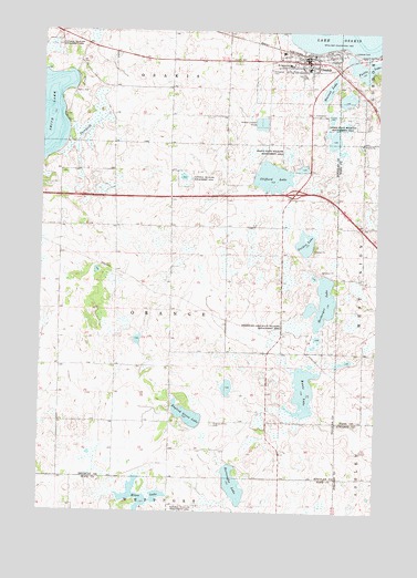
Osakis, MN USGS Topographic Map
Click on map above to begin viewing in our Map Viewer.

This topographic map contains these locations and features:
Feature Name Type Latitude Longitude GNIS ID View Map
Burroughs LakeLakeN45.7571°W95.1776°640681View Map
Calvary CemeteryCemeteryN45.8677°W95.1811°640775View Map
City of OsakisCivilN45.8649°W95.1516°2396090View Map
Clifford LakeLakeN45.8372°W95.1647°641335View Map
Community Memorial HomeHospitalN45.8694°W95.1611°2069751View Map
Ellen LakeLakeN45.7541°W95.2122°643275View Map
English Grove CemeteryCemeteryN45.7730°W95.1853°643383View Map
English Grove LakeLakeN45.7745°W95.1940°643384View Map
Evergreen CemeteryCemeteryN45.8647°W95.1659°643459View Map
Faille LakeLakeN45.8652°W95.1316°643491View Map
Gulden LakeLakeN45.8200°W95.1520°644524View Map
Herberger LakeLakeN45.8048°W95.1448°644898View Map
Herberger Lake State Wildlife Management AreParkN45.7980°W95.1531°644899View Map
Immaculate Conception ChurchChurchN45.8664°W95.1581°2069732View Map
Interchange 114CrossingN45.8333°W95.1556°2069845View Map
Kuntz LakeLakeN45.7817°W95.1517°646276View Map
Lakes Area Charter SchoolSchoolN45.8667°W95.1661°2069721View Map
Lakeside CemeteryCemeteryN45.8691°W95.1347°646419View Map
Osagi ParkParkN45.8700°W95.1431°2069722View Map
OsakisPopulated PlaceN45.8669°W95.1523°649011View Map
Osakis (historical)LocaleN45.8683°W95.1508°2069724View Map
Osakis Athletic FieldsParkN45.8625°W95.1569°2069723View Map
Osakis City HallBuildingN45.8675°W95.1517°2069726View Map
Osakis Fire DepartmentBuildingN45.8673°W95.1531°2666223View Map
Osakis Lutheran ChurchChurchN45.8664°W95.1506°2069730View Map
Osakis Medical ClinicHospitalN45.8636°W95.1444°2069752View Map
Osakis Police DepartmentBuildingN45.8669°W95.1517°2069727View Map
Osakis Post OfficePost OfficeN45.8683°W95.1550°2069725View Map
Osakis Public SchoolSchoolN45.8653°W95.1514°2069789View Map
Osakis State Wildlife Management AreaParkN45.8514°W95.1395°649012View Map
Osakis Visitor Heritage CenterBuildingN45.8650°W95.1394°2068812View Map
Osakis Wayside ParkParkN45.8669°W95.1519°2069756View Map
Presbyterian ChurchChurchN45.8658°W95.1539°2069728View Map
Redeemer Lutheran ChurchChurchN45.8650°W95.1581°2069731View Map
Saint Agnes SchoolSchoolN45.8664°W95.1592°650482View Map
Smith LakeLakeN45.8522°W95.2486°652178View Map
Smith Lake Resort and CampgroundLocaleN45.8653°W95.2389°2069755View Map
Stage Station Historical MarkerParkN45.8669°W95.1519°2069757View Map
Stage Station Historical MarkerParkN45.8669°W95.1519°2069758View Map
Stevens LakeLakeN45.8598°W95.1441°652628View Map
Todd County Waterfowl Production AreaParkN45.8027°W95.1304°2765530View Map
Township of OrangeCivilN45.8024°W95.2016°665212View Map
United Methodist ChurchChurchN45.8675°W95.1500°2069729View Map

Note: Coordinates in the location and feature list above are referenced to NAD83 datum.


Copyright (C) 2008-2024 Ryan Niemi / Sunset Dynamics ... All Rights Reserved