TopoQuest Logo
Do you find TopoQuest useful?
Help keep TopoQuest running and adding new maps/features by donating!
Bitcoin:  19c7KJd3qBynnjoSw5npx9KScwjBe4ifkT
Litecoin:  LXs6TkuXGGXo1vDsWCkWVdjQX94eUKd6ui
Home View Maps Find Maps Find Places Resources & Links


Onalaska, Washington Topographic Map

USGS Map Title: Onalaska, WA
USGS Map MRC: 46122E6
DRG (GeoTIFF) Download: o46122e6.tif


Neighboring USGS Topographic Map Quads:


  Logan Hill, WA  
46122F7
 

  Onalaska NW, WA  
46122F6
 

  Bernier Creek, WA  
46122F5
 

  Jackson Prairie, WA  
46122E7
 

  Onalaska, WA  
46122E6
 

  Mayfield Lake, WA  
46122E5
 

  Toledo, WA  
46122D7
 

  Eden Valley, WA  
46122D6
 

  Hatchet Mountain, WA  
46122D5


Map MRC Location:

N47°
W123°
N47°
W122°
H8 H7 H6 H5 H4 H3 H2 H1
G8 G7 G6 G5 G4 G3 G2 G1
F8 F7 F6 F5 F4 F3 F2 F1
E8 E7 E6 E5 E4 E3 E2 E1
D8 D7 D6 D5 D4 D3 D2 D1
C8 C7 C6 C5 C4 C3 C2 C1
B8 B7 B6 B5 B4 B3 B2 B1
A8 A7 A6 A5 A4 A3 A2 A1
N46°
W123°
N46°
W122°

Onalaska, WA USGS 1:24K Topographic Map Preview:
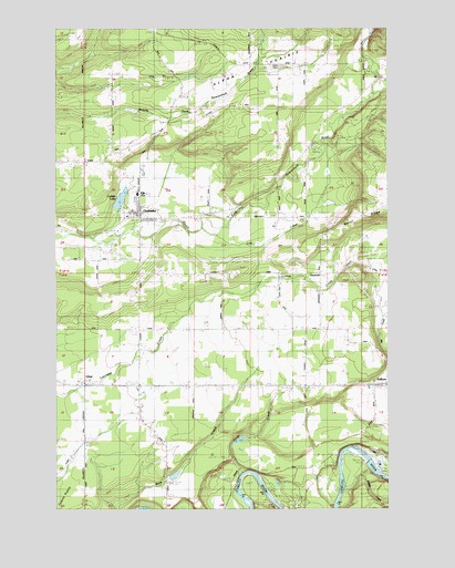
Onalaska, WA USGS Topographic Map
Click on map above to begin viewing in our Map Viewer.

This topographic map contains these locations and features:
Feature Name Type Latitude Longitude GNIS ID View Map
Alpha CemeteryCemeteryN46.6166°W122.6669°1515824View Map
Alpha PrairieFlatN46.6140°W122.7023°1515825View Map
Alpine DairyLocaleN46.5222°W122.7422°2704359View Map
Brights CreekStreamN46.5062°W122.6429°1516958View Map
Burnt RidgeRidgeN46.5826°W122.6259°1528678View Map
Burnt Ridge AirstripAirportN46.5854°W122.6262°1533869View Map
Carlisle LakeReservoirN46.5799°W122.7271°1532219View Map
Carlisle Lake DamDamN46.5782°W122.7279°1532218View Map
EthelPopulated PlaceN46.5321°W122.7404°1519385View Map
Ethel DivisionCivilN46.5224°W122.7366°1939506View Map
Ethel International Airport (historical)AirportN46.5308°W122.6869°1533761View Map
Ethel Post OfficePost OfficeN46.5326°W122.7407°2781655View Map
Frase CreekStreamN46.6229°W122.6321°1519771View Map
Jones CreekStreamN46.5090°W122.6821°1521457View Map
Kearney CreekStreamN46.6071°W122.6326°1521583View Map
LacamasPopulated PlaceN46.5609°W122.6518°1521808View Map
Lacamas DairyLocaleN46.5583°W122.6508°2703541View Map
Lewis County Fire District 1 Station 1 - 1BuildingN46.5775°W122.7192°2619441View Map
Lewis County Fire District 1 Station 1 - 2BuildingN46.5931°W122.7298°2619817View Map
Lewis County Fire District 8 Salkum Volunteer Fire DepartmentBuildingN46.5312°W122.6285°2619336View Map
Lewis County Fire District 8 Station 3BuildingN46.5314°W122.7196°2619343View Map
Lost CreekStreamN46.5726°W122.6959°1522461View Map
Mill CreekStreamN46.5165°W122.6373°1523161View Map
Misty Morning DairyLocaleN46.5553°W122.6544°2704361View Map
Nelsons Nitch AirportAirportN46.5425°W122.7174°1533868View Map
OnalaskaPopulated PlaceN46.5751°W122.7182°1524053View Map
Onalaska Census Designated PlaceCensusN46.5783°W122.7110°2586742View Map
Onalaska Elementary SchoolSchoolN46.5814°W122.7186°1530684View Map
Onalaska High SchoolSchoolN46.5818°W122.7206°1530683View Map
Onalaska Post OfficePost OfficeN46.5760°W122.7243°2781577View Map
PhillipsPopulated PlaceN46.5721°W122.7421°1530213View Map
Powell DamDamN46.5082°W122.7096°1532075View Map
SalkumPopulated PlaceN46.5321°W122.6259°1525380View Map
Salkum Post OfficePost OfficeN46.5325°W122.6251°2781673View Map

Note: Coordinates in the location and feature list above are referenced to NAD83 datum.


Copyright (C) 2008-2024 Ryan Niemi / Sunset Dynamics ... All Rights Reserved