TopoQuest Logo
Do you find TopoQuest useful?
Help keep TopoQuest running and adding new maps/features by donating!
Bitcoin:  19c7KJd3qBynnjoSw5npx9KScwjBe4ifkT
Litecoin:  LXs6TkuXGGXo1vDsWCkWVdjQX94eUKd6ui
Home View Maps Find Maps Find Places Resources & Links


North Berwick, Maine Topographic Map

USGS Map Title: North Berwick, ME
USGS Map MRC: 43070C6
DRG (GeoTIFF) Download: o43070c6.tif


Neighboring USGS Topographic Map Quads:


  Sanford, ME  
43070D7
 

  Alfred, ME  
43070D6
 

  Kennebunk, ME  
43070D5
 

  Somersworth, NH  
43070C7
 

  North Berwick, ME  
43070C6
 

  Wells, ME  
43070C5
 

  Dover East, NH  
43070B7
 

  York Harbor, ME  
43070B6
 

  York Beach, ME  
43070B5


Map MRC Location:

N44°
W71°
N44°
W70°
H8 H7 H6 H5 H4 H3 H2 H1
G8 G7 G6 G5 G4 G3 G2 G1
F8 F7 F6 F5 F4 F3 F2 F1
E8 E7 E6 E5 E4 E3 E2 E1
D8 D7 D6 D5 D4 D3 D2 D1
C8 C7 C6 C5 C4 C3 C2 C1
B8 B7 B6 B5 B4 B3 B2 B1
A8 A7 A6 A5 A4 A3 A2 A1
N43°
W71°
N43°
W70°

North Berwick, ME USGS 1:24K Topographic Map Preview:
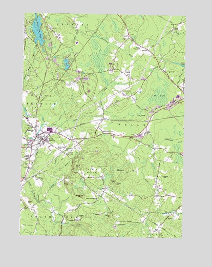
North Berwick, ME USGS Topographic Map
Click on map above to begin viewing in our Map Viewer.

This topographic map contains these locations and features:
Feature Name Type Latitude Longitude GNIS ID View Map
Allen HillSummitN43.3656°W70.7281°561184View Map
Amys PondReservoirN43.3043°W70.7415°1910737View Map
Bald HillSummitN43.3473°W70.6803°561503View Map
Bald Hill CrossingPopulated PlaceN43.3426°W70.6728°561508View Map
Bald Hill GraveyardCemeteryN43.3443°W70.6805°2737082View Map
Baston LotCemeteryN43.2825°W70.6871°2737085View Map
Bauneg Beg PondReservoirN43.3649°W70.7388°561734View Map
Bauneg Beg Pond DamDamN43.3565°W70.7397°1774233View Map
Bears Den Recreational Vehicle ParkLocaleN43.3037°W70.6520°1910759View Map
Berwick Branch SchoolSchoolN43.2687°W70.6995°1910763View Map
Bethel Gospel MissionChurchN43.2993°W70.7220°562102View Map
Blueberry Ridge Trailer ParkPopulated PlaceN43.3523°W70.7089°1910780View Map
Boston LotCemeteryN43.2549°W70.6417°2737098View Map
Boyd BrookStreamN43.2629°W70.7248°562818View Map
Boyd CornerPopulated PlaceN43.2965°W70.7137°579150View Map
Bragdpm BrookStreamN43.3348°W70.6842°1910783View Map
Brown HillSummitN43.2798°W70.7135°563049View Map
Chicks BrookStreamN43.2573°W70.7217°563938View Map
Clay CemeteryCemeteryN43.2733°W70.6318°1912307View Map
Cole Gould CemeteryCemeteryN43.3692°W70.7330°2737144View Map
D A Hurd LibraryBuildingN43.3084°W70.7394°1910833View Map
Dennett BrookStreamN43.2873°W70.7234°565033View Map
Douthy Falls DamDamN43.3064°W70.7375°1774229View Map
Ed Hanscom PondLakeN43.3504°W70.6901°1910850View Map
Elm Brook CemeteryCemeteryN43.3617°W70.6680°2736430View Map
First Congregational ChurchChurchN43.3065°W70.7384°1910873View Map
Grays CornerPopulated PlaceN43.3087°W70.6542°579357View Map
Great HillSummitN43.2684°W70.7448°567153View Map
Great Works River ReservoirReservoirN43.3097°W70.7354°1774230View Map
Great Works River ReservoirReservoirN43.3194°W70.7472°1774232View Map
Green BrookStreamN43.2640°W70.6409°567201View Map
Hanscom HillSummitN43.2601°W70.7023°567574View Map
High Pine Baptist ChurchChurchN43.3570°W70.6573°1910928View Map
HighpinePopulated PlaceN43.3559°W70.6539°568043View Map
Hillside CemeteryCemeteryN43.3198°W70.7398°568067View Map
Hobbs CrossingPopulated PlaceN43.3676°W70.6342°579412View Map
Hubbard HillSummitN43.2834°W70.6378°568422View Map
Hussey BrookStreamN43.2690°W70.7370°568517View Map
Hussey Plow Company DamDamN43.3036°W70.7388°1774227View Map
Jackson CemeteryCemeteryN43.3054°W70.6648°568735View Map
Johns SwampSwampN43.3179°W70.6589°568907View Map
Kenyon HillSummitN43.2615°W70.6812°569127View Map
Little PondLakeN43.3466°W70.7162°569967View Map
Littlefield CemeteryCemeteryN43.3073°W70.6781°570114View Map
Littlefield LotCemeteryN43.2733°W70.6315°2736516View Map
Merriland RidgeRidgeN43.3243°W70.6378°571148View Map
Merriland Ridge Church (historical)ChurchN43.3079°W70.6567°1911023View Map
Mount Pleasant CemeteryCemeteryN43.3116°W70.7413°571774View Map
Neoutaque River ReservoirReservoirN43.3034°W70.7395°1774228View Map
Neoutaquet RiverStreamN43.3023°W70.7373°572094View Map
North BerwickPopulated PlaceN43.3037°W70.7334°572254View Map
North Berwick Census Designated PlaceCensusN43.3020°W70.7324°2377942View Map
North Berwick Elementary SchoolSchoolN43.3064°W70.7412°2738019View Map
North Berwick Fire DepartmentBuildingN43.3048°W70.7356°2552791View Map
North Berwick Fire StationBuildingN43.3643°W70.7491°2553195View Map
North Berwick Police DepartmentBuildingN43.3056°W70.7343°2735940View Map
North Berwick Post OfficePost OfficeN43.3065°W70.7352°2789358View Map
Orris FallsFallsN43.2753°W70.7108°2559629View Map
Orris Falls Conservation AreaParkN43.2758°W70.7089°2559631View Map
Parsonage CornerPopulated PlaceN43.3081°W70.6862°579602View Map
Perkins BrookStreamN43.3120°W70.7231°573200View Map
Perkins TownPopulated PlaceN43.3384°W70.7045°579615View Map
Pratt and Whitney Protective Ambulance ServicesBuildingN43.3083°W70.7284°2666833View Map
Prescott HillSummitN43.3116°W70.7383°573782View Map
Quaker CemeteryCemeteryN43.2895°W70.7448°573916View Map
Sanford Country ClubLocaleN43.3726°W70.7339°581599View Map
Sanford Health CampLocaleN43.3562°W70.6603°574903View Map
Saywards CornerPopulated PlaceN43.3623°W70.6687°574978View Map
Smith BrookStreamN43.3162°W70.7328°1911179View Map
South Berwick-Wells ChurchChurchN43.2704°W70.6903°575757View Map
Spring HillSummitN43.2729°W70.7032°576104View Map
Staples DamDamN43.3172°W70.7445°1774231View Map
TatnicPopulated PlaceN43.2770°W70.6839°576668View Map
Tatnic HillSummitN43.2812°W70.6781°576669View Map
Tatnic HillsSummitN43.2870°W70.6951°576670View Map
The HeathSwampN43.3295°W70.6451°576815View Map
The SaddlebackSummitN43.2875°W70.6767°576914View Map
The SandsFlatN43.2562°W70.7448°576918View Map
Town WoodsWoodsN43.3429°W70.6351°577237View Map
Town Woods BrookStreamN43.3459°W70.6253°577238View Map
Varney CrossingPopulated PlaceN43.2937°W70.7434°577694View Map
Welch HillSummitN43.2891°W70.7081°577983View Map
Wells Fire Station High PineBuildingN43.3607°W70.6660°2553105View Map
Wells School (historical)SchoolN43.3612°W70.6689°1911255View Map
Wells School Number NineSchoolN43.3065°W70.6901°1911256View Map
Wells School Number Seven (historical)SchoolN43.3009°W70.6439°1911257View Map
Wells School Number Six (historical)SchoolN43.2743°W70.6367°1911258View Map
Wells School Number Ten (historical)SchoolN43.3298°W70.6251°1911259View Map
Wells School Number Twelve (historical)SchoolN43.3398°W70.6653°1911260View Map
West BrookStreamN43.3123°W70.7337°578105View Map
Winn LotCemeteryN43.2536°W70.6431°2736595View Map
Winn LotCemeteryN43.2549°W70.6473°2736597View Map
Winn LotCemeteryN43.2521°W70.6549°2736598View Map
Winn Parsons LotCemeteryN43.2573°W70.6542°2736599View Map
Zebelon Knight HallBuildingN43.2715°W70.6909°1911308View Map

Note: Coordinates in the location and feature list above are referenced to NAD83 datum.


Copyright (C) 2008-2024 Ryan Niemi / Sunset Dynamics ... All Rights Reserved