TopoQuest Logo
Do you find TopoQuest useful?
Help keep TopoQuest running and adding new maps/features by donating!
Bitcoin:  19c7KJd3qBynnjoSw5npx9KScwjBe4ifkT
Litecoin:  LXs6TkuXGGXo1vDsWCkWVdjQX94eUKd6ui
Home View Maps Find Maps Find Places Resources & Links


Nolensville, Tennessee Topographic Map

USGS Map Title: Nolensville, TN
USGS Map MRC: 35086H6
DRG (GeoTIFF) Download: o35086h6.tif


Neighboring USGS Topographic Map Quads:


  Oak Hill, TN  
36086A7
 

  Antioch, TN  
36086A6
 

  La Vergne, TN  
36086A5
 

  Franklin, TN  
35086H7
 

  Nolensville, TN  
35086H6
 

  Smyrna, TN  
35086H5
 

  Bethesda, TN  
35086G7
 

  College Grove, TN  
35086G6
 

  Rockvale, TN  
35086G5


Map MRC Location:

N36°
W87°
N36°
W86°
H8 H7 H6 H5 H4 H3 H2 H1
G8 G7 G6 G5 G4 G3 G2 G1
F8 F7 F6 F5 F4 F3 F2 F1
E8 E7 E6 E5 E4 E3 E2 E1
D8 D7 D6 D5 D4 D3 D2 D1
C8 C7 C6 C5 C4 C3 C2 C1
B8 B7 B6 B5 B4 B3 B2 B1
A8 A7 A6 A5 A4 A3 A2 A1
N35°
W87°
N35°
W86°

Nolensville, TN USGS 1:24K Topographic Map Preview:
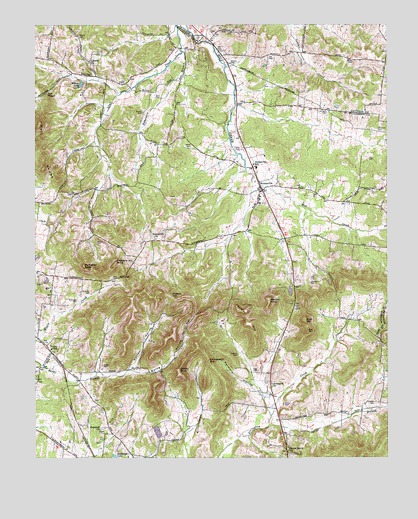
Nolensville, TN USGS Topographic Map
Click on map above to begin viewing in our Map Viewer.

This topographic map contains these locations and features:
Feature Name Type Latitude Longitude GNIS ID View Map
Arrington ChurchChurchN35.8962°W86.6658°1275906View Map
Ashbaugh LakeLakeN35.8756°W86.7218°1275935View Map
Battle CemeteryCemeteryN35.9898°W86.6369°1276478View Map
Brentwood Fire Department Station 4BuildingN35.9787°W86.7237°2654012View Map
Burke HollowValleyN35.9002°W86.7153°1279051View Map
Butt CemeteryCemeteryN35.9789°W86.7071°1279195View Map
Canaan FarmsLocaleN35.8783°W86.7386°2663278View Map
Chinquapin HillSummitN35.9031°W86.6883°1280488View Map
Chrisman CemeteryCemeteryN35.9701°W86.6283°1280516View Map
Coleman CemeteryCemeteryN35.8911°W86.6298°1280943View Map
Commissioner District 5CivilN35.8865°W86.6814°2464506View Map
Concord ChurchChurchN35.9956°W86.6925°1281068View Map
Concord ForestPopulated PlaceN35.9906°W86.6903°1312474View Map
Daddy KnobSummitN35.9006°W86.6992°1281958View Map
Edmondson BranchStreamN35.9923°W86.6981°1283534View Map
Fly CemeteryCemeteryN35.9614°W86.6314°1284534View Map
Gray CemeteryCemeteryN35.9923°W86.6253°1646360View Map
Green Grove ChurchChurchN35.8765°W86.6594°1286091View Map
Hailey - Rash CemeteryCemeteryN35.9748°W86.7119°1278474View Map
Hamor CemeteryCemeteryN35.9964°W86.7340°1286691View Map
Hickory HillsPopulated PlaceN35.8801°W86.7364°1312505View Map
Hill CemeteryCemeteryN35.9906°W86.6672°1287787View Map
Holt ChapelChurchN35.9803°W86.7456°1288163View Map
Holt KnobsRidgeN35.9665°W86.7478°1288169View Map
Holt MineMineN35.9478°W86.7069°1321948View Map
Hooker HillsPopulated PlaceN35.9312°W86.7497°1312940View Map
Hopewell ChurchChurchN35.8831°W86.7269°1288314View Map
Jenkins HillSummitN35.9178°W86.6778°1289359View Map
Johnson CemeteryCemeteryN35.9256°W86.6525°1289557View Map
Lake Colonial EstatesReservoirN35.8827°W86.7066°1302190View Map
Lake Colonial EstatesPopulated PlaceN35.8831°W86.7033°1312521View Map
Lake Colonial Estates DamDamN35.8817°W86.7067°1302191View Map
Liberty ChurchChurchN35.9898°W86.7308°1291135View Map
Matthews CemeteryCemeteryN35.9223°W86.6305°1321970View Map
McCanless CemeteryCemeteryN35.8981°W86.6264°1321973View Map
McCanless CemeteryCemeteryN35.8882°W86.6405°1321974View Map
McFarlin CemeteryCemeteryN35.9748°W86.6461°1293291View Map
McKnight CemeteryCemeteryN35.9203°W86.7350°1293393View Map
McMahan KnobSummitN35.9306°W86.7325°1293415View Map
Molly HollowValleyN35.9001°W86.7282°1312536View Map
Morton CemeteryCemeteryN35.9889°W86.6811°1294469View Map
Morton KnobSummitN35.9206°W86.6669°1294473View Map
NolensvillePopulated PlaceN35.9523°W86.6694°1295807View Map
Nolensville CemeteryCemeteryN35.9495°W86.6703°1321984View Map
Nolensville ChurchChurchN35.9392°W86.7078°1295808View Map
Nolensville Division (historical)CensusN35.9170°W86.6778°1649026View Map
Nolensville Elementary SchoolSchoolN35.9598°W86.6728°1648447View Map
Nolensville Police DepartmentBuildingN35.9626°W86.6738°2766020View Map
Nolensville Post OfficePost OfficeN35.9623°W86.6718°1651827View Map
Nolensville Volunteer Fire DepartmentBuildingN35.9484°W86.6679°2653891View Map
Owl CreekPopulated PlaceN35.9978°W86.7028°1312545View Map
Ozburn CemeteryCemeteryN35.9048°W86.6780°1296626View Map
Page CemeteryCemeteryN35.9001°W86.6708°1296647View Map
Paige BranchStreamN35.8842°W86.6672°1296652View Map
Palmore HollowValleyN35.8944°W86.6709°1296705View Map
Pleasant Hill KnobSummitN35.9306°W86.7222°1297891View Map
Pleasant Hill Plantation (historical)LocaleN35.9787°W86.7486°1321992View Map
Polk HillSummitN35.9145°W86.6542°1298059View Map
Potato HillSummitN35.9223°W86.7014°1298331View Map
Redmon QuarryMineN35.9426°W86.6656°1321996View Map
Shannon CemeteryCemeteryN35.9228°W86.7303°1301228View Map
Smith CemeteryCemeteryN35.9652°W86.6944°1270618View Map
StonebrookPopulated PlaceN35.9631°W86.6714°1312565View Map
Street CemeteryCemeteryN35.9017°W86.7258°1271583View Map
Sunset AcresPopulated PlaceN35.9676°W86.6969°1312567View Map
Town of NolensvilleCivilN35.9570°W86.6762°2406995View Map
Trinity Elementary SchoolSchoolN35.9065°W86.7442°1648184View Map
Vernon CemeteryCemeteryN35.9373°W86.7280°1273428View Map
Warren HollowValleyN35.9005°W86.7165°1273839View Map
Willow LakeReservoirN35.9828°W86.7336°1274765View Map

Note: Coordinates in the location and feature list above are referenced to NAD83 datum.


Copyright (C) 2008-2024 Ryan Niemi / Sunset Dynamics ... All Rights Reserved