TopoQuest Logo
Do you find TopoQuest useful?
Help keep TopoQuest running and adding new maps/features by donating!
Bitcoin:  19c7KJd3qBynnjoSw5npx9KScwjBe4ifkT
Litecoin:  LXs6TkuXGGXo1vDsWCkWVdjQX94eUKd6ui
Home View Maps Find Maps Find Places Resources & Links


New Auburn, Wisconsin Topographic Map

USGS Map Title: New Auburn, WI
USGS Map MRC: 45091B5
DRG (GeoTIFF) Download: o45091b5.tif


Neighboring USGS Topographic Map Quads:


  Chetek, WI  
45091C6
 

  Moose Ear Lake, WI  
45091C5
 

  Chain Lake, WI  
45091C4
 

  Sand Creek, WI  
45091B6
 

  New Auburn, WI  
45091B5
 

  Marsh-Miller Lake, WI  
45091B4
 

  Colfax North, WI  
45091A6
 

  Como Creek, WI  
45091A5
 

  Bloomer, WI  
45091A4


Map MRC Location:

N46°
W92°
N46°
W91°
H8 H7 H6 H5 H4 H3 H2 H1
G8 G7 G6 G5 G4 G3 G2 G1
F8 F7 F6 F5 F4 F3 F2 F1
E8 E7 E6 E5 E4 E3 E2 E1
D8 D7 D6 D5 D4 D3 D2 D1
C8 C7 C6 C5 C4 C3 C2 C1
B8 B7 B6 B5 B4 B3 B2 B1
A8 A7 A6 A5 A4 A3 A2 A1
N45°
W92°
N45°
W91°

New Auburn, WI USGS 1:24K Topographic Map Preview:
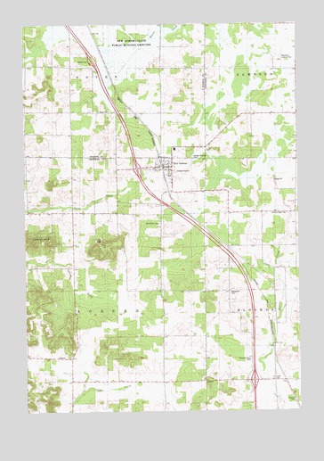
New Auburn, WI USGS Topographic Map
Click on map above to begin viewing in our Map Viewer.

This topographic map contains these locations and features:
Feature Name Type Latitude Longitude GNIS ID View Map
Auburn TownhallBuildingN45.1425°W91.6077°1842783View Map
Auburn Valley School (historical)SchoolN45.1425°W91.6077°1578469View Map
Auburnville School (historical)SchoolN45.1491°W91.5624°1578470View Map
Bethel Lutheran ChurchChurchN45.2061°W91.5596°1842785View Map
Blaha FarmsLocaleN45.1647°W91.5697°2711414View Map
Carlson School (historical)SchoolN45.2214°W91.5724°1578457View Map
Duncan Creek CemeteryCemeteryN45.1894°W91.5065°1564177View Map
Duncan Creek FarmsLocaleN45.1550°W91.5128°2711382View Map
Duncan Creek School (historical)SchoolN45.1894°W91.5168°1578477View Map
Flying O Airport (historical)AirportN45.1797°W91.5182°1582107View Map
Lagesse Dairy FarmLocaleN45.1719°W91.5350°2711378View Map
Ling School (historical)SchoolN45.2211°W91.5213°1578489View Map
Marquardt CemeteryCemeteryN45.1633°W91.5318°1569062View Map
Moose FarmsLocaleN45.1864°W91.5872°2711413View Map
New AuburnPopulated PlaceN45.2041°W91.5582°1570199View Map
New Auburn CemeteryCemeteryN45.1858°W91.5632°1570200View Map
New Auburn Elementary SchoolSchoolN45.2096°W91.5561°2713281View Map
New Auburn Junior / Senior High SchoolSchoolN45.2096°W91.5561°1842888View Map
New Auburn Police DepartmentBuildingN45.2050°W91.5596°2759931View Map
New Auburn Post OfficePost OfficeN45.2050°W91.5608°2711386View Map
New Auburn Sedge Meadow State Natural AreaParkN45.2392°W91.5728°2085473View Map
New Auburn State Public Hunting GroundsParkN45.2422°W91.5757°1570201View Map
New Auburn Volunteer Fire DepartmentBuildingN45.2050°W91.5603°2696820View Map
New Auburn Wildlife Area G12 565 DamDamN45.2483°W91.5635°1793174View Map
Old Maids BluffCliffN45.1805°W91.6204°1570780View Map
Pleasant Valley CemeteryCemeteryN45.1419°W91.5227°1571648View Map
Pleasant Valley School (historical)SchoolN45.1461°W91.5218°1578498View Map
Pleasant Valley Turkey FarmLocaleN45.1617°W91.5286°2711384View Map
Saint Judes Catholic ChurchChurchN45.2044°W91.5629°1842900View Map
Sunny Meadow Amish SchoolSchoolN45.1902°W91.5152°2713249View Map
Town of AuburnCivilN45.1574°W91.6070°1582729View Map
Twin Lakes Amish SchoolSchoolN45.2429°W91.5002°2713383View Map
Vetterkind StripAirportN45.2399°W91.5098°1582106View Map
Village of New AuburnCivilN45.1988°W91.5665°1583798View Map
Weber FarmsLocaleN45.1547°W91.5261°2711376View Map
Wright Charolais FarmLocaleN45.2369°W91.5611°2711409View Map

Note: Coordinates in the location and feature list above are referenced to NAD83 datum.


Copyright (C) 2008-2024 Ryan Niemi / Sunset Dynamics ... All Rights Reserved