TopoQuest Logo
Do you find TopoQuest useful?
Help keep TopoQuest running and adding new maps/features by donating!
Bitcoin:  19c7KJd3qBynnjoSw5npx9KScwjBe4ifkT
Litecoin:  LXs6TkuXGGXo1vDsWCkWVdjQX94eUKd6ui
Home View Maps Find Maps Find Places Resources & Links


Nacimiento Peak, New Mexico Topographic Map

USGS Map Title: Nacimiento Peak, NM
USGS Map MRC: 36106A7
DRG (GeoTIFF) Download: o36106a7.tif


Neighboring USGS Topographic Map Quads:


  Regina, NM  
36106B8
 

  Gallina, NM  
36106B7
 

  Arroyo Del Agua, NM  
36106B6
 

  Cuba, NM  
36106A8
 

  Nacimiento Peak, NM  
36106A7
 

  Jarosa, NM  
36106A6
 

  San Pablo, NM  
35106H8
 

  Rancho del Chaparral, NM  
35106H7
 

  Seven Springs, NM  
35106H6


Map MRC Location:

N37°
W107°
N37°
W106°
H8 H7 H6 H5 H4 H3 H2 H1
G8 G7 G6 G5 G4 G3 G2 G1
F8 F7 F6 F5 F4 F3 F2 F1
E8 E7 E6 E5 E4 E3 E2 E1
D8 D7 D6 D5 D4 D3 D2 D1
C8 C7 C6 C5 C4 C3 C2 C1
B8 B7 B6 B5 B4 B3 B2 B1
A8 A7 A6 A5 A4 A3 A2 A1
N36°
W107°
N36°
W106°

Nacimiento Peak, NM USGS 1:24K Topographic Map Preview:
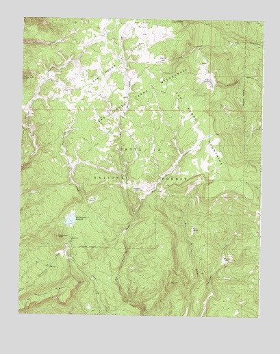
Nacimiento Peak, NM USGS Topographic Map
Click on map above to begin viewing in our Map Viewer.

This topographic map contains these locations and features:
Feature Name Type Latitude Longitude GNIS ID View Map
American ParkFlatN36.0231°W106.7673°903139View Map
Clear Creek Recreation SiteLocaleN36.0009°W106.8300°936789View Map
Clear Creek TrailTrailN36.0736°W106.8339°905205View Map
Coyote Ranger DistrictBuildingN36.0001°W106.8470°2658009View Map
Cuba DitchCanalN36.0467°W106.8309°905541View Map
Deer MountainSummitN36.0139°W106.7959°905698View Map
El CajeteAreaN36.0209°W106.8628°906034View Map
Eureka MesaSummitN36.0136°W106.8445°906206View Map
Highline TrailTrailN36.1022°W106.7923°906980View Map
Los Pinos TrailTrailN36.0850°W106.8248°908226View Map
Nacimiento CampgroundLocaleN36.0320°W106.8475°909006View Map
Nacimiento PeakSummitN36.0328°W106.8545°909009View Map
Oso CreekStreamN36.1159°W106.7673°909388View Map
Palomas TrailTrailN36.0500°W106.8034°909458View Map
Parque VenadoFlatN36.0370°W106.7853°909485View Map
Peņas Negras TrailTrailN36.0861°W106.7923°909543View Map
Perchas TrailTrailN36.0656°W106.7942°936788View Map
Puertecito de las PerchasGapN36.0531°W106.8167°909884View Map
Redonda TrailTrailN36.0917°W106.7734°910092View Map
Rito AnastacioStreamN36.0836°W106.8250°910286View Map
Rito de las PerchasStreamN36.0422°W106.8148°910267View Map
San Gregorio ReservoirReservoirN36.0399°W106.8487°910622View Map
San Gregorio Reservoir DamDamN36.0384°W106.8506°923961View Map
San Pedro CabinLocaleN36.1167°W106.8242°910701View Map
San Pedro MountainsRangeN36.1000°W106.8006°912565View Map
San Pedro ParksAreaN36.1061°W106.8259°910705View Map
San Pedro Parks WildernessReserveN36.1024°W106.8267°2038666View Map
San Pedro PeaksRangeN36.1228°W106.8136°920697View Map
Santa Fe National ForestForestN36.0783°W106.7849°918413View Map
Vallecito DamianBasinN36.0484°W106.8375°912049View Map
Vega del OsoAreaN36.1081°W106.8017°912081View Map
Vega RedondaSpringN36.0992°W106.7790°912084View Map

Note: Coordinates in the location and feature list above are referenced to NAD83 datum.


Copyright (C) 2008-2024 Ryan Niemi / Sunset Dynamics ... All Rights Reserved