TopoQuest Logo
Do you find TopoQuest useful?
Help keep TopoQuest running and adding new maps/features by donating!
Bitcoin:  19c7KJd3qBynnjoSw5npx9KScwjBe4ifkT
Litecoin:  LXs6TkuXGGXo1vDsWCkWVdjQX94eUKd6ui
Home View Maps Find Maps Find Places Resources & Links


Mount San Antonio, California Topographic Map

USGS Map Title: Mount San Antonio, CA
USGS Map MRC: 34117C6
DRG (GeoTIFF) Download: o34117c6.tif


Neighboring USGS Topographic Map Quads:


  Valyermo, CA  
34117D7
 

  Mescal Creek, CA  
34117D6
 

  Phelan, CA  
34117D5
 

  Crystal Lake, CA  
34117C7
 

  Mount San Antonio, CA  
34117C6
 

  Telegraph Peak, CA  
34117C5
 

  Glendora, CA  
34117B7
 

  Mount Baldy, CA  
34117B6
 

  Cucamonga Peak, CA  
34117B5


Map MRC Location:

N35°
W118°
N35°
W117°
H8 H7 H6 H5 H4 H3 H2 H1
G8 G7 G6 G5 G4 G3 G2 G1
F8 F7 F6 F5 F4 F3 F2 F1
E8 E7 E6 E5 E4 E3 E2 E1
D8 D7 D6 D5 D4 D3 D2 D1
C8 C7 C6 C5 C4 C3 C2 C1
B8 B7 B6 B5 B4 B3 B2 B1
A8 A7 A6 A5 A4 A3 A2 A1
N34°
W118°
N34°
W117°

Mount San Antonio, CA USGS 1:24K Topographic Map Preview:
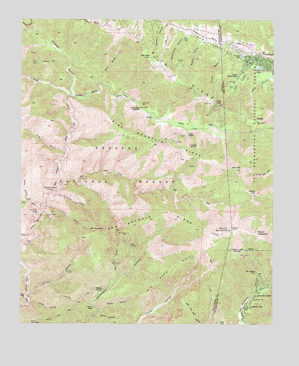
Mount San Antonio, CA USGS Topographic Map
Click on map above to begin viewing in our Map Viewer.

This topographic map contains these locations and features:
Feature Name Type Latitude Longitude GNIS ID View Map
Acorn CanyonValleyN34.3561°W117.6362°269427View Map
Airplane FlatFlatN34.2861°W117.7478°269451View Map
Alder GulchValleyN34.3200°W117.7292°269475View Map
Allison GulchValleyN34.2628°W117.7464°269495View Map
Allison MineMineN34.2714°W117.7276°269496View Map
Allison TrailTrailN34.2606°W117.7212°269497View Map
Baldora MineMineN34.2772°W117.7026°1669817View Map
Baldy TrailTrailN34.2733°W117.6548°269651View Map
Bear FlatFlatN34.2508°W117.6501°269737View Map
Bear GulchValleyN34.3481°W117.7101°269738View Map
Big Butch WashStreamN34.2614°W117.6370°269812View Map
Big Horn MineMineN34.3561°W117.7448°269828View Map
Big Horn RidgeRidgeN34.2719°W117.6770°269829View Map
Big Pine StationLocaleN34.3706°W117.6895°275741View Map
Blind CanyonValleyN34.2544°W117.7131°269913View Map
Blue RidgeRidgeN34.3544°W117.6803°269936View Map
Blue Ridge CampLocaleN34.3594°W117.6867°269937View Map
Blue RIdge Electronic SiteLocaleN34.3522°W117.6745°275171View Map
Blue Ridge Ski LiftLocaleN34.3692°W117.6928°1654560View Map
Cabin FlatFlatN34.3419°W117.6978°270121View Map
Cabin Flat CampgroundLocaleN34.3428°W117.7001°275172View Map
Camp LupineLocaleN34.3278°W117.6681°270201View Map
Camp Maria StellaLocaleN34.3522°W117.6434°270203View Map
Camp San AntonioLocaleN34.2622°W117.6337°270218View Map
Clark GulchValleyN34.2994°W117.7376°270487View Map
Columbine SpringSpringN34.3231°W117.6672°270571View Map
Dawson PeakSummitN34.3033°W117.6359°270769View Map
Dawson Peak TrailTrailN34.3058°W117.6503°1802868View Map
Dry GulchValleyN34.2658°W117.7067°270927View Map
Eagle MineMineN34.2819°W117.6959°270967View Map
East Table MountainSummitN34.3678°W117.6292°2570970View Map
Falls GulchValleyN34.3033°W117.7337°271102View Map
Fish ForkStreamN34.3058°W117.7317°271145View Map
Fish Fork CampLocaleN34.3056°W117.7334°271146View Map
Flume CanyonValleyN34.3650°W117.6509°271162View Map
Fossil CanyonValleyN34.2561°W117.7120°271184View Map
Glacier CampLocaleN34.2572°W117.6364°271303View Map
Glacier Picnic AreaLocaleN34.2564°W117.6362°276768View Map
Glacier Picnic GroundLocaleN34.2586°W117.6356°275047View Map
Gold Dollar MineMineN34.2869°W117.6984°271325View Map
Gold Ridge MineMineN34.2781°W117.6381°271335View Map
Government CanyonValleyN34.3683°W117.6653°271377View Map
Guffy CampLocaleN34.3414°W117.6545°271458View Map
Heaton Flat TrailTrailN34.2519°W117.7334°271533View Map
Holiday Hill Ski LiftLocaleN34.3647°W117.6792°1654665View Map
Inspiration PointSummitN34.3708°W117.7084°275176View Map
Iron ForkStreamN34.2956°W117.7412°271728View Map
Iron Fork CampLocaleN34.2961°W117.7423°271729View Map
Iron MountainSummitN34.2883°W117.7128°271730View Map
Junior Republic Camp (historical)LocaleN34.3617°W117.6509°1844338View Map
Laurel GulchValleyN34.2586°W117.7473°271995View Map
Manker CampgroundLocaleN34.2653°W117.6314°276769View Map
Manker CampgroundLocaleN34.2656°W117.6309°275173View Map
Manker FlatFlatN34.2650°W117.6295°272324View Map
Mine GulchValleyN34.3431°W117.7278°272484View Map
Mine Gulch CampLocaleN34.3439°W117.7264°272485View Map
Mount Baldy Post OfficePost OfficeN34.2635°W117.6335°2455875View Map
Mount HarwoodSummitN34.2864°W117.6331°271508View Map
Mount High East Ski AreaLocaleN34.3692°W117.6798°275170View Map
Mount High East Ski LiftLocaleN34.3642°W117.6798°277466View Map
Mount High West Ski AreaLocaleN34.3547°W117.7406°276766View Map
Mount High West Ski AreaLocaleN34.3717°W117.6920°275178View Map
Mount High West Ski LiftLocaleN34.3719°W117.6945°1655289View Map
Mount San AntonioSummitN34.2889°W117.6467°273439View Map
Mount View Organizational CampLocaleN34.3686°W117.6837°276771View Map
Mount View Organizational CampLocaleN34.3697°W117.6837°275169View Map
Native Son MineMineN34.3392°W117.6906°272625View Map
Pacific Crest ReservoirReservoirN34.3664°W117.6923°275177View Map
Pine MountainSummitN34.3136°W117.6445°272994View Map
Pine Mountain RidgeRidgeN34.3256°W117.6878°272999View Map
PL and P TrailTrailN34.3164°W117.7314°275048View Map
Prairie ForkStreamN34.3431°W117.7278°273116View Map
Prairie Fork Guard StationLocaleN34.3389°W117.6917°273117View Map
Prairie Fork Guard Station (historical)LocaleN34.3275°W117.6684°1669900View Map
Ross GulchValleyN34.3008°W117.7478°273359View Map
San Antonio FallsFallsN34.2719°W117.6345°273436View Map
San Antonio RidgeRidgeN34.2922°W117.6898°273437View Map
San Bernardino County Fire Department Station 14 WrightwoodBuildingN34.3591°W117.6289°2664521View Map
San Gabriel MountainsRangeN34.2889°W117.6467°254210View Map
Sawmill CanyonValleyN34.3731°W117.6789°273592View Map
Sheep Mountain WildernessReserveN34.3043°W117.7205°1802867View Map
Stanley-Miller MineMineN34.2947°W117.7376°273889View Map
Swan RockPillarN34.2611°W117.7489°273979View Map
The NarrowsValleyN34.2832°W117.7469°274090View Map
Twin LakesReservoirN34.3553°W117.6335°274246View Map
Vincent GulchValleyN34.3433°W117.7248°251061View Map
Weber CampLocaleN34.2569°W117.7148°274407View Map
Widco MineMineN34.2750°W117.7034°274490View Map
Widman RanchLocaleN34.2636°W117.7092°1802870View Map
Wright LakeReservoirN34.3601°W117.6419°274577View Map
Wright MountainSummitN34.3336°W117.6328°274579View Map
WrightwoodPopulated PlaceN34.3608°W117.6334°1652816View Map
Wrightwood Census Designated PlaceCensusN34.3495°W117.6299°2409630View Map
Wrightwood Elementary SchoolSchoolN34.3613°W117.6361°1841866View Map
Wrightwood Post OfficePost OfficeN34.3602°W117.6304°1841867View Map

Note: Coordinates in the location and feature list above are referenced to NAD83 datum.


Copyright (C) 2008-2024 Ryan Niemi / Sunset Dynamics ... All Rights Reserved