TopoQuest Logo
Do you find TopoQuest useful?
Help keep TopoQuest running and adding new maps/features by donating!
Bitcoin:  19c7KJd3qBynnjoSw5npx9KScwjBe4ifkT
Litecoin:  LXs6TkuXGGXo1vDsWCkWVdjQX94eUKd6ui
Home View Maps Find Maps Find Places Resources & Links


Mount Ellen, Vermont Topographic Map

USGS Map Title: Mount Ellen, VT
USGS Map MRC: 44072B8
DRG (GeoTIFF) Download: o44072b8.tif


Neighboring USGS Topographic Map Quads:


  Hinesburg, VT  
44073C1
 

  Huntington, VT  
44072C8
 

  Waterbury, VT  
44072C7
 

  Bristol, VT  
44073B1
 

  Mount Ellen, VT  
44072B8
 

  Waitsfield, VT  
44072B7
 

  South Mountain, VT  
44073A1
 

  Lincoln, VT  
44072A8
 

  Warren, VT  
44072A7


Map MRC Location:

N45°
W73°
N45°
W72°
H8 H7 H6 H5 H4 H3 H2 H1
G8 G7 G6 G5 G4 G3 G2 G1
F8 F7 F6 F5 F4 F3 F2 F1
E8 E7 E6 E5 E4 E3 E2 E1
D8 D7 D6 D5 D4 D3 D2 D1
C8 C7 C6 C5 C4 C3 C2 C1
B8 B7 B6 B5 B4 B3 B2 B1
A8 A7 A6 A5 A4 A3 A2 A1
N44°
W73°
N44°
W72°

Mount Ellen, VT USGS 1:24K Topographic Map Preview:
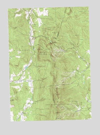
Mount Ellen, VT USGS Topographic Map
Click on map above to begin viewing in our Map Viewer.

This topographic map contains these locations and features:
Feature Name Type Latitude Longitude GNIS ID View Map
Appalachian GapGapN44.2109°W72.9315°1460528View Map
Baby Stark MountainSummitN44.2159°W72.9296°1460537View Map
Bakers BrookStreamN44.2384°W72.9682°1460544View Map
Beane MountainSummitN44.2270°W72.9221°1460573View Map
Beane TrailTrailN44.2401°W72.9343°1460574View Map
Beaver Meadow BrookStreamN44.2198°W72.9665°1460585View Map
Birch Glen CampLocaleN44.2367°W72.9304°1460616View Map
Bristol Municipal ForestForestN44.1484°W72.9521°1918049View Map
Buels GoreCivilN44.2051°W72.9467°1462058View Map
Camels Hump State ParkParkN44.2267°W72.9335°1460694View Map
Catamount Cross Country TrailTrailN44.1962°W72.9126°1919014View Map
Chamberlain GlenValleyN44.2106°W72.9337°1460716View Map
Cutts PeakSummitN44.1537°W72.9287°1460771View Map
DowningvillePopulated PlaceN44.1331°W72.9823°1460807View Map
Fayston Elementary SchoolSchoolN44.1792°W72.8843°1460865View Map
Finn BasinBasinN44.2131°W72.8860°1460872View Map
German FlatsFlatN44.1731°W72.8882°1460896View Map
Glen Ellen Ski AreaLocaleN44.1737°W72.9062°1461793View Map
Gore CemeteryCemeteryN44.2325°W72.9654°1460913View Map
Hallock BrookStreamN44.1689°W72.9896°1460950View Map
HanksvillePopulated PlaceN44.2478°W72.9621°1460960View Map
Hemlock HillSummitN44.2187°W72.8979°1460985View Map
Hillsboro MountainSummitN44.2284°W72.9904°1460992View Map
Huntington GapGapN44.2414°W72.9085°1461014View Map
Huntington Gap Wildlife Manangement AreaParkN44.2251°W72.9329°1918715View Map
JerusalemPopulated PlaceN44.1698°W72.9704°1461022View Map
Jerusalem CemeteryCemeteryN44.1694°W72.9846°1461023View Map
Jerusalem TrailTrailN44.1828°W72.9498°1461024View Map
Lincoln MountainSummitN44.1537°W72.9287°1461073View Map
Lincoln PeakSummitN44.1273°W72.9284°1461074View Map
Little Ireland CemeteryCemeteryN44.1959°W72.9990°1461078View Map
Lockwood BrookStreamN44.1751°W72.8862°1461092View Map
Mad River Glen Nordic Ski CenterLocaleN44.2023°W72.9182°1919104View Map
Mad River Glen Ski AreaLocaleN44.2009°W72.9246°1461798View Map
Molly Stark MountainSummitN44.2220°W72.9271°1461164View Map
Mount EllenSummitN44.1601°W72.9293°1460843View Map
Mount PleasantSummitN44.1487°W72.9976°1461287View Map
Nancy Hanks PeakSummitN44.1331°W72.9290°1461198View Map
Rice BrookStreamN44.1364°W72.8801°1461324View Map
Slide BrookStreamN44.1787°W72.8829°1461409View Map
Stark MountainSummitN44.1842°W72.9293°1461466View Map
Starksboro Volunteer Fire Department Station 2BuildingN44.1696°W72.9849°2121340View Map
Stave BrookStreamN44.2095°W72.9654°1461468View Map
Strattonwald DamDamN44.1551°W72.8779°1766725View Map
Sugarbush Ski CenterLocaleN44.1945°W72.8912°1919219View Map
Sugarbush Valley Ski AreaLocaleN44.1373°W72.9068°1461807View Map
Sugarbush VillagePopulated PlaceN44.1414°W72.8957°1919220View Map
Theron Dean ShelterLocaleN44.2106°W72.9315°1918907View Map
Warren Volunteer Fire Department Sugarbush SubstationBuildingN44.1381°W72.8920°2121369View Map
WDOT-FM (Warren)TowerN44.1270°W72.9282°1462010View Map

Note: Coordinates in the location and feature list above are referenced to NAD83 datum.


Copyright (C) 2008-2024 Ryan Niemi / Sunset Dynamics ... All Rights Reserved