TopoQuest Logo
Do you find TopoQuest useful?
Help keep TopoQuest running and adding new maps/features by donating!
Bitcoin:  19c7KJd3qBynnjoSw5npx9KScwjBe4ifkT
Litecoin:  LXs6TkuXGGXo1vDsWCkWVdjQX94eUKd6ui
Home View Maps Find Maps Find Places Resources & Links


Mount Carmel, Vermont Topographic Map

USGS Map Title: Mount Carmel, VT
USGS Map MRC: 43072G8
DRG (GeoTIFF) Download: o43072g8.tif


Neighboring USGS Topographic Map Quads:


  East Middlebury, VT  
43073H1
 

  Bread Loaf, VT  
43072H8
 

  Hancock, VT  
43072H7
 

  Brandon, VT  
43073G1
 

  Mount Carmel, VT  
43072G8
 

  Rochester, VT  
43072G7
 

  Proctor, VT  
43073F1
 

  Chittenden, VT  
43072F8
 

  Pico Peak, VT  
43072F7


Map MRC Location:

N44°
W73°
N44°
W72°
H8 H7 H6 H5 H4 H3 H2 H1
G8 G7 G6 G5 G4 G3 G2 G1
F8 F7 F6 F5 F4 F3 F2 F1
E8 E7 E6 E5 E4 E3 E2 E1
D8 D7 D6 D5 D4 D3 D2 D1
C8 C7 C6 C5 C4 C3 C2 C1
B8 B7 B6 B5 B4 B3 B2 B1
A8 A7 A6 A5 A4 A3 A2 A1
N43°
W73°
N43°
W72°

Mount Carmel, VT USGS 1:24K Topographic Map Preview:
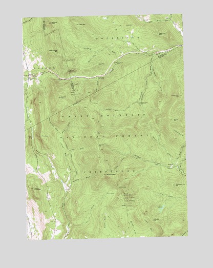
Mount Carmel, VT USGS Topographic Map
Click on map above to begin viewing in our Map Viewer.

This topographic map contains these locations and features:
Feature Name Type Latitude Longitude GNIS ID View Map
Baker BrookStreamN43.7776°W72.9698°1460540View Map
Bear BrookStreamN43.8406°W72.9396°1460575View Map
Bear MountainSummitN43.8703°W72.9551°1460577View Map
Beaudry BrookStreamN43.7770°W72.9687°1460579View Map
Beaver MeadowsLakeN43.7660°W72.8948°1460589View Map
Bee BrookStreamN43.7951°W72.9682°1460593View Map
Bingo CemeteryCemeteryN43.8724°W72.8853°1460614View Map
Bloodroot GapGapN43.8023°W72.9423°1460622View Map
Bloodroot MountainSummitN43.7856°W72.9371°1460623View Map
Bloodroot Mountain TrailTrailN43.7948°W72.9218°1460624View Map
Boiling SpringSpringN43.7748°W72.9373°1460629View Map
Brandon Brook Picnic GroundLocaleN43.8401°W72.9421°1460651View Map
Brandon GapGapN43.8401°W72.9676°1460652View Map
Bump CemeteryCemeteryN43.7602°W72.9768°1460679View Map
Cape Lookoff MountainSummitN43.8556°W72.9726°1460700View Map
Carmel CampLocaleN43.7678°W72.9221°1460703View Map
Chittenden BrookStreamN43.8526°W72.8971°1460724View Map
Chittenden Brook CampgroundLocaleN43.8256°W72.9098°1460725View Map
Chittenden Brook Cross-Country Ski TrailTrailN43.8273°W72.9123°1461756View Map
Chittenden Brook TrailTrailN43.8215°W72.9254°1460726View Map
Corporation MountainSummitN43.8292°W72.8790°1460761View Map
Farr PeakSummitN43.8092°W72.9437°1460863View Map
Gillespie PeakSummitN43.8715°W72.9773°1460901View Map
Goshen Four CornersLocaleN43.8423°W72.9957°1460918View Map
Goshen MountainSummitN43.8298°W72.9709°1460919View Map
Hawk MountainSummitN43.8481°W72.9412°1460974View Map
Hayes BrookStreamN43.7870°W72.8796°1460975View Map
Horrid BrookStreamN43.8548°W72.9418°1461003View Map
Joe Smith BrookStreamN43.8453°W72.8998°1461028View Map
Jones MountainSummitN43.8695°W72.9187°1461034View Map
Kettle BrookStreamN43.8045°W72.9721°1461044View Map
Kiln BrookStreamN43.7540°W72.9671°1461047View Map
Little Pico MountainSummitN43.8640°W72.8934°1461084View Map
MichiganPopulated PlaceN43.7895°W72.8848°1461143View Map
Michigan BrookStreamN43.7898°W72.8834°1461144View Map
Morrill BrookStreamN43.7923°W72.8846°1461172View Map
Mount CarmelSummitN43.7742°W72.9201°1460704View Map
Mount Carmel State ForestForestN43.7715°W72.9201°1461177View Map
Mount HorridSummitN43.8503°W72.9671°1461004View Map
Mount NickwaketSummitN43.7790°W72.9940°1461208View Map
New Boston TrailTrailN43.7615°W72.9215°1461205View Map
Oliver Reynolds CemeteryCemeteryN43.8669°W72.8795°1922505View Map
Perkins BrookStreamN43.8717°W72.8848°1461263View Map
Pine BrookStreamN43.8737°W72.9084°1461277View Map
Proctor Village Municipal ForestForestN43.7726°W72.9451°1922061View Map
Puss and Kill BrookStreamN43.8045°W72.9721°1461302View Map
Round MountainSummitN43.8156°W72.8846°1461355View Map
Slab Bridge BrookStreamN43.7923°W72.8846°1461407View Map
Smith BrookStreamN43.8520°W72.9229°1461411View Map
Souphouse FlatFlatN43.8481°W72.9268°1461420View Map
Steam Mill BrookStreamN43.7776°W72.9698°1461469View Map
Sunrise CampLocaleN43.8312°W72.9604°1461497View Map
Telephone GapGapN43.7598°W72.9018°1461515View Map
The CapeSummitN43.8081°W72.9865°1461525View Map
The Great CliffCliffN43.8448°W72.9643°1461531View Map
Thousand Acre HillSummitN43.7787°W72.8840°1461542View Map
Town of ChittendenCivilN43.7606°W72.9208°1462071View Map
West Hill CemeteryCemeteryN43.8551°W72.9097°1461592View Map
West Hill School (historical)SchoolN43.8595°W72.9154°1922706View Map
Wetmore CemeteryCemeteryN43.7567°W72.9971°1461602View Map
Wetmore GapGapN43.7787°W72.9276°1461603View Map
Wetmore Gap TrailTrailN43.7856°W72.9148°1461604View Map

Note: Coordinates in the location and feature list above are referenced to NAD83 datum.


Copyright (C) 2008-2024 Ryan Niemi / Sunset Dynamics ... All Rights Reserved